
ਤਸਵੀਰ:Algeria location map.svg

Size of this PNG preview of this SVG file: 604 × 600 ਪਿਕਸਲ. ਹੋਰ ਰੈਜ਼ੋਲਿਊਸ਼ਨਜ਼: 242 × 240 ਪਿਕਸਲ | 483 × 480 ਪਿਕਸਲ | 773 × 768 ਪਿਕਸਲ | 1,031 × 1,024 ਪਿਕਸਲ | 2,062 × 2,048 ਪਿਕਸਲ | 1,287 × 1,278 ਪਿਕਸਲ.
ਅਸਲ ਫ਼ਾਈਲ (SVG ਫ਼ਾਈਲ, ਆਮ ਤੌਰ ’ਤੇ 1,287 × 1,278 ਪਿਕਸਲ, ਫ਼ਾਈਲ ਦਾ ਅਕਾਰ: 281 KB)
ਸਾਰ
| Camera location | | View this and other nearby images on: OpenStreetMap |
|---|
| ਵੇਰਵਾ |
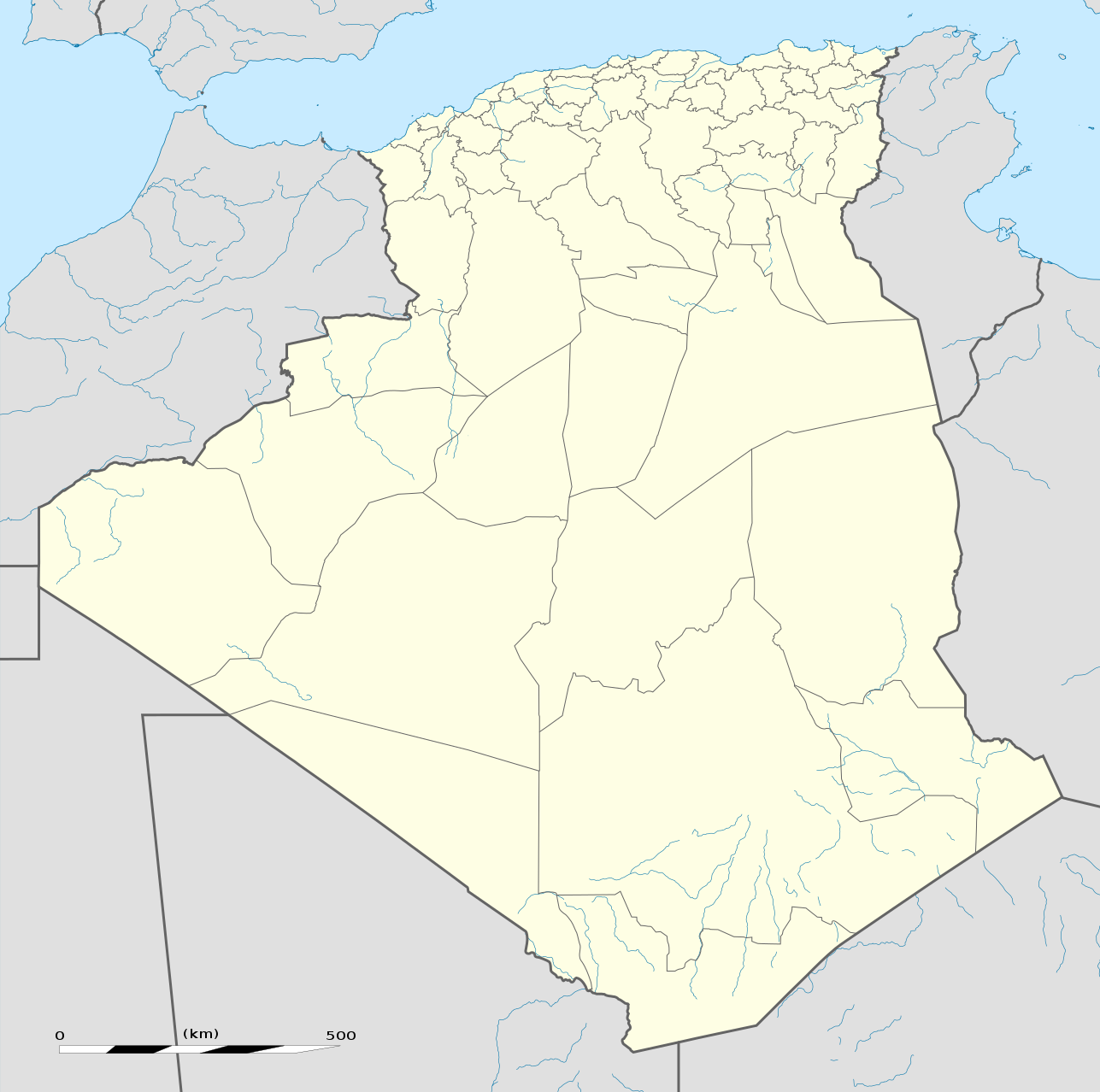
العربية: خريطة إدارية فارغة للجزائر، لأغراض موقع-جيو.
English: Blank administrative map of Algeria, for geo-location purposes.
Français : Carte administrative vierge de l'Algérie, destinée à la géolocalisation. Scale: 1:6,800,000 (precision: 1,700 m)
Geographic limits of the map:
|
||
| ਮਿਤੀ | |||
| ਸਰੋਤ |
ਆਪਣਾ ਕੰਮ
|
||
| ਲਿਖਾਰੀ | Eric Gaba (Sting - fr:Sting) | ||
| ਇਜਾਜ਼ਤ (ਇਸ ਫ਼ਾਈਲ ਦੀ ਮੁੜਵਰਤੋਂ ਕਰੋ) |
|
||
| Other versions |
Derivative works of this file: French Algeria evolution 1830-1962 map-fr.svg
|


ਲਸੰਸ
I, the copyright holder of this work, hereby publish it under the following licenses:
ਇਸ ਫ਼ਾਈਲ ਦਾ ਲਸੰਸ ਕ੍ਰਿਏਟਿਵ ਕਾਮਨਜ਼ ਐਟ੍ਰੀਬਿਊਸ਼ਨ-ਸ਼ੇਅਰ ਅਲਾਈਕ 3.0 ਅਨਪੋਰਟੇਡ ਹੈ।
- ਤੁਹਾਨੂੰ ਖੁੱਲ੍ਹ ਹੈ:
- ਸਾਂਝਾ ਕਰਨ ਦੀ – ਰਚਨਾ ਨੂੰ ਕਾਪੀ, ਵੰਡਣਾ ਅਤੇ ਭੇਜਣਾ
- ਮੁੜ-ਰਲ਼ਾਉਣ ਦੀ – ਰਚਨਾ ਨੂੰ ਢਾਲਣਾ
- ਥੱਲੇ ਲਿਖੀਆਂ ਸ਼ਰਤਾਂ ਹੇਠ:
- ਗੁਣਾਂ ਦੀ ਦੱਸ – ਉਚਿਤ ਕ੍ਰੈਡਿਟ ਦੇਵੋ, ਲਾਇਸੰਸ ਦਾ ਇੱਕ ਲਿੰਕ ਪ੍ਰਦਾਨ ਕਰੋ ਅਤੇ ਇਹ ਦਰਸਾਓ ਕਿ ਕੀ ਤਬਦੀਲੀਆਂ ਕੀਤੀਆਂ ਗਈਆਂ ਸਨ। ਤੁਸੀਂ ਇਹ ਕਿਸੇ ਵੀ ਵਾਜਬ ਤਰੀਕੇ ਨਾਲ ਕਰ ਸਕਦੇ ਹੋ, ਪਰ ਇਹ ਤਰੀਕਾ ਅਜਿਹਾ ਨਹੀਂ ਹੋਣਾ ਚਾਹੀਦਾ ਜੋ ਇਹ ਦਰਸਾਵੇ ਕਿ ਲਾਇਸੰਸਕਰਤਾ ਤੁਹਾਨੂੰ ਜਾਂ ਤੁਹਾਡੀ ਵਰਤੋਂ ਦਾ ਸਮਰਥਨ ਕਰਦਾ ਹੈ।
- ਸ਼ੇਅਰ ਅਲਾਈਕ – ਜੇਕਰ ਤੁਸੀਂ ਸਮੱਗਰੀ ਨੂੰ ਰੀਮਿਕਸ ਕਰਦੇ ਹੋ, ਬਦਲਦੇ ਹੋ ਜਾਂ ਬਣਾਉਂਦੇ ਹੋ, ਤਾਂ ਆਪਣੇ ਯੋਗਦਾਨ ਇੱਕੋ ਜਿਹੇ ਜਾਂ ਅਨੁਕੂਲ ਲਾਇਸੰਸ ਦੇ ਅਧੀਨ ਕਰੋ।

|
ਇਸ ਸਫ਼ੇ ਨੂੰ ਗਨੂ ਲਸੰਸ, ਵਰਜ਼ਨ 1.2 ਜਾਂ ਫਰੀ ਸਾਫਟਵੇਅਰ ਫਾਊਂਡੇਸ਼ਨ ਦੁਆਰਾ ਪ੍ਰਕਾਸ਼ਿਤ ਕੀਤੇ ਨਵੇਂ ਵਰਜ਼ਨ ਤਹਿਤ ਕਾਪੀ ਕਰਨ, ਵੰਡਣ ਜਾਂ/ਅਤੇ ਤਬਦੀਲੀ ਕਰਨ ਦੀ ਖੁੱਲ ਹੈ; ਬਿਨਾ ਕਿਸੇ ਸਥਿਰ ਫਰੰਟ-ਕਵਰ ਜਾਂ ਬੈਕ ਕਵਰ ਲਿਖਤਾਂ ਤੋਂ ਬਿਨਾਂ। ਇਸ ਲਸੰਸ ਦੀ ਇੱਕ ਕਾਪੀ ਇਸ ਗਨੂ ਫਰੀ ਲਸੰਸ ਭਾਗ ਵਿੱਚ ਮੌਜੂਦ ਹੈ। |
ਤੁਸੀਂ ਆਪਣੀ ਮਰਜ਼ੀ ਦਾ ਲਸੰਸ ਚੁਣ ਸਕਦੇ ਹੋ।
ਫ਼ਾਈਲ ਦਾ ਅਤੀਤ
ਤਾਰੀਖ/ਸਮੇਂ ’ਤੇ ਕਲਿੱਕ ਕਰੋ ਤਾਂ ਉਸ ਸਮੇਂ ਦੀ ਫਾਈਲ ਪੇਸ਼ ਹੋ ਜਾਵੇਗੀ।
| ਮਿਤੀ/ਸਮਾਂ | ਨਮੂਨਾ | ਨਾਪ | ਵਰਤੋਂਕਾਰ | ਟਿੱਪਣੀ | |
|---|---|---|---|---|---|
| ਮੌਜੂਦਾ | 19:01, 16 ਮਾਰਚ 2020 | | 1,287 × 1,278 (281 KB) | NordNordWest | upd 2019 |
| 12:51, 17 ਨਵੰਬਰ 2009 |  | 1,287 × 1,278 (364 KB) | Sting | == {{int:filedesc}} == {{Location|28|19|00|N|1|39|00|E|scale:8000000}} <br/> {{Information |Description={{en|Blank administrative map of Algeria, for geo-location purposes.}} {{fr|Carte administrative vierge de l'Algérie, |
ਫ਼ਾਈਲ ਦੀ ਵਰਤੋਂ
ਇਹ ਫਾਈਲ ਹੇਠਾਂ ਦਿੱਤਾ ਸਫ਼ਾ ਵਰਤਦਾ ਹੈ:
ਫ਼ਾਈਲ ਦੀ ਵਿਆਪਕ ਵਰਤੋਂ
ਇਸ ਫ਼ਾਈਲ ਨੂੰ ਹੋਰ ਹੇਠ ਲਿਖੇ ਵਿਕੀ ਵਰਤਦੇ ਹਨ:
- ab.wikipedia.org ਉੱਤੇ ਵਰਤੋਂ
- af.wikipedia.org ਉੱਤੇ ਵਰਤੋਂ
- als.wikipedia.org ਉੱਤੇ ਵਰਤੋਂ
- am.wikipedia.org ਉੱਤੇ ਵਰਤੋਂ
- an.wikipedia.org ਉੱਤੇ ਵਰਤੋਂ
- ar.wikipedia.org ਉੱਤੇ ਵਰਤੋਂ
- أولاد تبان
- العلمة (ولاية سطيف)
- كأس الأمم الإفريقية 1990
- صالح باي (ولاية سطيف)
- قالب:خريطة مواقع الجزائر
- عين آزال
- بوقاعة
- قنزات
- مطار الشلف - أبو بكر بلقايد
- الحامة (ولاية سطيف)
- تالة ايفاسن
- بابور (سطيف)
- زلزال الشلف 1980
- تيزي نبشار
- قالب:خارطة جبال الجزائر
- قالب:خريطة مدن الجزائر
- ماوكلان
- بوطالب
- سيدي حمادوش
- قالب:ص.م/موقع جغرافي
- قالب:ص.م/موقع جغرافي/شرح
- بطولة إفريقيا تحت 20 سنة لكرة القدم 2013
- حمام قرقور
- مستخدم:عبد المؤمن/ملعب
- عين السبت
- بوعنداس
- بني فودة
- بني حسين (ولاية سطيف)
- ذراع قبيلة
- الأوريسية
- قلال
- معاوية (ولاية سطيف)
ਇਸ ਫ਼ਾਈਲ ਦੀ ਹੋਰ ਵਿਆਪਕ ਵਰਤੋਂ ਵੇਖੋ।