
ਤਸਵੀਰ:Buir Nuur in Eastern Mongolia and in China (Inner Mongolia), LandSat-7 2005-08-9.png

ਇਸ ਝਾਤ ਦਾ ਅਕਾਰ: 531 × 599 ਪਿਕਸਲ. ਹੋਰ ਰੈਜ਼ੋਲਿਊਸ਼ਨਜ਼: 213 × 240 ਪਿਕਸਲ | 426 × 480 ਪਿਕਸਲ | 681 × 768 ਪਿਕਸਲ | 908 × 1,024 ਪਿਕਸਲ | 1,642 × 1,852 ਪਿਕਸਲ.
ਅਸਲ ਫ਼ਾਈਲ (1,642 × 1,852 ਪਿਕਸਲ, ਫ਼ਾਈਲ ਅਕਾਰ: 4.83 MB, MIME ਕਿਸਮ: image/png)
,_LandSat-7_2005-08-9.png)
ਸਾਰ
| ਵੇਰਵਾ |
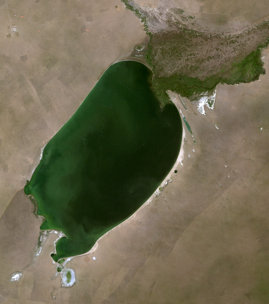
English: Buir Nuur lake in Eastern Mongolia (Dornod province) and in China (Inner Mongolia), LandSat-7 satellite image, 2005-08-9, near natural colors, 30 m resolution |
| ਮਿਤੀ | |
| ਸਰੋਤ | http://edcsns17.cr.usgs.gov/NewEarthExplorer/ |
| ਲਿਖਾਰੀ | NASA |
ਲਸੰਸ
| This file is in the public domain in the United States because it was solely created by NASA. NASA copyright policy states that "NASA material is not protected by copyright unless noted". (See Template:PD-USGov, NASA copyright policy page or JPL Image Use Policy.) | ||
 |
Warnings:
|
ਫ਼ਾਈਲ ਦਾ ਅਤੀਤ
ਤਾਰੀਖ/ਸਮੇਂ ’ਤੇ ਕਲਿੱਕ ਕਰੋ ਤਾਂ ਉਸ ਸਮੇਂ ਦੀ ਫਾਈਲ ਪੇਸ਼ ਹੋ ਜਾਵੇਗੀ।
| ਮਿਤੀ/ਸਮਾਂ | ਨਮੂਨਾ | ਨਾਪ | ਵਰਤੋਂਕਾਰ | ਟਿੱਪਣੀ | |
|---|---|---|---|---|---|
| ਮੌਜੂਦਾ | 17:32, 1 ਨਵੰਬਰ 2010 | | 1,642 × 1,852 (4.83 MB) | Bogomolov.PL | {{Information |Description={{en|1=Buir Nuur lake in Eastern Mongolia (Dornod province) and in China (Inner Mongolia), LandSat-7 satellite image, 2005-08-9, near natural colors, 30 m resolution}} |Source=http://edcsns17.cr.usgs.gov/NewEarthExplorer/ |Autho |
ਫ਼ਾਈਲ ਦੀ ਵਰਤੋਂ
ਇਹ ਫਾਈਲ ਹੇਠਾਂ ਦਿੱਤਾ ਸਫ਼ਾ ਵਰਤਦਾ ਹੈ:
ਫ਼ਾਈਲ ਦੀ ਵਿਆਪਕ ਵਰਤੋਂ
ਇਸ ਫ਼ਾਈਲ ਨੂੰ ਹੋਰ ਹੇਠ ਲਿਖੇ ਵਿਕੀ ਵਰਤਦੇ ਹਨ:
- arz.wikipedia.org ਉੱਤੇ ਵਰਤੋਂ
- bg.wikipedia.org ਉੱਤੇ ਵਰਤੋਂ
- cs.wikipedia.org ਉੱਤੇ ਵਰਤੋਂ
- cv.wikipedia.org ਉੱਤੇ ਵਰਤੋਂ
- de.wikipedia.org ਉੱਤੇ ਵਰਤੋਂ
- en.wikipedia.org ਉੱਤੇ ਵਰਤੋਂ
- es.wikipedia.org ਉੱਤੇ ਵਰਤੋਂ
- fa.wikipedia.org ਉੱਤੇ ਵਰਤੋਂ
- fi.wikipedia.org ਉੱਤੇ ਵਰਤੋਂ
- fr.wikipedia.org ਉੱਤੇ ਵਰਤੋਂ
- hu.wikipedia.org ਉੱਤੇ ਵਰਤੋਂ
- id.wikipedia.org ਉੱਤੇ ਵਰਤੋਂ
- it.wikipedia.org ਉੱਤੇ ਵਰਤੋਂ
- ja.wikipedia.org ਉੱਤੇ ਵਰਤੋਂ
- ko.wikipedia.org ਉੱਤੇ ਵਰਤੋਂ
- lt.wikipedia.org ਉੱਤੇ ਵਰਤੋਂ
- lv.wikipedia.org ਉੱਤੇ ਵਰਤੋਂ
- mn.wikipedia.org ਉੱਤੇ ਵਰਤੋਂ
- pl.wikipedia.org ਉੱਤੇ ਵਰਤੋਂ
- ru.wikipedia.org ਉੱਤੇ ਵਰਤੋਂ
- tr.wikipedia.org ਉੱਤੇ ਵਰਤੋਂ
- uk.wikipedia.org ਉੱਤੇ ਵਰਤੋਂ
- vi.wikipedia.org ਉੱਤੇ ਵਰਤੋਂ
- www.wikidata.org ਉੱਤੇ ਵਰਤੋਂ
- zh.wikipedia.org ਉੱਤੇ ਵਰਤੋਂ
,_LandSat-7_2005-08-9.png)