
ਤਸਵੀਰ:Estonia location map (2005-2017) no rivers.svg

Size of this PNG preview of this SVG file: 718 × 600 ਪਿਕਸਲ. ਹੋਰ ਰੈਜ਼ੋਲਿਊਸ਼ਨਜ਼: 287 × 240 ਪਿਕਸਲ | 575 × 480 ਪਿਕਸਲ | 920 × 768 ਪਿਕਸਲ | 1,226 × 1,024 ਪਿਕਸਲ | 2,452 × 2,048 ਪਿਕਸਲ | 1,668 × 1,393 ਪਿਕਸਲ.
ਅਸਲ ਫ਼ਾਈਲ (SVG ਫ਼ਾਈਲ, ਆਮ ਤੌਰ ’ਤੇ 1,668 × 1,393 ਪਿਕਸਲ, ਫ਼ਾਈਲ ਦਾ ਅਕਾਰ: 407 KB)
ਸਾਰ
| ਵੇਰਵਾ |
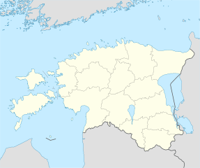
Deutsch: Positionskarte von Estland
Quadratische Plattkarte, N-S-Streckung 180 %. Geographische Begrenzung der Karte:
English: Location map of Estonia
Equirectangular projection, N/S stretching 180 %. Geographic limits of the map:
|
||
| ਮਿਤੀ | |||
| ਸਰੋਤ | own work, using United States National Imagery and Mapping Agency data | ||
| ਲਿਖਾਰੀ | NordNordWest | ||
| Other versions |
Derivative works of this file: |
||
| SVG genesis |
|

_no_rivers.svg)
.svg)
ਲਸੰਸ
I, the copyright holder of this work, hereby publish it under the following licenses:

|
ਇਸ ਸਫ਼ੇ ਨੂੰ ਗਨੂ ਲਸੰਸ, ਵਰਜ਼ਨ 1.2 ਜਾਂ ਫਰੀ ਸਾਫਟਵੇਅਰ ਫਾਊਂਡੇਸ਼ਨ ਦੁਆਰਾ ਪ੍ਰਕਾਸ਼ਿਤ ਕੀਤੇ ਨਵੇਂ ਵਰਜ਼ਨ ਤਹਿਤ ਕਾਪੀ ਕਰਨ, ਵੰਡਣ ਜਾਂ/ਅਤੇ ਤਬਦੀਲੀ ਕਰਨ ਦੀ ਖੁੱਲ ਹੈ; ਬਿਨਾ ਕਿਸੇ ਸਥਿਰ ਫਰੰਟ-ਕਵਰ ਜਾਂ ਬੈਕ ਕਵਰ ਲਿਖਤਾਂ ਤੋਂ ਬਿਨਾਂ। ਇਸ ਲਸੰਸ ਦੀ ਇੱਕ ਕਾਪੀ ਇਸ ਗਨੂ ਫਰੀ ਲਸੰਸ ਭਾਗ ਵਿੱਚ ਮੌਜੂਦ ਹੈ। |
ਇਸ ਫ਼ਾਈਲ ਦਾ ਲਸੰਸ ਕ੍ਰਿਏਟਿਵ ਕਾਮਨਜ਼ ਐਟ੍ਰੀਬਿਊਸ਼ਨ-ਸ਼ੇਅਰ ਅਲਾਈਕ 3.0 ਅਨਪੋਰਟੇਡ ਹੈ।
- ਤੁਹਾਨੂੰ ਖੁੱਲ੍ਹ ਹੈ:
- ਸਾਂਝਾ ਕਰਨ ਦੀ – ਰਚਨਾ ਨੂੰ ਕਾਪੀ, ਵੰਡਣਾ ਅਤੇ ਭੇਜਣਾ
- ਮੁੜ-ਰਲ਼ਾਉਣ ਦੀ – ਰਚਨਾ ਨੂੰ ਢਾਲਣਾ
- ਥੱਲੇ ਲਿਖੀਆਂ ਸ਼ਰਤਾਂ ਹੇਠ:
- ਗੁਣਾਂ ਦੀ ਦੱਸ – ਉਚਿਤ ਕ੍ਰੈਡਿਟ ਦੇਵੋ, ਲਾਇਸੰਸ ਦਾ ਇੱਕ ਲਿੰਕ ਪ੍ਰਦਾਨ ਕਰੋ ਅਤੇ ਇਹ ਦਰਸਾਓ ਕਿ ਕੀ ਤਬਦੀਲੀਆਂ ਕੀਤੀਆਂ ਗਈਆਂ ਸਨ। ਤੁਸੀਂ ਇਹ ਕਿਸੇ ਵੀ ਵਾਜਬ ਤਰੀਕੇ ਨਾਲ ਕਰ ਸਕਦੇ ਹੋ, ਪਰ ਇਹ ਤਰੀਕਾ ਅਜਿਹਾ ਨਹੀਂ ਹੋਣਾ ਚਾਹੀਦਾ ਜੋ ਇਹ ਦਰਸਾਵੇ ਕਿ ਲਾਇਸੰਸਕਰਤਾ ਤੁਹਾਨੂੰ ਜਾਂ ਤੁਹਾਡੀ ਵਰਤੋਂ ਦਾ ਸਮਰਥਨ ਕਰਦਾ ਹੈ।
- ਸ਼ੇਅਰ ਅਲਾਈਕ – ਜੇਕਰ ਤੁਸੀਂ ਸਮੱਗਰੀ ਨੂੰ ਰੀਮਿਕਸ ਕਰਦੇ ਹੋ, ਬਦਲਦੇ ਹੋ ਜਾਂ ਬਣਾਉਂਦੇ ਹੋ, ਤਾਂ ਆਪਣੇ ਯੋਗਦਾਨ ਇੱਕੋ ਜਿਹੇ ਜਾਂ ਅਨੁਕੂਲ ਲਾਇਸੰਸ ਦੇ ਅਧੀਨ ਕਰੋ।
ਤੁਸੀਂ ਆਪਣੀ ਮਰਜ਼ੀ ਦਾ ਲਸੰਸ ਚੁਣ ਸਕਦੇ ਹੋ।
ਫ਼ਾਈਲ ਦਾ ਅਤੀਤ
ਤਾਰੀਖ/ਸਮੇਂ ’ਤੇ ਕਲਿੱਕ ਕਰੋ ਤਾਂ ਉਸ ਸਮੇਂ ਦੀ ਫਾਈਲ ਪੇਸ਼ ਹੋ ਜਾਵੇਗੀ।
| ਮਿਤੀ/ਸਮਾਂ | ਨਮੂਨਾ | ਨਾਪ | ਵਰਤੋਂਕਾਰ | ਟਿੱਪਣੀ | |
|---|---|---|---|---|---|
| ਮੌਜੂਦਾ | 06:14, 6 ਮਈ 2019 | | 1,668 × 1,393 (407 KB) | Lasunncty | fix svg errors and reduce file size |
| 20:05, 9 ਮਈ 2009 |  | 1,668 × 1,393 (464 KB) | NordNordWest | some troubles with changing location maps that way | |
| 17:18, 9 ਮਈ 2009 |  | 1,000 × 835 (639 KB) | Ahnode | *1. Resized the objects to W:1000px, H:835px. *2. Created two separate layers for Estonia itself and the rest of the world. *3. Subtracted lakes from shape areas and divided area of Estonia into counties to ease future creation of location maps. | |
| 19:03, 25 ਅਗਸਤ 2008 |  | 1,668 × 1,393 (464 KB) | NordNordWest | size correction | |
| 14:11, 7 ਜੁਲਾਈ 2008 |  | 556 × 464 (467 KB) | NordNordWest | ||
| 14:25, 29 ਜੂਨ 2008 |  | 556 × 464 (468 KB) | NordNordWest | {{Information |Description= {{de|Positionskarte von Estland}} Quadratische Plattkarte, N-S-Streckung 180 %. Geographische Begrenzung der Karte: * N: 60.4° N * S: 57.2° N * W: 21.5° O * O: 28.4° O {{en|Location map of [[:en:Estonia|Esto |
ਫ਼ਾਈਲ ਦੀ ਵਰਤੋਂ
ਇਹ ਫਾਈਲ ਹੇਠਾਂ ਦਿੱਤਾ ਸਫ਼ਾ ਵਰਤਦਾ ਹੈ:
ਫ਼ਾਈਲ ਦੀ ਵਿਆਪਕ ਵਰਤੋਂ
ਇਸ ਫ਼ਾਈਲ ਨੂੰ ਹੋਰ ਹੇਠ ਲਿਖੇ ਵਿਕੀ ਵਰਤਦੇ ਹਨ:
- af.wikipedia.org ਉੱਤੇ ਵਰਤੋਂ
- ba.wikipedia.org ਉੱਤੇ ਵਰਤੋਂ
- be-tarask.wikipedia.org ਉੱਤੇ ਵਰਤੋਂ
- Талін
- Шаблён:Лякалізацыйная мапа Эстоніі
- Саарэмаа
- Талінскі ўнівэрсытэт
- Валга
- Выру
- Йыхві
- Вільяндзі
- Харку (возера)
- Выртс’ярв
- Пярну
- Муху
- Йыгева
- Раквэрэ
- Тартускі ўнівэрсытэт
- Тарту
- Шаблён:Пратока
- Шаблён:Пратока/Дакумэнтацыя
- Музэй акупацыяў
- Царква Сьвятога Міхаіла (Кейля)
- Царква прытулку Сьвятога Яна (Талін)
- Палдыскі
- Царква Сьвятога Яна (Талін)
- Калёна Перамогі ў вайне за незалежнасьць Эстоніі
- Нарва (горад)
- Кейля
- Курэсаарэ
- Саўэ
- Царква Сьвятога Олафа (Талін)
- Домскі сабор (Талін)
- Нараўскі замак
- Кохтла-Ярвэ
- Кейля (замак)
- Царква Сьвятога Марціна (Вальяла)
- Пылва
- Талінская ратуша
- Суўр Мунамягі
- Юлемістэ (возера)
- Кляштар Сьвятой Біргіты
- Пюхціцкі манастыр
- Элва
- Сабор Аляксандра Неўскага (Талін)
- Царква Сьвятога Духа (Талін)
- Хіюмаа
- Кік-ін-дэ-Кёк
- Стары Томас
- Эстонскі марскі музэй
ਇਸ ਫ਼ਾਈਲ ਦੀ ਹੋਰ ਵਿਆਪਕ ਵਰਤੋਂ ਵੇਖੋ।
_no_rivers.svg)
_no_rivers.svg)