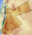
ਤਸਵੀਰ:Jordan location map.svg

Size of this PNG preview of this SVG file: 545 × 600 ਪਿਕਸਲ. ਹੋਰ ਰੈਜ਼ੋਲਿਊਸ਼ਨਜ਼: 218 × 240 ਪਿਕਸਲ | 436 × 480 ਪਿਕਸਲ | 698 × 768 ਪਿਕਸਲ | 931 × 1,024 ਪਿਕਸਲ | 1,861 × 2,048 ਪਿਕਸਲ | 1,088 × 1,197 ਪਿਕਸਲ.
ਅਸਲ ਫ਼ਾਈਲ (SVG ਫ਼ਾਈਲ, ਆਮ ਤੌਰ ’ਤੇ 1,088 × 1,197 ਪਿਕਸਲ, ਫ਼ਾਈਲ ਦਾ ਅਕਾਰ: 130 KB)
ਫ਼ਾਈਲ ਦਾ ਅਤੀਤ
ਤਾਰੀਖ/ਸਮੇਂ ’ਤੇ ਕਲਿੱਕ ਕਰੋ ਤਾਂ ਉਸ ਸਮੇਂ ਦੀ ਫਾਈਲ ਪੇਸ਼ ਹੋ ਜਾਵੇਗੀ।
| ਮਿਤੀ/ਸਮਾਂ | ਨਮੂਨਾ | ਨਾਪ | ਵਰਤੋਂਕਾਰ | ਟਿੱਪਣੀ | |
|---|---|---|---|---|---|
| ਮੌਜੂਦਾ | 09:40, 5 ਮਾਰਚ 2009 |  | 1,088 × 1,197 (130 KB) | NordNordWest | {{Information |Description= {{de|Positionskarte von Jordanien}} Quadratische Plattkarte, N-S-Streckung 115 %. Geographische Begrenzung der Karte: * N: 33.5° N * S: 29.1° N * W: 34.8° O * O: 39.4° O {{en|Location map of [[:en:Jordan | |
ਫ਼ਾਈਲ ਦੀ ਵਰਤੋਂ
ਇਹ ਫਾਈਲ ਹੇਠਾਂ ਦਿੱਤੇ 3 ਸਫ਼ੇ ਵਰਤਦੇ ਹਨ:
ਫ਼ਾਈਲ ਦੀ ਵਿਆਪਕ ਵਰਤੋਂ
ਇਸ ਫ਼ਾਈਲ ਨੂੰ ਹੋਰ ਹੇਠ ਲਿਖੇ ਵਿਕੀ ਵਰਤਦੇ ਹਨ:
- af.wikipedia.org ਉੱਤੇ ਵਰਤੋਂ
- am.wikipedia.org ਉੱਤੇ ਵਰਤੋਂ
- an.wikipedia.org ਉੱਤੇ ਵਰਤੋਂ
- ar.wikipedia.org ਉੱਤੇ ਵਰਤੋਂ
- بصيرا
- الشميساني
- أذرح
- الحصن (إربد)
- الشجرة (إربد)
- حوض الديسي
- إيدون (إربد)
- قالب:خريطة مواقع الأردن
- قائمة محافظات الأردن
- قالب:خريطة التقسيمات الإدارية في الأردن
- قالب:محافظة أردنية 2
- قالب:خريطة مواقع الأردن/شرح
- القوات البرية الملكية الأردنية
- سياسة الأردن المائية
- قلعة العقبة
- محطة توليد كهرباء العقبة الحرارية
- محطة توليد كهرباء شرق عمان
- قائمة مواقع التراث العالمي في الأردن
- بطولة اتحاد غرب آسيا لكرة القدم 2000
- الدوري الأردني 2009–10
- الدوري الأردني 2011–12
- قاعدة الملك الحسين الجوية
- الانتخابات النيابية الأردنية 2016
- قاعدة الملك فيصل بن عبد العزيز الجوية
- قاعدة الأمير حسن الجوية
- الدوري الأردني 2016–17
- بسطة (معان)
- الرشادية (الطفيلة)
- قصر بشير
- قلعة ضبعة
- باب الذراع
- عين الزارة
- الحدلات
- الشقيق (الأردن)
- العريض (مادبا)
- الجديدة (مادبا)
- دليلة الحمايدة (مادبا)
- القصور الأموية في الأردن (قلاع الصحراء)
- قرية السلع
- المواجهات بين أنتيغونوس والأنباط
- قائمة مخيمات اللاجئين السوريين في الأردن
- حشبون
ਇਸ ਫ਼ਾਈਲ ਦੀ ਹੋਰ ਵਿਆਪਕ ਵਰਤੋਂ ਵੇਖੋ।


