
ਤਸਵੀਰ:Kosovo location map.svg

Size of this PNG preview of this SVG file: 529 × 599 ਪਿਕਸਲ. ਹੋਰ ਰੈਜ਼ੋਲਿਊਸ਼ਨਜ਼: 212 × 240 ਪਿਕਸਲ | 424 × 480 ਪਿਕਸਲ | 678 × 768 ਪਿਕਸਲ | 904 × 1,024 ਪਿਕਸਲ | 1,808 × 2,048 ਪਿਕਸਲ | 1,015 × 1,150 ਪਿਕਸਲ.
ਅਸਲ ਫ਼ਾਈਲ (SVG ਫ਼ਾਈਲ, ਆਮ ਤੌਰ ’ਤੇ 1,015 × 1,150 ਪਿਕਸਲ, ਫ਼ਾਈਲ ਦਾ ਅਕਾਰ: 149 KB)

|
The boundaries on this map show the de facto situation. This is just one of several different views on the subject (see COM:NPOV). |
ਸਾਰ
| ਵੇਰਵਾ |
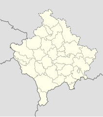
Deutsch: Positionskarte des Kosovo
Quadratische Plattkarte, N-S-Streckung 140 %. Geographische Begrenzung der Karte:
English: Location map of Kosovo
Equirectangular projection, N/S stretching 140 %. Geographic limits of the map:
|
| ਮਿਤੀ | 01-08-2008 |
| ਸਰੋਤ | own work, using United States National Imagery and Mapping Agency data |
| ਲਿਖਾਰੀ | NordNordWest |

|
This map has been made or improved in the German Kartenwerkstatt (Map Lab). You can propose maps to improve as well.
|
ਲਸੰਸ
I, the copyright holder of this work, hereby publish it under the following licenses:

|
ਇਸ ਸਫ਼ੇ ਨੂੰ ਗਨੂ ਲਸੰਸ, ਵਰਜ਼ਨ 1.2 ਜਾਂ ਫਰੀ ਸਾਫਟਵੇਅਰ ਫਾਊਂਡੇਸ਼ਨ ਦੁਆਰਾ ਪ੍ਰਕਾਸ਼ਿਤ ਕੀਤੇ ਨਵੇਂ ਵਰਜ਼ਨ ਤਹਿਤ ਕਾਪੀ ਕਰਨ, ਵੰਡਣ ਜਾਂ/ਅਤੇ ਤਬਦੀਲੀ ਕਰਨ ਦੀ ਖੁੱਲ ਹੈ; ਬਿਨਾ ਕਿਸੇ ਸਥਿਰ ਫਰੰਟ-ਕਵਰ ਜਾਂ ਬੈਕ ਕਵਰ ਲਿਖਤਾਂ ਤੋਂ ਬਿਨਾਂ। ਇਸ ਲਸੰਸ ਦੀ ਇੱਕ ਕਾਪੀ ਇਸ ਗਨੂ ਫਰੀ ਲਸੰਸ ਭਾਗ ਵਿੱਚ ਮੌਜੂਦ ਹੈ। |
ਇਸ ਫ਼ਾਈਲ ਦਾ ਲਸੰਸ ਕ੍ਰਿਏਟਿਵ ਕਾਮਨਜ਼ ਐਟ੍ਰੀਬਿਊਸ਼ਨ-ਸ਼ੇਅਰ ਅਲਾਈਕ 3.0 ਅਨਪੋਰਟੇਡ ਹੈ।
- ਤੁਹਾਨੂੰ ਖੁੱਲ੍ਹ ਹੈ:
- ਸਾਂਝਾ ਕਰਨ ਦੀ – ਰਚਨਾ ਨੂੰ ਕਾਪੀ, ਵੰਡਣਾ ਅਤੇ ਭੇਜਣਾ
- ਮੁੜ-ਰਲ਼ਾਉਣ ਦੀ – ਰਚਨਾ ਨੂੰ ਢਾਲਣਾ
- ਥੱਲੇ ਲਿਖੀਆਂ ਸ਼ਰਤਾਂ ਹੇਠ:
- ਗੁਣਾਂ ਦੀ ਦੱਸ – ਉਚਿਤ ਕ੍ਰੈਡਿਟ ਦੇਵੋ, ਲਾਇਸੰਸ ਦਾ ਇੱਕ ਲਿੰਕ ਪ੍ਰਦਾਨ ਕਰੋ ਅਤੇ ਇਹ ਦਰਸਾਓ ਕਿ ਕੀ ਤਬਦੀਲੀਆਂ ਕੀਤੀਆਂ ਗਈਆਂ ਸਨ। ਤੁਸੀਂ ਇਹ ਕਿਸੇ ਵੀ ਵਾਜਬ ਤਰੀਕੇ ਨਾਲ ਕਰ ਸਕਦੇ ਹੋ, ਪਰ ਇਹ ਤਰੀਕਾ ਅਜਿਹਾ ਨਹੀਂ ਹੋਣਾ ਚਾਹੀਦਾ ਜੋ ਇਹ ਦਰਸਾਵੇ ਕਿ ਲਾਇਸੰਸਕਰਤਾ ਤੁਹਾਨੂੰ ਜਾਂ ਤੁਹਾਡੀ ਵਰਤੋਂ ਦਾ ਸਮਰਥਨ ਕਰਦਾ ਹੈ।
- ਸ਼ੇਅਰ ਅਲਾਈਕ – ਜੇਕਰ ਤੁਸੀਂ ਸਮੱਗਰੀ ਨੂੰ ਰੀਮਿਕਸ ਕਰਦੇ ਹੋ, ਬਦਲਦੇ ਹੋ ਜਾਂ ਬਣਾਉਂਦੇ ਹੋ, ਤਾਂ ਆਪਣੇ ਯੋਗਦਾਨ ਇੱਕੋ ਜਿਹੇ ਜਾਂ ਅਨੁਕੂਲ ਲਾਇਸੰਸ ਦੇ ਅਧੀਨ ਕਰੋ।
ਤੁਸੀਂ ਆਪਣੀ ਮਰਜ਼ੀ ਦਾ ਲਸੰਸ ਚੁਣ ਸਕਦੇ ਹੋ।
ਫ਼ਾਈਲ ਦਾ ਅਤੀਤ
ਤਾਰੀਖ/ਸਮੇਂ ’ਤੇ ਕਲਿੱਕ ਕਰੋ ਤਾਂ ਉਸ ਸਮੇਂ ਦੀ ਫਾਈਲ ਪੇਸ਼ ਹੋ ਜਾਵੇਗੀ।
| ਮਿਤੀ/ਸਮਾਂ | ਨਮੂਨਾ | ਨਾਪ | ਵਰਤੋਂਕਾਰ | ਟਿੱਪਣੀ | |
|---|---|---|---|---|---|
| ਮੌਜੂਦਾ | 16:53, 15 ਦਸੰਬਰ 2016 | | 1,015 × 1,150 (149 KB) | NordNordWest | Reverted to version as of 10:16, 13 December 2016 (UTC); yeah, strange, try official maps; and now stop changing this map without a discussion _before_ |
| 14:08, 15 ਦਸੰਬਰ 2016 |  | 1,015 × 1,150 (103 KB) | AceDouble | Reverted to version as of 22:04, 12 December 2016 (UTC) Strange boundaries!? that's a funny one. Check it here> http://www.balgoc.org.tr/harita/kosova.jpg | |
| 10:16, 13 ਦਸੰਬਰ 2016 |  | 1,015 × 1,150 (149 KB) | NordNordWest | Reverted to version as of 13:03, 23 November 2009 (UTC); no need for different colours, strange boundaries | |
| 22:04, 12 ਦਸੰਬਰ 2016 |  | 1,015 × 1,150 (103 KB) | AceDouble | update | |
| 13:03, 23 ਨਵੰਬਰ 2009 |  | 1,015 × 1,150 (149 KB) | NordNordWest | update | |
| 18:49, 6 ਮਈ 2009 |  | 1,016 × 1,150 (198 KB) | NordNordWest | more detailed | |
| 08:04, 29 ਅਗਸਤ 2008 |  | 1,016 × 1,150 (78 KB) | NordNordWest | ||
| 17:41, 1 ਅਗਸਤ 2008 |  | 339 × 383 (77 KB) | NordNordWest | {{Information |Description= {{de|Positionskarte des Kosovo}} Quadratische Plattkarte, N-S-Streckung 140 %. Geographische Begrenzung der Karte: * N: 43.4° N * S: 41.7° N * W: 19.8° O * O: 21.9° O {{en|Location map of [[:en:Kosovo|Kosovo] |
ਫ਼ਾਈਲ ਦੀ ਵਰਤੋਂ
ਇਸ ਫ਼ਾਈਲ ਦੀ ਵਰਤੋਂ ਕਰਨ ਵਾਲੇ ਕੋਈ ਪੰਨੇ ਨਹੀਂ ਹਨ।
ਫ਼ਾਈਲ ਦੀ ਵਿਆਪਕ ਵਰਤੋਂ
ਇਸ ਫ਼ਾਈਲ ਨੂੰ ਹੋਰ ਹੇਠ ਲਿਖੇ ਵਿਕੀ ਵਰਤਦੇ ਹਨ:
- de.wikipedia.org ਉੱਤੇ ਵਰਤੋਂ
- eo.wikipedia.org ਉੱਤੇ ਵਰਤੋਂ
- es.wikipedia.org ਉੱਤੇ ਵਰਤੋਂ
- fr.wikipedia.org ਉੱਤੇ ਵਰਤੋਂ
- mt.wikipedia.org ਉੱਤੇ ਵਰਤੋਂ
- pl.wikipedia.org ਉੱਤੇ ਵਰਤੋਂ
- ru.wikipedia.org ਉੱਤੇ ਵਰਤੋਂ
- sv.wikipedia.org ਉੱਤੇ ਵਰਤੋਂ
- uk.wikipedia.org ਉੱਤੇ ਵਰਤੋਂ