
ਤਸਵੀਰ:Venezuela location map.svg

Size of this PNG preview of this SVG file: 670 × 599 ਪਿਕਸਲ. ਹੋਰ ਰੈਜ਼ੋਲਿਊਸ਼ਨਜ਼: 268 × 240 ਪਿਕਸਲ | 537 × 480 ਪਿਕਸਲ | 859 × 768 ਪਿਕਸਲ | 1,145 × 1,024 ਪਿਕਸਲ | 2,290 × 2,048 ਪਿਕਸਲ | 1,654 × 1,479 ਪਿਕਸਲ.
ਅਸਲ ਫ਼ਾਈਲ (SVG ਫ਼ਾਈਲ, ਆਮ ਤੌਰ ’ਤੇ 1,654 × 1,479 ਪਿਕਸਲ, ਫ਼ਾਈਲ ਦਾ ਅਕਾਰ: 743 KB)
ਸਾਰ
| ਵੇਰਵਾ |
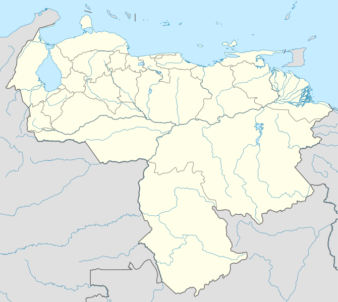
Deutsch: Positionskarte von Venezuela
Quadratische Plattkarte, N-S-Streckung 101 %. Geographische Begrenzung der Karte:
English: Location map of Venezuela
Equirectangular projection, N/S stretching 101 %. Geographic limits of the map:
|
| ਮਿਤੀ | |
| ਸਰੋਤ |
ਆਪਣਾ ਕੰਮ, using
|
| ਲਿਖਾਰੀ | NordNordWest |
| ਇਜਾਜ਼ਤ (ਇਸ ਫ਼ਾਈਲ ਦੀ ਮੁੜਵਰਤੋਂ ਕਰੋ) |
I, the copyright holder of this work, hereby publish it under the following license: ਇਸ ਫ਼ਾਈਲ ਦਾ ਲਸੰਸ ਕ੍ਰਿਏਟਿਵ ਕਾਮਨਜ਼ ਐਟ੍ਰੀਬਿਊਸ਼ਨ-ਸ਼ੇਅਰ ਅਲਾਈਕ 3.0 ਅਨਪੋਰਟੇਡ ਹੈ।
|
| Other versions |
Derivative works of this file: Venezuela relief location map.jpg
|

.svg)
.jpg)

|
This map has been made or improved in the German Kartenwerkstatt (Map Lab). You can propose maps to improve as well.
|
ਫ਼ਾਈਲ ਦਾ ਅਤੀਤ
ਤਾਰੀਖ/ਸਮੇਂ ’ਤੇ ਕਲਿੱਕ ਕਰੋ ਤਾਂ ਉਸ ਸਮੇਂ ਦੀ ਫਾਈਲ ਪੇਸ਼ ਹੋ ਜਾਵੇਗੀ।
| ਮਿਤੀ/ਸਮਾਂ | ਨਮੂਨਾ | ਨਾਪ | ਵਰਤੋਂਕਾਰ | ਟਿੱਪਣੀ | |
|---|---|---|---|---|---|
| ਮੌਜੂਦਾ | 19:38, 21 ਸਤੰਬਰ 2009 | | 1,654 × 1,479 (743 KB) | NordNordWest | =={{int:filedesc}}== {{Information |Description= {{de|Positionskarte von Venezuela}} Quadratische Plattkarte, N-S-Streckung 101 %. Geographische Begrenzung der Karte: * N: 12.8° N * S: 0.4° N * W: 73.6° W * O: 59.6° W {{en|Location m |
ਫ਼ਾਈਲ ਦੀ ਵਰਤੋਂ
ਇਹ ਫਾਈਲ ਹੇਠਾਂ ਦਿੱਤਾ ਸਫ਼ਾ ਵਰਤਦਾ ਹੈ:
ਫ਼ਾਈਲ ਦੀ ਵਿਆਪਕ ਵਰਤੋਂ
ਇਸ ਫ਼ਾਈਲ ਨੂੰ ਹੋਰ ਹੇਠ ਲਿਖੇ ਵਿਕੀ ਵਰਤਦੇ ਹਨ:
- af.wikipedia.org ਉੱਤੇ ਵਰਤੋਂ
- als.wikipedia.org ਉੱਤੇ ਵਰਤੋਂ
- am.wikipedia.org ਉੱਤੇ ਵਰਤੋਂ
- an.wikipedia.org ਉੱਤੇ ਵਰਤੋਂ
- Caracas
- Maracaibo
- Valencia (Venezuela)
- Maracay
- Barquisimeto
- San Cristóbal (Venezuela)
- La Guaira
- Ciudat Bolívar
- Maturín
- Mérida (Venezuela)
- Los Teques
- Barinas (ciudat)
- Coro (Venezuela)
- San Juan de Los Morros
- La Asunción
- San Felipe (Venezuela)
- Trujillo (Venezuela)
- Puerto Ayacucho
- Cumaná
- Barcelona (Venezuela)
- Guanare
- Tucupita
- San Fernando de Apure
- San Carlos (Venezuela)
- Puerto La Cruz
- Puerto Cabello
- Ciudat Guayana
- San Fernando de Atabapo
- Ciudat Ojeda
- Cabimas
- Lechería
- Isla Ratón
- Plantilla:Mapa de localización Venezuela
- Guasdualito
- Colonia Tovar
- Urica
- ast.wikipedia.org ਉੱਤੇ ਵਰਤੋਂ
- awa.wikipedia.org ਉੱਤੇ ਵਰਤੋਂ
- az.wikipedia.org ਉੱਤੇ ਵਰਤੋਂ
- ba.wikipedia.org ਉੱਤੇ ਵਰਤੋਂ
ਇਸ ਫ਼ਾਈਲ ਦੀ ਹੋਰ ਵਿਆਪਕ ਵਰਤੋਂ ਵੇਖੋ।