
ਤਸਵੀਰ:Blank-Map-Iran-With-Water-Bodies.PNG

ਇਸ ਝਾਤ ਦਾ ਅਕਾਰ: 652 × 600 ਪਿਕਸਲ. ਹੋਰ ਰੈਜ਼ੋਲਿਊਸ਼ਨਜ਼: 261 × 240 ਪਿਕਸਲ | 522 × 480 ਪਿਕਸਲ | 895 × 823 ਪਿਕਸਲ.
ਅਸਲ ਫ਼ਾਈਲ (895 × 823 ਪਿਕਸਲ, ਫ਼ਾਈਲ ਅਕਾਰ: 28 KB, MIME ਕਿਸਮ: image/png)
ਸਾਰ
| ਵੇਰਵਾ |
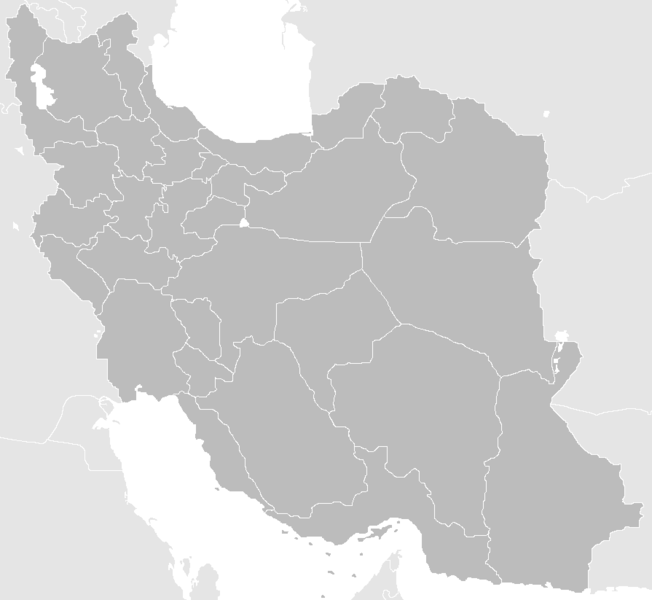
English: Blank Map of the territory claimed by Iran With Water Bodies and Neighbors فارسی: نقشه خالی ایران به همراه سرزمینهای آبی و کشورهای همسایه |
| ਮਿਤੀ | |
| ਸਰੋਤ | self-made adding water bodies and neighbors and applying some corrections and updates to a previous version Image:Blank-Map-Iran.PNG, which in turn was a corrected and updated version of Image:BlankMap-Iran.PNG created and uploaded by Shinas |
| ਲਿਖਾਰੀ | Siamax |
ਲਸੰਸ
| This work has been released into the public domain by its author, I, Siamax. This applies worldwide. In some countries this may not be legally possible; if so: I, Siamax grants anyone the right to use this work for any purpose, without any conditions, unless such conditions are required by law. |
ਫ਼ਾਈਲ ਦਾ ਅਤੀਤ
ਤਾਰੀਖ/ਸਮੇਂ ’ਤੇ ਕਲਿੱਕ ਕਰੋ ਤਾਂ ਉਸ ਸਮੇਂ ਦੀ ਫਾਈਲ ਪੇਸ਼ ਹੋ ਜਾਵੇਗੀ।
| ਮਿਤੀ/ਸਮਾਂ | ਨਮੂਨਾ | ਨਾਪ | ਵਰਤੋਂਕਾਰ | ਟਿੱਪਣੀ | |
|---|---|---|---|---|---|
| ਮੌਜੂਦਾ | 11:33, 23 ਜੂਨ 2013 | | 895 × 823 (28 KB) | BasilLeaf | بروزرسانی استانهای یزد و خراسان جنوبی |
| 12:32, 12 ਨਵੰਬਰ 2010 |  | 895 × 823 (43 KB) | M samadi | Border of South & Razavi Khorasans updated. | |
| 05:07, 18 ਅਕਤੂਬਰ 2010 |  | 895 × 823 (46 KB) | Siamax | Alborz province added | |
| 22:01, 29 ਜੁਲਾਈ 2007 |  | 895 × 823 (46 KB) | Siamax | == Summary == {{Information |Description=Blank Map of Iran With Water Bodies and Neighbors |Source=self-made adding water bodies and neighbors and applying some corrections and updates to a previous version Image:Blank-Map-Iran.PNG, which in turn wa | |
| 18:39, 29 ਜੁਲਾਈ 2007 |  | 895 × 823 (46 KB) | Siamax | {{Information |Description=Blank Map of Iran With Water Bodies and Neighbors |Source=self-made adding water bodies and neighbors and applying some corrections and updates to a previous version Image:Blank-Map-Iran.PNG, which in turn was a corrected |
ਫ਼ਾਈਲ ਦੀ ਵਰਤੋਂ
ਇਹ ਫਾਈਲ ਹੇਠਾਂ ਦਿੱਤੇ 2 ਸਫ਼ੇ ਵਰਤਦੇ ਹਨ:
ਫ਼ਾਈਲ ਦੀ ਵਿਆਪਕ ਵਰਤੋਂ
ਇਸ ਫ਼ਾਈਲ ਨੂੰ ਹੋਰ ਹੇਠ ਲਿਖੇ ਵਿਕੀ ਵਰਤਦੇ ਹਨ:
- ar.wikipedia.org ਉੱਤੇ ਵਰਤੋਂ
- av.wikipedia.org ਉੱਤੇ ਵਰਤੋਂ
- ba.wikipedia.org ਉੱਤੇ ਵਰਤੋਂ
- bn.wikipedia.org ਉੱਤੇ ਵਰਤੋਂ
- ce.wikipedia.org ਉੱਤੇ ਵਰਤੋਂ
- ckb.wikipedia.org ਉੱਤੇ ਵਰਤੋਂ
- diq.wikipedia.org ਉੱਤੇ ਵਰਤੋਂ
- el.wikipedia.org ਉੱਤੇ ਵਰਤੋਂ
- en.wikipedia.org ਉੱਤੇ ਵਰਤੋਂ
- Law Enforcement Command of the Islamic Republic of Iran
- User:Siamax
- Template:Provinces of Iran Labelled Map
- User:Jonny-mt/Gallery of current first-level administrative country subdivisions maps
- Outline of Iran
- Administrative divisions of Iran
- Talk:Iran/Archive 11
- List of cities in Iran by province
- User:Reza1615/pdf2
- Borders of Iran
- User:Falcaorib
- eu.wikipedia.org ਉੱਤੇ ਵਰਤੋਂ
- fa.wikipedia.org ਉੱਤੇ ਵਰਤੋਂ
- fi.wikipedia.org ਉੱਤੇ ਵਰਤੋਂ
- hi.wikipedia.org ਉੱਤੇ ਵਰਤੋਂ
- hr.wikipedia.org ਉੱਤੇ ਵਰਤੋਂ
- hu.wiktionary.org ਉੱਤੇ ਵਰਤੋਂ
- id.wikipedia.org ਉੱਤੇ ਵਰਤੋਂ
- is.wikipedia.org ਉੱਤੇ ਵਰਤੋਂ
- kk.wikipedia.org ਉੱਤੇ ਵਰਤੋਂ
ਇਸ ਫ਼ਾਈਲ ਦੀ ਹੋਰ ਵਿਆਪਕ ਵਰਤੋਂ ਵੇਖੋ।