
ਤਸਵੀਰ:Distrito Federal RA Plano Piloto.svg

Size of this PNG preview of this SVG file: 800 × 448 ਪਿਕਸਲ. ਹੋਰ ਰੈਜ਼ੋਲਿਊਸ਼ਨਜ਼: 320 × 179 ਪਿਕਸਲ | 640 × 358 ਪਿਕਸਲ | 1,024 × 573 ਪਿਕਸਲ | 1,280 × 716 ਪਿਕਸਲ | 2,560 × 1,432 ਪਿਕਸਲ | 974 × 545 ਪਿਕਸਲ.
ਅਸਲ ਫ਼ਾਈਲ (SVG ਫ਼ਾਈਲ, ਆਮ ਤੌਰ ’ਤੇ 974 × 545 ਪਿਕਸਲ, ਫ਼ਾਈਲ ਦਾ ਅਕਾਰ: 1.77 MB)

|
Standardization of derivative maps
Feel free to create derivations of this work, but if you want to illustrate a Wikipedia article with derivative works of this or similar maps of Brazil, please strictly follow the visual standard, nomenclature and classification already in use. All maps of Brazilian subdivisions are being adaptated or created in this way. We do not want to inhibit creativity but the pattern adopted here was presented and accepted by the Lusophone community and should be followed whenever possible. |
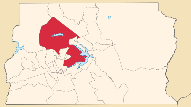
| ਵੇਰਵਾ | Map locator of Distrito Federal' administrative region I Plano Piloto | ||||||||
| ਮਿਤੀ | |||||||||
| ਸਰੋਤ | ਆਪਣਾ ਕੰਮ | ||||||||
| ਲਿਖਾਰੀ | FORTES | ||||||||
| ਇਜਾਜ਼ਤ (ਇਸ ਫ਼ਾਈਲ ਦੀ ਮੁੜਵਰਤੋਂ ਕਰੋ) |
I, the copyright holder of this work, hereby publish it under the following licenses:
This file is licensed under the Creative Commons Attribution 2.5 Generic license.
ਤੁਸੀਂ ਆਪਣੀ ਮਰਜ਼ੀ ਦਾ ਲਸੰਸ ਚੁਣ ਸਕਦੇ ਹੋ। |

ਫ਼ਾਈਲ ਦਾ ਅਤੀਤ
ਤਾਰੀਖ/ਸਮੇਂ ’ਤੇ ਕਲਿੱਕ ਕਰੋ ਤਾਂ ਉਸ ਸਮੇਂ ਦੀ ਫਾਈਲ ਪੇਸ਼ ਹੋ ਜਾਵੇਗੀ।
| ਮਿਤੀ/ਸਮਾਂ | ਨਮੂਨਾ | ਨਾਪ | ਵਰਤੋਂਕਾਰ | ਟਿੱਪਣੀ | |
|---|---|---|---|---|---|
| ਮੌਜੂਦਾ | 15:26, 5 ਅਪਰੈਲ 2020 | | 974 × 545 (1.77 MB) | Furious97 | Corrigindo cores. |
| 02:51, 5 ਅਪਰੈਲ 2020 |  | 974 × 545 (1.77 MB) | Furious97 | Atualizado conforme a Lei Complementar nº 958/2019 (Distrito Federal), que redefiniu os limites territoriais das regiões administrativas. | |
| 14:48, 4 ਜੂਨ 2007 |  | 1,130 × 550 (2.18 MB) | Srfortes | {{User:Raphael.lorenzeto/DerivativeMaps}} {{Information| |Description='''English:''' Map locator of the administrative region of Brasília in the Federal District, Brazil.<br> '''Português:''' Mapa de localização da região administrativa de Brasília |
ਫ਼ਾਈਲ ਦੀ ਵਰਤੋਂ
ਇਸ ਫ਼ਾਈਲ ਦੀ ਵਰਤੋਂ ਕਰਨ ਵਾਲੇ ਕੋਈ ਪੰਨੇ ਨਹੀਂ ਹਨ।
ਫ਼ਾਈਲ ਦੀ ਵਿਆਪਕ ਵਰਤੋਂ
ਇਸ ਫ਼ਾਈਲ ਨੂੰ ਹੋਰ ਹੇਠ ਲਿਖੇ ਵਿਕੀ ਵਰਤਦੇ ਹਨ:
- arz.wikipedia.org ਉੱਤੇ ਵਰਤੋਂ
- bg.wikipedia.org ਉੱਤੇ ਵਰਤੋਂ
- bn.wikipedia.org ਉੱਤੇ ਵਰਤੋਂ
- de.wikipedia.org ਉੱਤੇ ਵਰਤੋਂ
- es.wikipedia.org ਉੱਤੇ ਵਰਤੋਂ
- fa.wikipedia.org ਉੱਤੇ ਵਰਤੋਂ
- gv.wikipedia.org ਉੱਤੇ ਵਰਤੋਂ
- hr.wikipedia.org ਉੱਤੇ ਵਰਤੋਂ
- it.wikipedia.org ਉੱਤੇ ਵਰਤੋਂ
- ja.wikipedia.org ਉੱਤੇ ਵਰਤੋਂ
- jv.wikipedia.org ਉੱਤੇ ਵਰਤੋਂ
- mai.wikipedia.org ਉੱਤੇ ਵਰਤੋਂ
- ml.wikipedia.org ਉੱਤੇ ਵਰਤੋਂ
- ne.wikipedia.org ਉੱਤੇ ਵਰਤੋਂ
- or.wikipedia.org ਉੱਤੇ ਵਰਤੋਂ
- pnb.wikipedia.org ਉੱਤੇ ਵਰਤੋਂ
- ps.wikipedia.org ਉੱਤੇ ਵਰਤੋਂ
- pt.wikipedia.org ਉੱਤੇ ਵਰਤੋਂ
- rm.wikipedia.org ਉੱਤੇ ਵਰਤੋਂ
- ro.wikipedia.org ਉੱਤੇ ਵਰਤੋਂ
- sco.wikipedia.org ਉੱਤੇ ਵਰਤੋਂ
- simple.wikipedia.org ਉੱਤੇ ਵਰਤੋਂ
- srn.wikipedia.org ਉੱਤੇ ਵਰਤੋਂ
- ta.wikipedia.org ਉੱਤੇ ਵਰਤੋਂ
- tet.wikipedia.org ਉੱਤੇ ਵਰਤੋਂ
- ur.wikipedia.org ਉੱਤੇ ਵਰਤੋਂ
- vi.wikipedia.org ਉੱਤੇ ਵਰਤੋਂ
- www.wikidata.org ਉੱਤੇ ਵਰਤੋਂ