
ਤਸਵੀਰ:India Kerala location map.svg

ਅਸਲ ਫ਼ਾਈਲ (SVG ਫ਼ਾਈਲ, ਆਮ ਤੌਰ ’ਤੇ 874 × 1,274 ਪਿਕਸਲ, ਫ਼ਾਈਲ ਦਾ ਅਕਾਰ: 350 KB)
ਸਾਰ
| ਵੇਰਵਾ |
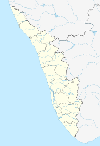
Quadratische Plattkarte, N-S-Streckung 102 %. Geographische Begrenzung der Karte:
Equirectangular projection, N/S stretching 102 %. Geographic limits of the map:
|
|
| ਮਿਤੀ | ||
| ਸਰੋਤ |
ਆਪਣਾ ਕੰਮ, using
|
|
| ਲਿਖਾਰੀ | NordNordWest | |
| ਇਜਾਜ਼ਤ (ਇਸ ਫ਼ਾਈਲ ਦੀ ਮੁੜਵਰਤੋਂ ਕਰੋ) |
This file is licensed under the Creative Commons Attribution-Share Alike 3.0 Germany license.
 ਇਸ ਫ਼ਾਈਲ ਦਾ ਲਸੰਸ ਕ੍ਰਿਏਟਿਵ ਕਾਮਨਜ਼ ਐਟ੍ਰੀਬਿਊਸ਼ਨ-ਸ਼ੇਅਰ ਅਲਾਈਕ 3.0 ਅਨਪੋਰਟੇਡ ਹੈ।
|


|
This map has been made or improved in the German Kartenwerkstatt (Map Lab). You can propose maps to improve as well.
|
ਫ਼ਾਈਲ ਦਾ ਅਤੀਤ
ਤਾਰੀਖ/ਸਮੇਂ ’ਤੇ ਕਲਿੱਕ ਕਰੋ ਤਾਂ ਉਸ ਸਮੇਂ ਦੀ ਫਾਈਲ ਪੇਸ਼ ਹੋ ਜਾਵੇਗੀ।
| ਮਿਤੀ/ਸਮਾਂ | ਨਮੂਨਾ | ਨਾਪ | ਵਰਤੋਂਕਾਰ | ਟਿੱਪਣੀ | |
|---|---|---|---|---|---|
| ਮੌਜੂਦਾ | 16:13, 10 ਜੂਨ 2023 | | 874 × 1,274 (350 KB) | C1MM | c boundaries |
| 16:04, 10 ਜੂਨ 2023 |  | 874 × 1,274 (351 KB) | C1MM | c bounds | |
| 14:41, 22 ਅਗਸਤ 2021 |  | 775 × 1,129 (394 KB) | C1MM | Corrected rivers and dist boundaries | |
| 18:17, 4 ਮਈ 2012 |  | 827 × 1,205 (135 KB) | NordNordWest | upd | |
| 09:30, 11 ਮਾਰਚ 2011 |  | 827 × 1,205 (132 KB) | NordNordWest | =={{int:filedesc}}== {{Information |Description= {{de|Positionskarte von Kerala, Indien}} Quadratische Plattkarte, N-S-Streckung 102 %. Geographische Begrenzung der Karte: * N: 13.0° N * S: 8.0° N * W: 74.5° O * O: 78.0° |
ਫ਼ਾਈਲ ਦੀ ਵਰਤੋਂ
ਇਹ ਫਾਈਲ ਹੇਠਾਂ ਦਿੱਤੇ 21 ਸਫ਼ੇ ਵਰਤਦੇ ਹਨ:
- ਅਜ਼ਹੇਕਲ ਬੀਚ
- ਅੰਚੁਤੇਂਗੂ
- ਅੱਲਾਪੁੜਾ ਬੀਚ
- ਕਪਿਲ, ਤਿਰੂਵਨੰਤਪੁਰਮ
- ਕਾਏਕੱਟੀ
- ਕੁੱਟੀਚਿਰਾ ਬੀਚ
- ਚੇਰਈ
- ਚੇਰਈ ਬੀਚ
- ਤਨੂਰ ਬੀਚ
- ਤੇਕੜੀ
- ਥੇਕੁੰਭਗਮ
- ਪਡਿੰਜਰੇਕਰਾ ਬੀਚ
- ਪੂਵਰ
- ਪੋੜੀਕਾਰਾ
- ਮੁਜ਼ੱਪਿਲੰਗਡ ਬੀਚ
- ਫਰਮਾ:Location map India Kerala
- ਫਰਮਾ:Location map ਕੇਰਲਾ ਭਾਰਤ
- ਫਰਮਾ:ਸਥਿਤੀ ਨਕਸ਼ਾ ਭਾਰਤ ਕੇਰਲਾ
- ਮੌਡਿਊਲ:Location map/data/India Kerala
- ਮੌਡਿਊਲ:Location map/data/India Kerala/doc
- ਮੌਡਿਊਲ:Location map/data/Kerala
ਫ਼ਾਈਲ ਦੀ ਵਿਆਪਕ ਵਰਤੋਂ
ਇਸ ਫ਼ਾਈਲ ਨੂੰ ਹੋਰ ਹੇਠ ਲਿਖੇ ਵਿਕੀ ਵਰਤਦੇ ਹਨ:
- ar.wikipedia.org ਉੱਤੇ ਵਰਤੋਂ
- azb.wikipedia.org ਉੱਤੇ ਵਰਤੋਂ
- باتی چاتالور
- باتی پودوسری
- پیدیکاپارامبو
- پیداوور
- وایاتوپوژا
- وئیلور
- پرووانتانام
- پرووالور
- پرووا (هیندوستان)
- پرونا (هیندوستان)
- پرونیلام
- واوانور
- پرونقوژی
- وانیمال
- وانییامبالام
- ونیکود
- ونجینیسری
- ونقانور
- سارکارا-چیرایینکیژو
- سانتانپارا
- ماژووانور
- ماژوکیر
- کالکونتال
- کالیکاو
- ماترا (هیندوستان)
- ماتیلاکام
- ماتامبا
- کالایاپورام
- کالاتوکاداوو
- کالانجور
- ونقانلور
- ونقولا
- ماروتا, ایندیا
- کالامپالا
- ونقارا, مالاپورام دیستریکت
- ونکیتانقو
- کالاکتی
- واندیتاوالام
- واندانمدو
- واندانپاتال
- وانداماتوم
- وانداژی-یی
- وانداژی-ی
- ونجارامودو
- ونپاکال
- کاکور (هیندوستان)
- ماریاناد
- کاکولیسری
- کاکودی
ਇਸ ਫ਼ਾਈਲ ਦੀ ਹੋਰ ਵਿਆਪਕ ਵਰਤੋਂ ਵੇਖੋ।