
ਤਸਵੀਰ:Indian Ocean-CIA WFB Map.png
ਇਸ ਤੋਂ ਵੱਡੀ ਤਸਵੀਰ ਮੌਜੂਦ ਨਹੀਂ ਹੈ।
Indian_Ocean-CIA_WFB_Map.png (330 × 330 ਪਿਕਸਲ, ਫ਼ਾਈਲ ਅਕਾਰ: 11 KB, MIME ਕਿਸਮ: image/png)

|
This locator map image could be re-created using vector graphics as an SVG file. This has several advantages; see Commons:Media for cleanup for more information. If an SVG form of this image is available, please upload it and afterwards replace this template with
{{vector version available|new image name}}.
It is recommended to name the SVG file “Indian Ocean-CIA WFB Map.svg”—then the template Vector version available (or Vva) does not need the new image name parameter. |
ਸਾਰ
| ਵੇਰਵਾ |
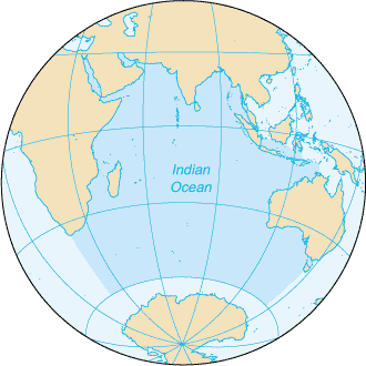
English: Map of The Indian Ocean with English captions. |
|||
| ਮਿਤੀ | ||||
| ਸਰੋਤ | The World Factbook | |||
| ਲਿਖਾਰੀ | United States Central Intelligence Agency | |||
| ਇਜਾਜ਼ਤ (ਇਸ ਫ਼ਾਈਲ ਦੀ ਮੁੜਵਰਤੋਂ ਕਰੋ) |
|
|||
| Other versions |
|


Derivative works
Derivative works of this file: Samudra Hindia.png
ਫ਼ਾਈਲ ਦਾ ਅਤੀਤ
ਤਾਰੀਖ/ਸਮੇਂ ’ਤੇ ਕਲਿੱਕ ਕਰੋ ਤਾਂ ਉਸ ਸਮੇਂ ਦੀ ਫਾਈਲ ਪੇਸ਼ ਹੋ ਜਾਵੇਗੀ।
| ਮਿਤੀ/ਸਮਾਂ | ਨਮੂਨਾ | ਨਾਪ | ਵਰਤੋਂਕਾਰ | ਟਿੱਪਣੀ | |
|---|---|---|---|---|---|
| ਮੌਜੂਦਾ | 09:14, 27 ਮਾਰਚ 2005 | | 330 × 330 (11 KB) | Wolfman~commonswiki | {{CIA-map}} |
ਫ਼ਾਈਲ ਦੀ ਵਰਤੋਂ
ਇਹ ਫਾਈਲ ਹੇਠਾਂ ਦਿੱਤੇ 3 ਸਫ਼ੇ ਵਰਤਦੇ ਹਨ:
ਫ਼ਾਈਲ ਦੀ ਵਿਆਪਕ ਵਰਤੋਂ
ਇਸ ਫ਼ਾਈਲ ਨੂੰ ਹੋਰ ਹੇਠ ਲਿਖੇ ਵਿਕੀ ਵਰਤਦੇ ਹਨ:
- am.wikipedia.org ਉੱਤੇ ਵਰਤੋਂ
- ang.wikipedia.org ਉੱਤੇ ਵਰਤੋਂ
- anp.wikipedia.org ਉੱਤੇ ਵਰਤੋਂ
- as.wikipedia.org ਉੱਤੇ ਵਰਤੋਂ
- azb.wikipedia.org ਉੱਤੇ ਵਰਤੋਂ
- ba.wikipedia.org ਉੱਤੇ ਵਰਤੋਂ
- be.wikipedia.org ਉੱਤੇ ਵਰਤੋਂ
- bg.wikipedia.org ਉੱਤੇ ਵਰਤੋਂ
- bh.wikipedia.org ਉੱਤੇ ਵਰਤੋਂ
- bjn.wikipedia.org ਉੱਤੇ ਵਰਤੋਂ
- blk.wikipedia.org ਉੱਤੇ ਵਰਤੋਂ
- cdo.wikipedia.org ਉੱਤੇ ਵਰਤੋਂ
- ckb.wikipedia.org ਉੱਤੇ ਵਰਤੋਂ
- co.wikipedia.org ਉੱਤੇ ਵਰਤੋਂ
- cs.wikipedia.org ਉੱਤੇ ਵਰਤੋਂ
- dty.wikipedia.org ਉੱਤੇ ਵਰਤੋਂ
- el.wikipedia.org ਉੱਤੇ ਵਰਤੋਂ
- en.wikipedia.org ਉੱਤੇ ਵਰਤੋਂ
- en.wikibooks.org ਉੱਤੇ ਵਰਤੋਂ
- en.wikinews.org ਉੱਤੇ ਵਰਤੋਂ
- en.wikisource.org ਉੱਤੇ ਵਰਤੋਂ
- en.wikiversity.org ਉੱਤੇ ਵਰਤੋਂ
- en.wiktionary.org ਉੱਤੇ ਵਰਤੋਂ
- fa.wikipedia.org ਉੱਤੇ ਵਰਤੋਂ
- fo.wikipedia.org ਉੱਤੇ ਵਰਤੋਂ
- gor.wikipedia.org ਉੱਤੇ ਵਰਤੋਂ
- gu.wikipedia.org ਉੱਤੇ ਵਰਤੋਂ
- gv.wikipedia.org ਉੱਤੇ ਵਰਤੋਂ
- hak.wikipedia.org ਉੱਤੇ ਵਰਤੋਂ
- ha.wikipedia.org ਉੱਤੇ ਵਰਤੋਂ
- he.wikipedia.org ਉੱਤੇ ਵਰਤੋਂ
- hi.wikipedia.org ਉੱਤੇ ਵਰਤੋਂ
- hu.wikipedia.org ਉੱਤੇ ਵਰਤੋਂ
- id.wikipedia.org ਉੱਤੇ ਵਰਤੋਂ
ਇਸ ਫ਼ਾਈਲ ਦੀ ਹੋਰ ਵਿਆਪਕ ਵਰਤੋਂ ਵੇਖੋ।