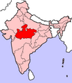
ਤਸਵੀਰ:Madhya Pradesh in India.png
Madhya_Pradesh_in_India.png (350 × 426 ਪਿਕਸਲ, ਫ਼ਾਈਲ ਅਕਾਰ: 76 KB, MIME ਕਿਸਮ: image/png)
ਫ਼ਾਈਲ ਦਾ ਅਤੀਤ
ਤਾਰੀਖ/ਸਮੇਂ ’ਤੇ ਕਲਿੱਕ ਕਰੋ ਤਾਂ ਉਸ ਸਮੇਂ ਦੀ ਫਾਈਲ ਪੇਸ਼ ਹੋ ਜਾਵੇਗੀ।
| ਮਿਤੀ/ਸਮਾਂ | ਨਮੂਨਾ | ਨਾਪ | ਵਰਤੋਂਕਾਰ | ਟਿੱਪਣੀ | |
|---|---|---|---|---|---|
| ਮੌਜੂਦਾ | 07:30, 23 ਅਪਰੈਲ 2005 |  | 350 × 426 (76 KB) | Nichalp | NPOV map |
| 07:21, 23 ਅਪਰੈਲ 2005 |  | 200 × 231 (22 KB) | Kerpal | Reverted to earlier revision | |
| 06:23, 23 ਅਪਰੈਲ 2005 |  | 500 × 608 (121 KB) | Nichalp | Reverted to earlier revision | |
| 05:00, 23 ਅਪਰੈਲ 2005 |  | 200 × 231 (22 KB) | Kerpal | Reverted to earlier revision | |
| 04:54, 23 ਅਪਰੈਲ 2005 |  | 500 × 608 (121 KB) | Nichalp | Reverted to earlier revision | |
| 21:05, 22 ਅਪਰੈਲ 2005 |  | 200 × 231 (22 KB) | Kerpal | Reverted to earlier revision | |
| 13:39, 22 ਅਪਰੈਲ 2005 |  | 500 × 608 (121 KB) | Nichalp | Reverted to earlier revision | |
| 09:48, 22 ਅਪਰੈਲ 2005 |  | 200 × 231 (22 KB) | Kerpal | originally by en:User:Morwen | |
| 18:00, 21 ਅਪਰੈਲ 2005 |  | 500 × 608 (121 KB) | Nichalp | --- Map made by me, ~~~ --- Note: The Indian state of w:Jammu and Kashmir is claimed by w:India, w:Pakistan and the w:People's Republic of China. This map depicts the boundaries of the state as it was in 1947. Areas administered by India |
ਫ਼ਾਈਲ ਦੀ ਵਰਤੋਂ
ਇਹ ਫਾਈਲ ਹੇਠਾਂ ਦਿੱਤਾ ਸਫ਼ਾ ਵਰਤਦਾ ਹੈ:
ਫ਼ਾਈਲ ਦੀ ਵਿਆਪਕ ਵਰਤੋਂ
ਇਸ ਫ਼ਾਈਲ ਨੂੰ ਹੋਰ ਹੇਠ ਲਿਖੇ ਵਿਕੀ ਵਰਤਦੇ ਹਨ:
- br.wikipedia.org ਉੱਤੇ ਵਰਤੋਂ
- bxr.wikipedia.org ਉੱਤੇ ਵਰਤੋਂ
- en.wikipedia.org ਉੱਤੇ ਵਰਤੋਂ
- User:Tanul
- Template:User Madhya Pradesh
- Jai Prakash Yadav (cricketer)
- User:Suyash
- User:Tanul/Userboxes
- User:Siddhant
- Dharampuri
- User:Chintu rohit
- 2004 Indian general election in Madhya Pradesh
- Wikipedia:WikiProject Madhya Pradesh
- Raja Hindu Rao
- User:!dea4u
- 2009 Indian general election in Madhya Pradesh
- Bindeshwari Goyal
- User:Gaurav713
- Template:MadhyaPradesh-stub
- Category:Madhya Pradeshi Wikipedians
- User:Abhinay.leo
- Template:User Madhya Pradesh/doc1
- User:Shobhit Gosain
- 2013 elections in India
- User:!dea4u/userboxes
- User:Suyash.dwivedi
- Bhima Kheda
- Nikhil Thakur
- User:Dr.Rohit Bhamoura
- Mukhya Mantri Yuva Swarozgar Yojana
- User:Brandybradham
- User:Har$h/sandbox
- User:Jaywardhan009
- List of speakers of the Madhya Pradesh Legislative Assembly
- User:Brandybradham/testcases
- User:Shreya.Bhopal
- User:Swapnil.Karambelkar
- User:Siddharth.Mishra
- User:Vijay Tiwari09
- User:Kiran.Dwivedi
- Newton Chikli Colliery disaster
- Nagjhiri
- Dewas Gate Inter State Bus Stand
- 2014 Indian general election in Madhya Pradesh
- Bicholi Hapsi
- Raigaon Assembly constituency
- Semariya Assembly constituency
- Mangawan Assembly constituency
- Manpur Assembly constituency
- Panagar Assembly constituency
- Sihora Assembly constituency
ਇਸ ਫ਼ਾਈਲ ਦੀ ਹੋਰ ਵਿਆਪਕ ਵਰਤੋਂ ਵੇਖੋ।


