
ਤਸਵੀਰ:Odisha locator map.svg

Size of this PNG preview of this SVG file: 607 × 600 ਪਿਕਸਲ. ਹੋਰ ਰੈਜ਼ੋਲਿਊਸ਼ਨਜ਼: 243 × 240 ਪਿਕਸਲ | 486 × 480 ਪਿਕਸਲ | 778 × 768 ਪਿਕਸਲ | 1,037 × 1,024 ਪਿਕਸਲ | 2,074 × 2,048 ਪਿਕਸਲ | 2,269 × 2,241 ਪਿਕਸਲ.
ਅਸਲ ਫ਼ਾਈਲ (SVG ਫ਼ਾਈਲ, ਆਮ ਤੌਰ ’ਤੇ 2,269 × 2,241 ਪਿਕਸਲ, ਫ਼ਾਈਲ ਦਾ ਅਕਾਰ: 211 KB)
| ਸਿਰਲੇਖ |
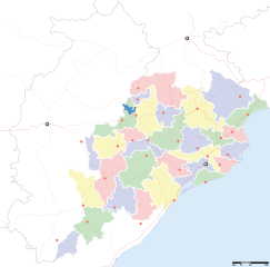
Orissa locator map |
||
| Description |
Locator map for the Indian state of w:Orissa. Equirectangular projection - Geographic limits of the map: top=24.27, bottom=17.691 |
||
| ਮਿਤੀ | |||
| ਸਰੋਤ |
ਆਪਣਾ ਕੰਮ |
||
| Creator |
|
||
| ਇਜਾਜ਼ਤ (ਇਸ ਫ਼ਾਈਲ ਦੀ ਮੁੜਵਰਤੋਂ ਕਰੋ) |
I, the copyright holder of this work, hereby publish it under the following license: ਇਸ ਫ਼ਾਈਲ ਦਾ ਲਸੰਸ ਕ੍ਰਿਏਟਿਵ ਕਾਮਨਜ਼ ਐਟ੍ਰੀਬਿਊਸ਼ਨ-ਸ਼ੇਅਰ ਅਲਾਈਕ 3.0 ਅਨਪੋਰਟੇਡ ਹੈ।
|
||
| Geotemporal data | |||
| Date depicted | second half of 20 century ਅਤੇ 21 century | ||
| Georeferencing | If inappropriate please set warp_status = skip to hide. | ||
| Archival data | |||
| Notes | Part of WikiProject India Maps | ||
ਫ਼ਾਈਲ ਦਾ ਅਤੀਤ
ਤਾਰੀਖ/ਸਮੇਂ ’ਤੇ ਕਲਿੱਕ ਕਰੋ ਤਾਂ ਉਸ ਸਮੇਂ ਦੀ ਫਾਈਲ ਪੇਸ਼ ਹੋ ਜਾਵੇਗੀ।
| ਮਿਤੀ/ਸਮਾਂ | ਨਮੂਨਾ | ਨਾਪ | ਵਰਤੋਂਕਾਰ | ਟਿੱਪਣੀ | |
|---|---|---|---|---|---|
| ਮੌਜੂਦਾ | 17:28, 6 ਸਤੰਬਰ 2008 | | 2,269 × 2,241 (211 KB) | Planemad | |
| 13:28, 21 ਫ਼ਰਵਰੀ 2008 |  | 647 × 564 (132 KB) | Mkeranat~commonswiki | {{Information |Description=Locator map for the state of [w:Orissa] updated to show white borders for districts |Source=self-made, based on India locator map by [w:User:Planemad] |Date=Feb 2008 |Author= Mkeranat |Permission= |other_versions= }} | |
| 21:32, 14 ਫ਼ਰਵਰੀ 2008 |  | 647 × 564 (130 KB) | Mkeranat~commonswiki | {{Information |Description=Locator map for the state of [w:Orissa] |Source=self-made, based on India locator map by [w:User:Planemad] |Date=Feb 2008 |Author= Mkeranat |Permission= |other_versions= }} |
ਫ਼ਾਈਲ ਦੀ ਵਰਤੋਂ
ਇਹ ਫਾਈਲ ਹੇਠਾਂ ਦਿੱਤੇ 2 ਸਫ਼ੇ ਵਰਤਦੇ ਹਨ:
ਫ਼ਾਈਲ ਦੀ ਵਿਆਪਕ ਵਰਤੋਂ
ਇਸ ਫ਼ਾਈਲ ਨੂੰ ਹੋਰ ਹੇਠ ਲਿਖੇ ਵਿਕੀ ਵਰਤਦੇ ਹਨ:
- ar.wikipedia.org ਉੱਤੇ ਵਰਤੋਂ
- as.wikipedia.org ਉੱਤੇ ਵਰਤੋਂ
- awa.wikipedia.org ਉੱਤੇ ਵਰਤੋਂ
- ba.wikipedia.org ਉੱਤੇ ਵਰਤੋਂ
- ceb.wikipedia.org ਉੱਤੇ ਵਰਤੋਂ
- de.wikipedia.org ਉੱਤੇ ਵਰਤੋਂ
- en.wikipedia.org ਉੱਤੇ ਵਰਤੋਂ
- es.wikipedia.org ਉੱਤੇ ਵਰਤੋਂ
- fa.wikipedia.org ਉੱਤੇ ਵਰਤੋਂ
- gu.wikipedia.org ਉੱਤੇ ਵਰਤੋਂ
- hi.wikipedia.org ਉੱਤੇ ਵਰਤੋਂ
- नलबण पक्षी अभयारण्य
- साँचा:ओड़िशा के लोकसभा निर्वाचन क्षेत्र
- आस्का लोक सभा निर्वाचन क्षेत्र
- भुवनेश्वर लोक सभा निर्वाचन क्षेत्र
- बलांगिर लोक सभा निर्वाचन क्षेत्र
- कटक लोक सभा निर्वाचन क्षेत्र
- ढेंकानाल लोक सभा निर्वाचन क्षेत्र
- जगतसिंहपुर लोक सभा निर्वाचन क्षेत्र
- जाजपुर लोक सभा निर्वाचन क्षेत्र
- कलाहांडी लोक सभा निर्वाचन क्षेत्र
- कंधमाल लोक सभा निर्वाचन क्षेत्र
ਇਸ ਫ਼ਾਈਲ ਦੀ ਹੋਰ ਵਿਆਪਕ ਵਰਤੋਂ ਵੇਖੋ।