
ਤਸਵੀਰ:Sierra Leone location map Topographic.png

ਇਸ ਝਾਤ ਦਾ ਅਕਾਰ: 600 × 600 ਪਿਕਸਲ. ਹੋਰ ਰੈਜ਼ੋਲਿਊਸ਼ਨਜ਼: 240 × 240 ਪਿਕਸਲ | 622 × 622 ਪਿਕਸਲ.
ਅਸਲ ਫ਼ਾਈਲ (622 × 622 ਪਿਕਸਲ, ਫ਼ਾਈਲ ਅਕਾਰ: 827 KB, MIME ਕਿਸਮ: image/png)
ਸਾਰ
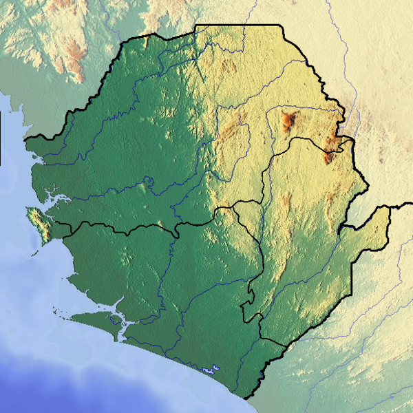
| ਵੇਰਵਾ |
Deutsch: Positionskarte von Sierra Leone
Quadratische Plattkarte. Geographische Begrenzung der Karte:
English: Location map of Sierra Leone
Equirectangular projection. Geographic limits of the map:
|
| ਮਿਤੀ | |
| ਸਰੋਤ |
ਆਪਣਾ ਕੰਮ
|
| ਲਿਖਾਰੀ | Dr Brains |
ਲਸੰਸ
I, the copyright holder of this work, hereby publish it under the following license:

|
Permission is granted to copy, distribute and/or modify this document under the terms of the GNU Free Documentation License, Version 1.2 only as published by the Free Software Foundation; with no Invariant Sections, no Front-Cover Texts, and no Back-Cover Texts. A copy of the license is included in the section entitled GNU Free Documentation License. | 1.2 only |
ਫ਼ਾਈਲ ਦਾ ਅਤੀਤ
ਤਾਰੀਖ/ਸਮੇਂ ’ਤੇ ਕਲਿੱਕ ਕਰੋ ਤਾਂ ਉਸ ਸਮੇਂ ਦੀ ਫਾਈਲ ਪੇਸ਼ ਹੋ ਜਾਵੇਗੀ।
| ਮਿਤੀ/ਸਮਾਂ | ਨਮੂਨਾ | ਨਾਪ | ਵਰਤੋਂਕਾਰ | ਟਿੱਪਣੀ | |
|---|---|---|---|---|---|
| ਮੌਜੂਦਾ | 14:11, 23 ਜੂਨ 2012 | | 622 × 622 (827 KB) | Dr Brains |
ਫ਼ਾਈਲ ਦੀ ਵਰਤੋਂ
ਇਹ ਫਾਈਲ ਹੇਠਾਂ ਦਿੱਤਾ ਸਫ਼ਾ ਵਰਤਦਾ ਹੈ:
ਫ਼ਾਈਲ ਦੀ ਵਿਆਪਕ ਵਰਤੋਂ
ਇਸ ਫ਼ਾਈਲ ਨੂੰ ਹੋਰ ਹੇਠ ਲਿਖੇ ਵਿਕੀ ਵਰਤਦੇ ਹਨ:
- ar.wikipedia.org ਉੱਤੇ ਵਰਤੋਂ
- ast.wikipedia.org ਉੱਤੇ ਵਰਤੋਂ
- az.wikipedia.org ਉੱਤੇ ਵਰਤੋਂ
- bn.wikipedia.org ਉੱਤੇ ਵਰਤੋਂ
- bs.wikipedia.org ਉੱਤੇ ਵਰਤੋਂ
- ceb.wikipedia.org ਉੱਤੇ ਵਰਤੋਂ
- cs.wikipedia.org ਉੱਤੇ ਵਰਤੋਂ
- de.wikipedia.org ਉੱਤੇ ਵਰਤੋਂ
- el.wikipedia.org ਉੱਤੇ ਵਰਤੋਂ
- en.wikipedia.org ਉੱਤੇ ਵਰਤੋਂ
- Freetown
- Bunce Island
- Mount Bintumani
- Loma Mountains
- Outamba-Kilimi National Park
- Tiwai Island
- Western Area Peninsula National Park
- Kangari Hills Forest Reserve
- Tingi Hills Forest Reserve
- Module:Location map/data/Sierra Leone/doc
- Lake Sonfon
- Masanga Hospital
- Freetown Central Mosque
- Pujehun Central Mosque
- Bumbuna Dam
- Immaculate Heart of Mary Cathedral, Bo
- Yawri Bay
- Jamiatul Atiq Mosque
- Module:Location map/data/Sierra Leone
- Lion Mountains
- eo.wikipedia.org ਉੱਤੇ ਵਰਤੋਂ
- es.wikipedia.org ਉੱਤੇ ਵਰਤੋਂ
- fa.wikipedia.org ਉੱਤੇ ਵਰਤੋਂ
- fi.wikipedia.org ਉੱਤੇ ਵਰਤੋਂ
- fr.wikipedia.org ਉੱਤੇ ਵਰਤੋਂ
ਇਸ ਫ਼ਾਈਲ ਦੀ ਹੋਰ ਵਿਆਪਕ ਵਰਤੋਂ ਵੇਖੋ।