
ਤਸਵੀਰ:Spain Galicia location map.svg

Size of this PNG preview of this SVG file: 512 × 553 ਪਿਕਸਲ. ਹੋਰ ਰੈਜ਼ੋਲਿਊਸ਼ਨਜ਼: 222 × 240 ਪਿਕਸਲ | 444 × 480 ਪਿਕਸਲ | 711 × 768 ਪਿਕਸਲ | 948 × 1,024 ਪਿਕਸਲ | 1,896 × 2,048 ਪਿਕਸਲ.
ਅਸਲ ਫ਼ਾਈਲ (SVG ਫ਼ਾਈਲ, ਆਮ ਤੌਰ ’ਤੇ 512 × 553 ਪਿਕਸਲ, ਫ਼ਾਈਲ ਦਾ ਅਕਾਰ: 576 KB)
ਸਾਰ
| ਵੇਰਵਾ |
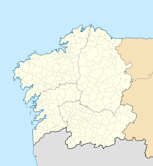
English: Location map of Galicia (Spain)
Equirectangular projection, N/S stretching 130 %. Geographic limits of the map:
Español: Mapa de localización de la comunidad autónoma de Galicia (España)
Proyección equirrectangular, N/S estirada 130 %. Límites geográficos del mapa:
|
|
| ਮਿਤੀ | ||
| ਸਰੋਤ | Own work based on: EspañaLoc.svg by HansenBCN | |
| ਲਿਖਾਰੀ | Miguillen | |
| SVG genesis | This locator map was created with Inkscape.
|
ਲਸੰਸ
Miguillen, the copyright holder of this work, hereby publishes it under the following license:
ਇਸ ਫ਼ਾਈਲ ਦਾ ਲਸੰਸ ਕ੍ਰਿਏਟਿਵ ਕਾਮਨਜ਼ ਐਟ੍ਰੀਬਿਊਸ਼ਨ-ਸ਼ੇਅਰ ਅਲਾਈਕ 3.0 ਅਨਪੋਰਟੇਡ ਹੈ।
ਐਟਰੀਬਿਊਸ਼ਨ: Miguillen
- ਤੁਹਾਨੂੰ ਖੁੱਲ੍ਹ ਹੈ:
- ਸਾਂਝਾ ਕਰਨ ਦੀ – ਰਚਨਾ ਨੂੰ ਕਾਪੀ, ਵੰਡਣਾ ਅਤੇ ਭੇਜਣਾ
- ਮੁੜ-ਰਲ਼ਾਉਣ ਦੀ – ਰਚਨਾ ਨੂੰ ਢਾਲਣਾ
- ਥੱਲੇ ਲਿਖੀਆਂ ਸ਼ਰਤਾਂ ਹੇਠ:
- ਗੁਣਾਂ ਦੀ ਦੱਸ – ਉਚਿਤ ਕ੍ਰੈਡਿਟ ਦੇਵੋ, ਲਾਇਸੰਸ ਦਾ ਇੱਕ ਲਿੰਕ ਪ੍ਰਦਾਨ ਕਰੋ ਅਤੇ ਇਹ ਦਰਸਾਓ ਕਿ ਕੀ ਤਬਦੀਲੀਆਂ ਕੀਤੀਆਂ ਗਈਆਂ ਸਨ। ਤੁਸੀਂ ਇਹ ਕਿਸੇ ਵੀ ਵਾਜਬ ਤਰੀਕੇ ਨਾਲ ਕਰ ਸਕਦੇ ਹੋ, ਪਰ ਇਹ ਤਰੀਕਾ ਅਜਿਹਾ ਨਹੀਂ ਹੋਣਾ ਚਾਹੀਦਾ ਜੋ ਇਹ ਦਰਸਾਵੇ ਕਿ ਲਾਇਸੰਸਕਰਤਾ ਤੁਹਾਨੂੰ ਜਾਂ ਤੁਹਾਡੀ ਵਰਤੋਂ ਦਾ ਸਮਰਥਨ ਕਰਦਾ ਹੈ।
- ਸ਼ੇਅਰ ਅਲਾਈਕ – ਜੇਕਰ ਤੁਸੀਂ ਸਮੱਗਰੀ ਨੂੰ ਰੀਮਿਕਸ ਕਰਦੇ ਹੋ, ਬਦਲਦੇ ਹੋ ਜਾਂ ਬਣਾਉਂਦੇ ਹੋ, ਤਾਂ ਆਪਣੇ ਯੋਗਦਾਨ ਇੱਕੋ ਜਿਹੇ ਜਾਂ ਅਨੁਕੂਲ ਲਾਇਸੰਸ ਦੇ ਅਧੀਨ ਕਰੋ।
ਫ਼ਾਈਲ ਦਾ ਅਤੀਤ
ਤਾਰੀਖ/ਸਮੇਂ ’ਤੇ ਕਲਿੱਕ ਕਰੋ ਤਾਂ ਉਸ ਸਮੇਂ ਦੀ ਫਾਈਲ ਪੇਸ਼ ਹੋ ਜਾਵੇਗੀ।
| ਮਿਤੀ/ਸਮਾਂ | ਨਮੂਨਾ | ਨਾਪ | ਵਰਤੋਂਕਾਰ | ਟਿੱਪਣੀ | |
|---|---|---|---|---|---|
| ਮੌਜੂਦਾ | 21:49, 19 ਅਕਤੂਬਰ 2016 | | 512 × 553 (576 KB) | HombreDHojalata | [http://www.xunta.es/dog/Publicados/2013/20130607/AnuncioG0244-060613-0003_gl.html DECRETO 83/2013, do 6 de xuño, polo que se aproba a fusión voluntaria dos municipios de Oza dos Ríos e Cesuras e se constitúe o municipio de Oza-Cesuras] DOG, 7 de x... |
| 21:33, 19 ਅਕਤੂਬਰ 2016 |  | 512 × 553 (576 KB) | HombreDHojalata | [http://www.xunta.gal/dog/Publicados/2016/20161017/AnuncioG0244-131016-0001_gl.html DECRETO 134/2016, do 22 de setembro, polo que se aproba a fusión voluntaria dos municipios de Cerdedo e Cotobade e se constitúe o municipio de Cerdedo-Cotobade], DOG... | |
| 18:32, 20 ਮਈ 2010 |  | 512 × 553 (551 KB) | Miguillen | color mar | |
| 15:28, 20 ਮਈ 2010 |  | 512 × 553 (551 KB) | Miguillen | == {{int:filedesc}} == {{Information |Description={{en|Location map of Galicia (Spain)}} Equirectangular projection, N/S stretching 130 %. Geographic limits of the map: * N: 43.055249° N * S: 39.750129° N * W: 2.282836° O * E: 0. |
ਫ਼ਾਈਲ ਦੀ ਵਰਤੋਂ
ਇਹ ਫਾਈਲ ਹੇਠਾਂ ਦਿੱਤਾ ਸਫ਼ਾ ਵਰਤਦਾ ਹੈ:
ਫ਼ਾਈਲ ਦੀ ਵਿਆਪਕ ਵਰਤੋਂ
ਇਸ ਫ਼ਾਈਲ ਨੂੰ ਹੋਰ ਹੇਠ ਲਿਖੇ ਵਿਕੀ ਵਰਤਦੇ ਹਨ:
- ar.wikipedia.org ਉੱਤੇ ਵਰਤੋਂ
- ast.wikipedia.org ਉੱਤੇ ਵਰਤੋਂ
- az.wikipedia.org ਉੱਤੇ ਵਰਤੋਂ
- ba.wikipedia.org ਉੱਤੇ ਵਰਤੋਂ
- be.wikipedia.org ਉੱਤੇ ਵਰਤੋਂ
- bg.wikipedia.org ਉੱਤੇ ਵਰਤੋਂ
- ca.wikipedia.org ਉੱਤੇ ਵਰਤੋਂ
- ceb.wikipedia.org ਉੱਤੇ ਵਰਤੋਂ
- cs.wikipedia.org ਉੱਤੇ ਵਰਤੋਂ
- de.wikipedia.org ਉੱਤੇ ਵਰਤੋਂ
ਇਸ ਫ਼ਾਈਲ ਦੀ ਹੋਰ ਵਿਆਪਕ ਵਰਤੋਂ ਵੇਖੋ।