
ਤਸਵੀਰ:Achit-Nuur Lake, Mongolia, Landsat-7, 2007-08-13.jpg
ਇਸ ਝਾਤ ਦਾ ਅਕਾਰ: 493 × 600 ਪਿਕਸਲ. ਹੋਰ ਰੈਜ਼ੋਲਿਊਸ਼ਨਜ਼: 197 × 240 ਪਿਕਸਲ | 394 × 480 ਪਿਕਸਲ | 631 × 768 ਪਿਕਸਲ | 1,062 × 1,292 ਪਿਕਸਲ.
ਅਸਲ ਫ਼ਾਈਲ (1,062 × 1,292 ਪਿਕਸਲ, ਫ਼ਾਈਲ ਅਕਾਰ: 283 KB, MIME ਕਿਸਮ: image/jpeg)
ਸਾਰ
| ਵੇਰਵਾ |
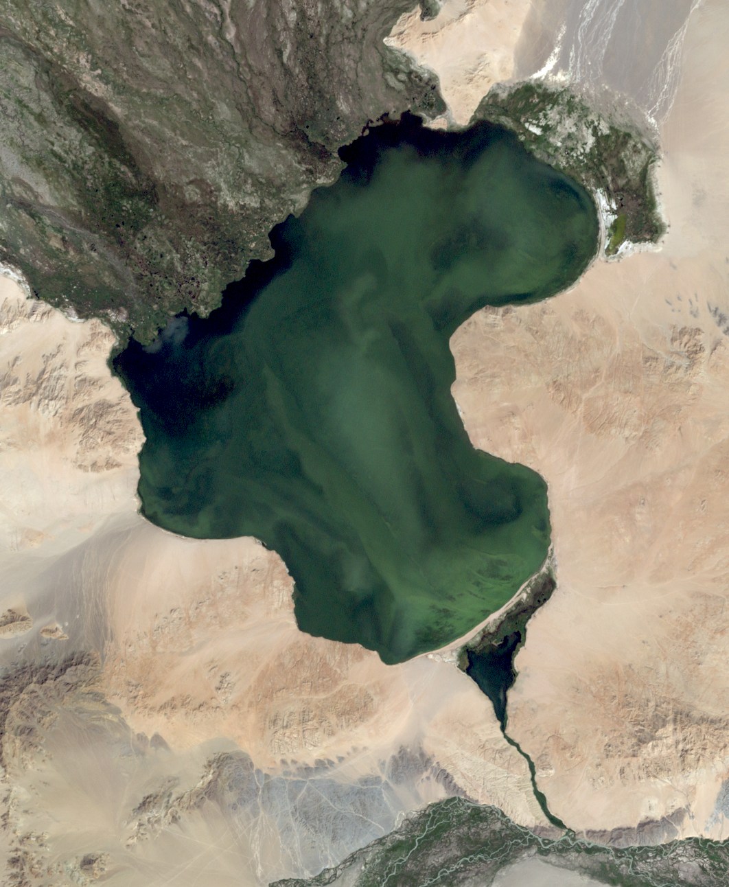
English: Achit-Nuur lake, West Mongolia, Landsat-7 near natural color, 30 m resolution |
| ਮਿਤੀ | |
| ਸਰੋਤ | http://glovis.usgs.gov/ |
| ਲਿਖਾਰੀ | NASA |
ਲਸੰਸ
| This file is in the public domain in the United States because it was solely created by NASA. NASA copyright policy states that "NASA material is not protected by copyright unless noted". (See Template:PD-USGov, NASA copyright policy page or JPL Image Use Policy.) | ||
 |
Warnings:
|
ਫ਼ਾਈਲ ਦਾ ਅਤੀਤ
ਤਾਰੀਖ/ਸਮੇਂ ’ਤੇ ਕਲਿੱਕ ਕਰੋ ਤਾਂ ਉਸ ਸਮੇਂ ਦੀ ਫਾਈਲ ਪੇਸ਼ ਹੋ ਜਾਵੇਗੀ।
| ਮਿਤੀ/ਸਮਾਂ | ਨਮੂਨਾ | ਨਾਪ | ਵਰਤੋਂਕਾਰ | ਟਿੱਪਣੀ | |
|---|---|---|---|---|---|
| ਮੌਜੂਦਾ | 21:20, 21 ਸਤੰਬਰ 2010 | | 1,062 × 1,292 (283 KB) | Bogomolov.PL | {{Information |Description={{en|1=Achit-Nuur lake, West Mongolia, Landsat-7 near natural color, 30 m resolution}} |Source=http://glovis.usgs.gov/ |Author=NASA |Date=2007-08-13 |Permission= |other_versions= }} Category:Lakes of Mongolia [[Category:Bay |
ਫ਼ਾਈਲ ਦੀ ਵਰਤੋਂ
ਇਹ ਫਾਈਲ ਹੇਠਾਂ ਦਿੱਤਾ ਸਫ਼ਾ ਵਰਤਦਾ ਹੈ:
ਫ਼ਾਈਲ ਦੀ ਵਿਆਪਕ ਵਰਤੋਂ
ਇਸ ਫ਼ਾਈਲ ਨੂੰ ਹੋਰ ਹੇਠ ਲਿਖੇ ਵਿਕੀ ਵਰਤਦੇ ਹਨ:
- de.wikipedia.org ਉੱਤੇ ਵਰਤੋਂ
- en.wikipedia.org ਉੱਤੇ ਵਰਤੋਂ
- es.wikipedia.org ਉੱਤੇ ਵਰਤੋਂ
- fa.wikipedia.org ਉੱਤੇ ਵਰਤੋਂ
- fr.wikipedia.org ਉੱਤੇ ਵਰਤੋਂ
- it.wikipedia.org ਉੱਤੇ ਵਰਤੋਂ
- lv.wikipedia.org ਉੱਤੇ ਵਰਤੋਂ
- mn.wikipedia.org ਉੱਤੇ ਵਰਤੋਂ
- ru.wikipedia.org ਉੱਤੇ ਵਰਤੋਂ
- sq.wikipedia.org ਉੱਤੇ ਵਰਤੋਂ
- vi.wikipedia.org ਉੱਤੇ ਵਰਤੋਂ