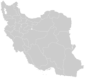
ਤਸਵੀਰ:Blank-Map-Iran.PNG

ਪੰਨਾ ਸਮੱਗਰੀ ਹੋਰ ਭਾਸ਼ਾਵਾਂ ਵਿੱਚ ਸਮਰਥਿਤ ਨਹੀਂ ਹੈ।
ਵਿਕੀਪੀਡੀਆ, ਇੱਕ ਅਜ਼ਾਦ ਗਿਆਨਕੋਸ਼ ਤੋਂ

ਅਸਲ ਫ਼ਾਈਲ(895 × 823 ਪਿਕਸਲ, ਫ਼ਾਈਲ ਅਕਾਰ: 22 KB, MIME ਕਿਸਮ: image/png)

ਇਹ ਫ਼ਾਈਲ Wikimedia Commons ਦੀ ਹੈ ਅਤੇ ਹੋਰ ਪਰਿਯੋਜਨਾਵਾਂ ਵਿੱਚ ਵੀ ਵਰਤੀ ਜਾ ਸਕਦੀ ਹੈ । ਇਸ ਫ਼ਾਈਲ ਦੇ ਵੇਰਵਾ ਸਫ਼ੇ ਵਿੱਚ ਮੌਜੂਦ ਵੇਰਵਾ ਹੇਠ ਦਿਸ ਰਿਹਾ ਹੈ।

ਸਾਰ

ਵੇਰਵਾ Blank Map of the territory claimed by Iran
ਮਿਤੀ
ਸਰੋਤ self-made applying some corrections and updates to a previous version Image:BlankMap-Iran.PNG created and uploaded by Shinas based mainly on Image:Iran.svg and other maps
ਲਿਖਾਰੀ Siamax

ਲਸੰਸ

Public domain This work has been released into the public domain by its author, I, Siamax. This applies worldwide.
In some countries this may not be legally possible; if so:
I, Siamax grants anyone the right to use this work for any purpose, without any conditions, unless such conditions are required by law.

Captions

Add a one-line explanation of what this file represents

Items portrayed in this file

ਚਿਤਰਨ

creator ਅੰਗਰੇਜ਼ੀ

27 ਜੁਲਾਈ 2007

checksum ਅੰਗਰੇਜ਼ੀ

ff872e02d15e4974ebac49738572d54fff2a59b2

determination method ਅੰਗਰੇਜ਼ੀ: SHA-1 ਅੰਗਰੇਜ਼ੀ

22,057 ਬਾਈਟ

height ਅੰਗਰੇਜ਼ੀ

823 ਪਿਕਸਲ

width ਅੰਗਰੇਜ਼ੀ

895 ਪਿਕਸਲ

ਫ਼ਾਈਲ ਦਾ ਅਤੀਤ

ਤਾਰੀਖ/ਸਮੇਂ ’ਤੇ ਕਲਿੱਕ ਕਰੋ ਤਾਂ ਉਸ ਸਮੇਂ ਦੀ ਫਾਈਲ ਪੇਸ਼ ਹੋ ਜਾਵੇਗੀ।

ਮਿਤੀ/ਸਮਾਂਨਮੂਨਾਨਾਪਵਰਤੋਂਕਾਰਟਿੱਪਣੀ
ਮੌਜੂਦਾ00:34, 24 ਜੂਨ 201300:34, 24 ਜੂਨ 2013 ਵੇਲੇ ਦੇ ਵਰਜਨ ਦਾ ਅੰਗੂਠਾਕਾਰ ਰੂਪ895 × 823 (22 KB)BasilLeafبروزرسانی مرزها
12:39, 12 ਨਵੰਬਰ 201012:39, 12 ਨਵੰਬਰ 2010 ਵੇਲੇ ਦੇ ਵਰਜਨ ਦਾ ਅੰਗੂਠਾਕਾਰ ਰੂਪ895 × 823 (36 KB)M samadiAlborz Province added, Border of South & Razavi Khorasans updated.
00:34, 28 ਜੁਲਾਈ 200700:34, 28 ਜੁਲਾਈ 2007 ਵੇਲੇ ਦੇ ਵਰਜਨ ਦਾ ਅੰਗੂਠਾਕਾਰ ਰੂਪ895 × 823 (39 KB)Siamax{{Information |Description=Blank Map of Iran |Source=self-made applying some corrections and updates to a previous version Image:BlankMap-Iran.PNG created and uploaded by Shinas |Date=27th July 2007 |Author= Siamax }}

ਇਸ ਫ਼ਾਈਲ ਦੀ ਵਰਤੋਂ ਕਰਨ ਵਾਲੇ ਕੋਈ ਪੰਨੇ ਨਹੀਂ ਹਨ।

ਫ਼ਾਈਲ ਦੀ ਵਿਆਪਕ ਵਰਤੋਂ

ਇਸ ਫ਼ਾਈਲ ਨੂੰ ਹੋਰ ਹੇਠ ਲਿਖੇ ਵਿਕੀ ਵਰਤਦੇ ਹਨ:

  • en.wikipedia.org ਉੱਤੇ ਵਰਤੋਂ

ਮੈਟਾਡੈਟਾ