
ਤਸਵੀਰ:Canada Manitoba location map 2.svg

Size of this PNG preview of this SVG file: 486 × 599 ਪਿਕਸਲ. ਹੋਰ ਰੈਜ਼ੋਲਿਊਸ਼ਨਜ਼: 195 × 240 ਪਿਕਸਲ | 389 × 480 ਪਿਕਸਲ | 623 × 768 ਪਿਕਸਲ | 831 × 1,024 ਪਿਕਸਲ | 1,661 × 2,048 ਪਿਕਸਲ | 1,512 × 1,864 ਪਿਕਸਲ.
ਅਸਲ ਫ਼ਾਈਲ (SVG ਫ਼ਾਈਲ, ਆਮ ਤੌਰ ’ਤੇ 1,512 × 1,864 ਪਿਕਸਲ, ਫ਼ਾਈਲ ਦਾ ਅਕਾਰ: 599 KB)
ਸਾਰ
| ਵੇਰਵਾ |
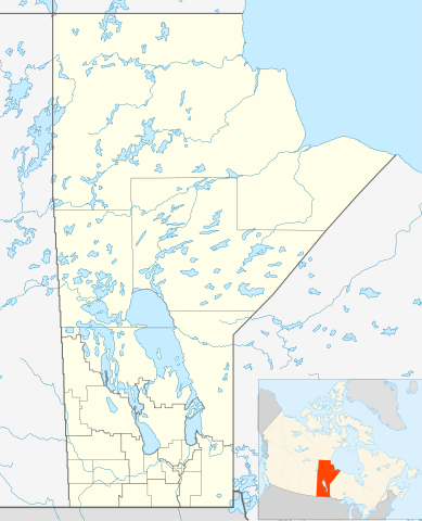
Quadratische Plattkarte, N-S-Streckung 170 %. Geographische Begrenzung der Karte:
Equirectangular projection, N/S stretching 170 %. Geographic limits of the map:
|
| ਮਿਤੀ | |
| ਸਰੋਤ | ਆਪਣਾ ਕੰਮ, File:Canada_Manitoba_location_map.svg by NordNordWest |
| ਲਿਖਾਰੀ | Hanhil 17:29, 24 September 2009 (UTC) |
| ਇਜਾਜ਼ਤ (ਇਸ ਫ਼ਾਈਲ ਦੀ ਮੁੜਵਰਤੋਂ ਕਰੋ) |
I, the copyright holder of this work, hereby publish it under the following license: ਇਸ ਫ਼ਾਈਲ ਦਾ ਲਸੰਸ ਕ੍ਰਿਏਟਿਵ ਕਾਮਨਜ਼ ਐਟ੍ਰੀਬਿਊਸ਼ਨ-ਸ਼ੇਅਰ ਅਲਾਈਕ 3.0 ਅਨਪੋਰਟੇਡ ਹੈ।
|
| SVG genesis |
ਫ਼ਾਈਲ ਦਾ ਅਤੀਤ
ਤਾਰੀਖ/ਸਮੇਂ ’ਤੇ ਕਲਿੱਕ ਕਰੋ ਤਾਂ ਉਸ ਸਮੇਂ ਦੀ ਫਾਈਲ ਪੇਸ਼ ਹੋ ਜਾਵੇਗੀ।
| ਮਿਤੀ/ਸਮਾਂ | ਨਮੂਨਾ | ਨਾਪ | ਵਰਤੋਂਕਾਰ | ਟਿੱਪਣੀ | |
|---|---|---|---|---|---|
| ਮੌਜੂਦਾ | 07:31, 3 ਫ਼ਰਵਰੀ 2019 | | 1,512 × 1,864 (599 KB) | JoKalliauer | valid id-names |
| 17:29, 24 ਸਤੰਬਰ 2009 |  | 1,512 × 1,864 (906 KB) | Hanhil | {{Information |Description= {{de|Positionskarte von Manitoba, Kanada}} Quadratische Plattkarte, N-S-Streckung 170 %. Geographische Begrenzung der Karte: * N: 60.3° N * S: 48.7° N * W: 104.0° W * O: 88.0° W {{en|Location |
ਫ਼ਾਈਲ ਦੀ ਵਰਤੋਂ
ਇਸ ਫ਼ਾਈਲ ਦੀ ਵਰਤੋਂ ਕਰਨ ਵਾਲੇ ਕੋਈ ਪੰਨੇ ਨਹੀਂ ਹਨ।
ਫ਼ਾਈਲ ਦੀ ਵਿਆਪਕ ਵਰਤੋਂ
ਇਸ ਫ਼ਾਈਲ ਨੂੰ ਹੋਰ ਹੇਠ ਲਿਖੇ ਵਿਕੀ ਵਰਤਦੇ ਹਨ:
- ar.wikipedia.org ਉੱਤੇ ਵਰਤੋਂ
- azb.wikipedia.org ਉੱਤੇ ਵਰਤੋਂ
- ba.wikipedia.org ਉੱਤੇ ਵਰਤੋਂ
- bg.wikipedia.org ਉੱਤੇ ਵਰਤੋਂ
- ca.wikipedia.org ਉੱਤੇ ਵਰਤੋਂ
- ceb.wikipedia.org ਉੱਤੇ ਵਰਤੋਂ
- en.wikipedia.org ਉੱਤੇ ਵਰਤੋਂ
- Gilbert Plains
- Neelin
- Cree
- The Pas
- Fort Garry
- Brandon, Manitoba
- Flin Flon
- Churchill, Manitoba
- Grunthal, Manitoba
- Lynn Lake
- International Peace Garden
- Birtle, Manitoba
- Portage la Prairie
- Dauphin, Manitoba
- Roblin, Manitoba
- Dominion City
- Manitou, Manitoba
- Forrest, Manitoba
- Thompson, Manitoba
- Steinbach, Manitoba
- Lower Fort Garry
- Deloraine, Manitoba
- Winnipegosis
- Sainte Rose du Lac
- Gunton, Manitoba
- Pisew Falls Provincial Park
- Hamiota, Manitoba
- CFB Shilo
- Winkler, Manitoba
- Boissevain, Manitoba
- Cranberry Portage
- Selkirk, Manitoba
- Morden, Manitoba
- Clearwater, Manitoba
- Souris, Manitoba
- Niverville, Manitoba
- Bakers Narrows
- Dugald, Manitoba
- Swan River, Manitoba
ਇਸ ਫ਼ਾਈਲ ਦੀ ਹੋਰ ਵਿਆਪਕ ਵਰਤੋਂ ਵੇਖੋ।