
ਤਸਵੀਰ:Canada USA Locator.svg

Size of this PNG preview of this SVG file: 800 × 353 ਪਿਕਸਲ. ਹੋਰ ਰੈਜ਼ੋਲਿਊਸ਼ਨਜ਼: 320 × 141 ਪਿਕਸਲ | 640 × 283 ਪਿਕਸਲ | 1,024 × 452 ਪਿਕਸਲ | 1,280 × 565 ਪਿਕਸਲ | 2,560 × 1,130 ਪਿਕਸਲ | 940 × 415 ਪਿਕਸਲ.
ਅਸਲ ਫ਼ਾਈਲ (SVG ਫ਼ਾਈਲ, ਆਮ ਤੌਰ ’ਤੇ 940 × 415 ਪਿਕਸਲ, ਫ਼ਾਈਲ ਦਾ ਅਕਾਰ: 1.76 MB)
ਸਾਰ
| ਵੇਰਵਾ | |
| ਮਿਤੀ | 23 ਮਈ 2011 (original upload date) |
| ਸਰੋਤ | No machine-readable source provided. Own work assumed (based on copyright claims). |
| ਲਿਖਾਰੀ | No machine-readable author provided. Artem Karimov assumed (based on copyright claims). |
ਲਸੰਸ
| I, the copyright holder of this work, release this work into the public domain. This applies worldwide. In some countries this may not be legally possible; if so: I grant anyone the right to use this work for any purpose, without any conditions, unless such conditions are required by law. |
ਫ਼ਾਈਲ ਦਾ ਅਤੀਤ
ਤਾਰੀਖ/ਸਮੇਂ ’ਤੇ ਕਲਿੱਕ ਕਰੋ ਤਾਂ ਉਸ ਸਮੇਂ ਦੀ ਫਾਈਲ ਪੇਸ਼ ਹੋ ਜਾਵੇਗੀ।
| ਮਿਤੀ/ਸਮਾਂ | ਨਮੂਨਾ | ਨਾਪ | ਵਰਤੋਂਕਾਰ | ਟਿੱਪਣੀ | |
|---|---|---|---|---|---|
| ਮੌਜੂਦਾ | 20:10, 14 ਅਗਸਤ 2011 | | 940 × 415 (1.76 MB) | Bazonka2 | + South Sudan |
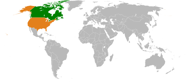
| 20:27, 23 ਮਈ 2011 |  | 940 × 415 (1.44 MB) | Artem Karimov | == {{int:filedesc}} == == {{int:filedesc}} == {{en|World map: Canada-United States (location)}} == {{int:license}} == {{PD-self}} Category:Maps of Canada Category:Locator maps of the United States [[Category:Bilateral maps of ca |
ਫ਼ਾਈਲ ਦੀ ਵਰਤੋਂ
ਇਸ ਫ਼ਾਈਲ ਦੀ ਵਰਤੋਂ ਕਰਨ ਵਾਲੇ ਕੋਈ ਪੰਨੇ ਨਹੀਂ ਹਨ।
ਫ਼ਾਈਲ ਦੀ ਵਿਆਪਕ ਵਰਤੋਂ
ਇਸ ਫ਼ਾਈਲ ਨੂੰ ਹੋਰ ਹੇਠ ਲਿਖੇ ਵਿਕੀ ਵਰਤਦੇ ਹਨ:
- ar.wikipedia.org ਉੱਤੇ ਵਰਤੋਂ
- ca.wikipedia.org ਉੱਤੇ ਵਰਤੋਂ
- de.wikipedia.org ਉੱਤੇ ਵਰਤੋਂ
- en.wikipedia.org ਉੱਤੇ ਵਰਤੋਂ
- Canada–United States relations
- Nymphaea odorata subsp. tuberosa
- Nymphaea leibergii
- Canada–United States sports rivalries
- Template:Infobox bilateral relations/sandbox
- Template:Infobox bilateral relations/testcases
- User:Gimelthedog/Template:Infobox bilateral
- Category:Canada–United States sports relations
- es.wikipedia.org ਉੱਤੇ ਵਰਤੋਂ
- eu.wikipedia.org ਉੱਤੇ ਵਰਤੋਂ
- fr.wikipedia.org ਉੱਤੇ ਵਰਤੋਂ
- he.wikipedia.org ਉੱਤੇ ਵਰਤੋਂ
- it.wikipedia.org ਉੱਤੇ ਵਰਤੋਂ
- pt.wikipedia.org ਉੱਤੇ ਵਰਤੋਂ
- ru.wikipedia.org ਉੱਤੇ ਵਰਤੋਂ
- www.wikidata.org ਉੱਤੇ ਵਰਤੋਂ
- zh.wikipedia.org ਉੱਤੇ ਵਰਤੋਂ