
ਤਸਵੀਰ:Europe blank laea location map.svg

Size of this PNG preview of this SVG file: 701 × 599 ਪਿਕਸਲ. ਹੋਰ ਰੈਜ਼ੋਲਿਊਸ਼ਨਜ਼: 281 × 240 ਪਿਕਸਲ | 561 × 480 ਪਿਕਸਲ | 898 × 768 ਪਿਕਸਲ | 1,198 × 1,024 ਪਿਕਸਲ | 2,395 × 2,048 ਪਿਕਸਲ | 1,401 × 1,198 ਪਿਕਸਲ.
ਅਸਲ ਫ਼ਾਈਲ (SVG ਫ਼ਾਈਲ, ਆਮ ਤੌਰ ’ਤੇ 1,401 × 1,198 ਪਿਕਸਲ, ਫ਼ਾਈਲ ਦਾ ਅਕਾਰ: 1.42 MB)
Bosnia
ਸਾਰ
| ਵੇਰਵਾ |
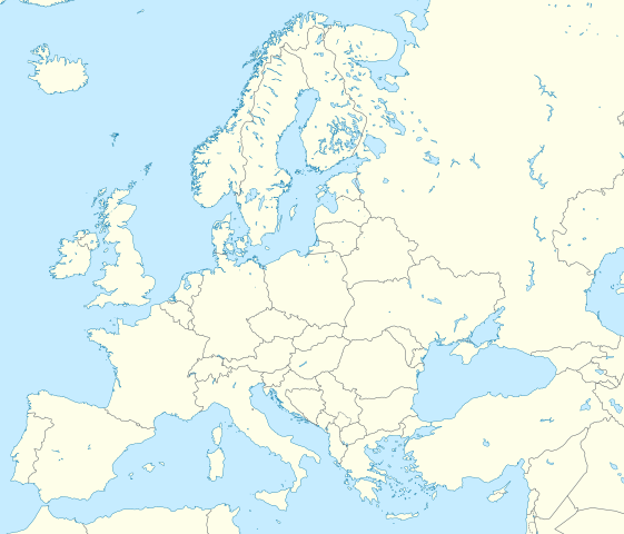
Deutsch: Positionskarte Europa; Politisch mit Staatsgrenzen; Flächentreue Azimutalprojektion
English: Location map Europe; Political with state boundaries; Lambert azimuthal equal-area projection
|
| ਮਿਤੀ | |
| ਸਰੋਤ |
ਆਪਣਾ ਕੰਮ
|
| ਲਿਖਾਰੀ | Alexrk2 |
| Other versions |
Derivative works of this file: []
|


.svg)


|
This map has been made or improved in the German Kartenwerkstatt (Map Lab). You can propose maps to improve as well.
|
ਲਸੰਸ
I, the copyright holder of this work, hereby publish it under the following license:
ਇਸ ਫ਼ਾਈਲ ਦਾ ਲਸੰਸ ਕ੍ਰਿਏਟਿਵ ਕਾਮਨਜ਼ ਐਟ੍ਰੀਬਿਊਸ਼ਨ-ਸ਼ੇਅਰ ਅਲਾਈਕ 3.0 ਅਨਪੋਰਟੇਡ ਹੈ।
- ਤੁਹਾਨੂੰ ਖੁੱਲ੍ਹ ਹੈ:
- ਸਾਂਝਾ ਕਰਨ ਦੀ – ਰਚਨਾ ਨੂੰ ਕਾਪੀ, ਵੰਡਣਾ ਅਤੇ ਭੇਜਣਾ
- ਮੁੜ-ਰਲ਼ਾਉਣ ਦੀ – ਰਚਨਾ ਨੂੰ ਢਾਲਣਾ
- ਥੱਲੇ ਲਿਖੀਆਂ ਸ਼ਰਤਾਂ ਹੇਠ:
- ਗੁਣਾਂ ਦੀ ਦੱਸ – ਉਚਿਤ ਕ੍ਰੈਡਿਟ ਦੇਵੋ, ਲਾਇਸੰਸ ਦਾ ਇੱਕ ਲਿੰਕ ਪ੍ਰਦਾਨ ਕਰੋ ਅਤੇ ਇਹ ਦਰਸਾਓ ਕਿ ਕੀ ਤਬਦੀਲੀਆਂ ਕੀਤੀਆਂ ਗਈਆਂ ਸਨ। ਤੁਸੀਂ ਇਹ ਕਿਸੇ ਵੀ ਵਾਜਬ ਤਰੀਕੇ ਨਾਲ ਕਰ ਸਕਦੇ ਹੋ, ਪਰ ਇਹ ਤਰੀਕਾ ਅਜਿਹਾ ਨਹੀਂ ਹੋਣਾ ਚਾਹੀਦਾ ਜੋ ਇਹ ਦਰਸਾਵੇ ਕਿ ਲਾਇਸੰਸਕਰਤਾ ਤੁਹਾਨੂੰ ਜਾਂ ਤੁਹਾਡੀ ਵਰਤੋਂ ਦਾ ਸਮਰਥਨ ਕਰਦਾ ਹੈ।
- ਸ਼ੇਅਰ ਅਲਾਈਕ – ਜੇਕਰ ਤੁਸੀਂ ਸਮੱਗਰੀ ਨੂੰ ਰੀਮਿਕਸ ਕਰਦੇ ਹੋ, ਬਦਲਦੇ ਹੋ ਜਾਂ ਬਣਾਉਂਦੇ ਹੋ, ਤਾਂ ਆਪਣੇ ਯੋਗਦਾਨ ਇੱਕੋ ਜਿਹੇ ਜਾਂ ਅਨੁਕੂਲ ਲਾਇਸੰਸ ਦੇ ਅਧੀਨ ਕਰੋ।
ਫ਼ਾਈਲ ਦਾ ਅਤੀਤ
ਤਾਰੀਖ/ਸਮੇਂ ’ਤੇ ਕਲਿੱਕ ਕਰੋ ਤਾਂ ਉਸ ਸਮੇਂ ਦੀ ਫਾਈਲ ਪੇਸ਼ ਹੋ ਜਾਵੇਗੀ।
| ਮਿਤੀ/ਸਮਾਂ | ਨਮੂਨਾ | ਨਾਪ | ਵਰਤੋਂਕਾਰ | ਟਿੱਪਣੀ | |
|---|---|---|---|---|---|
| ਮੌਜੂਦਾ | 03:13, 9 ਮਾਰਚ 2020 | | 1,401 × 1,198 (1.42 MB) | Ratherous | Add more inland water for better accuracy |
| 10:28, 1 ਫ਼ਰਵਰੀ 2020 |  | 1,401 × 1,198 (1.84 MB) | Thayts | + disputed crimea, golan heights, and other minor border tweaks | |
| 20:50, 11 ਮਾਰਚ 2010 |  | 1,401 × 1,198 (1.84 MB) | Alexrk2 | fixing inland water | |
| 19:58, 11 ਮਾਰਚ 2010 |  | 1,401 × 1,198 (1.83 MB) | Alexrk2 | == Summary == {{Information |Description= {{de|Positionskarte Europa; Politisch mit Staatsgrenzen; Flächentreue Azimutalprojektion}} {{en|Location map Europe; Political with state boundaries; Lambert azimuthal equal-area pro |
ਫ਼ਾਈਲ ਦੀ ਵਰਤੋਂ
ਇਹ ਫਾਈਲ ਹੇਠਾਂ ਦਿੱਤੇ 2 ਸਫ਼ੇ ਵਰਤਦੇ ਹਨ:
ਫ਼ਾਈਲ ਦੀ ਵਿਆਪਕ ਵਰਤੋਂ
ਇਸ ਫ਼ਾਈਲ ਨੂੰ ਹੋਰ ਹੇਠ ਲਿਖੇ ਵਿਕੀ ਵਰਤਦੇ ਹਨ:
- ab.wikipedia.org ਉੱਤੇ ਵਰਤੋਂ
- af.wikipedia.org ਉੱਤੇ ਵਰਤੋਂ
- als.wikipedia.org ਉੱਤੇ ਵਰਤੋਂ
- ar.wikipedia.org ਉੱਤੇ ਵਰਤੋਂ
- دوري أبطال أوروبا 2000–01
- دوري أبطال أوروبا 1994–95
- دوري أبطال أوروبا 1995–96
- دوري أبطال أوروبا 1996–97
- قالب:خريطة مواقع أوروبا
- بطولات رابطة محترفي التنس 500 نقطة
- الدوري الأوروبي لكرة السلة
- قالب:خريطة موقع أوروبا
- مجموعة سيتي لكرة القدم
- دوري أبطال أوروبا لكرة اليد
- الدوري الأوروبي 2016–17
- الكأس الدولية للأبطال 2016
- دوري أبطال أوروبا 2017–18
- الكأس الدولية للأبطال 2019
- قائمة مدن الاتحاد الأوروبي حسب تعداد السكان المسلمين
- ناسداك نورديك
- قالب:2019–20 coronavirus pandemic data/Map (dots)
- يوروكوربس
- دوري المؤتمر الأوروبي 2021–22
- دوري السوبر الأوروبي
- الدوري الأوروبي 2022–23
- سباق الجائزة الكبرى للدراجات النارية موسم 2022
- دوري أبطال أوروبا 2023–24
- الدوري الأوروبي 2023–24
- سباق الجائزة الكبرى للدراجات النارية موسم 2023
- دوري المؤتمر الأوروبي 2023–24
- arz.wikipedia.org ਉੱਤੇ ਵਰਤੋਂ
- ast.wikipedia.org ਉੱਤੇ ਵਰਤੋਂ
- av.wikipedia.org ਉੱਤੇ ਵਰਤੋਂ
- azb.wikipedia.org ਉੱਤੇ ਵਰਤੋਂ
ਇਸ ਫ਼ਾਈਲ ਦੀ ਹੋਰ ਵਿਆਪਕ ਵਰਤੋਂ ਵੇਖੋ।