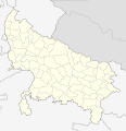
ਤਸਵੀਰ:India Uttar Pradesh districts 2012.svg

ਪੰਨਾ ਸਮੱਗਰੀ ਹੋਰ ਭਾਸ਼ਾਵਾਂ ਵਿੱਚ ਸਮਰਥਿਤ ਨਹੀਂ ਹੈ।
ਵਿਕੀਪੀਡੀਆ, ਇੱਕ ਅਜ਼ਾਦ ਗਿਆਨਕੋਸ਼ ਤੋਂ

ਅਸਲ ਫ਼ਾਈਲ(SVG ਫ਼ਾਈਲ, ਆਮ ਤੌਰ ’ਤੇ 2,379 × 2,466 ਪਿਕਸਲ, ਫ਼ਾਈਲ ਦਾ ਅਕਾਰ: 128 KB)

ਇਹ ਫ਼ਾਈਲ Wikimedia Commons ਦੀ ਹੈ ਅਤੇ ਹੋਰ ਪਰਿਯੋਜਨਾਵਾਂ ਵਿੱਚ ਵੀ ਵਰਤੀ ਜਾ ਸਕਦੀ ਹੈ । ਇਸ ਫ਼ਾਈਲ ਦੇ ਵੇਰਵਾ ਸਫ਼ੇ ਵਿੱਚ ਮੌਜੂਦ ਵੇਰਵਾ ਹੇਠ ਦਿਸ ਰਿਹਾ ਹੈ।

ਸਾਰ

ਵੇਰਵਾ
English: Locator map of the districts of Uttar Pradesh, India. Based on File:India Uttar Pradesh districts 2010.svg
ਮਿਤੀ (UTC)
ਸਰੋਤ This file was derived from: India Uttar Pradesh districts 2010.svg
ਲਿਖਾਰੀ


This is a retouched picture, which means that it has been digitally altered from its original version. Modifications: update 2012. The original can be viewed here: India Uttar Pradesh districts 2010.svg. Modifications made by NordNordWest.

ਲਸੰਸ

I, the copyright holder of this work, hereby publish it under the following license:
This work has been released into the public domain by its author, Example, at the [[::|ਅੰਗਰੇਜ਼ੀ ਵਿਕੀਪੀਡੀਆ]] project. This applies worldwide.

In case this is not legally possible:
Example grants anyone the right to use this work for any purpose, without any conditions, unless such conditions are required by law.

Original upload log

This image is a derivative work of the following images:

  • File:India_Uttar_Pradesh_districts_2010.svg licensed with PD-user-w
    • 2010-11-14T12:46:21Z Pitichinaccio 2379x2466 (127533 Bytes) small corr.
    • 2010-11-13T23:57:32Z Pitichinaccio 2379x2466 (127171 Bytes) {{Information |Description={{en|Locator map of the districts of Uttar Pradesh, India. Based on [[:File:Uttar Pradesh locator map.svg]]}} |Source=*[[:File:India_Uttar_Pradesh_districts.svg|]] |Date=2010-11-13 23:56 (UTC) |Auth

Captions

Add a one-line explanation of what this file represents

Items portrayed in this file

ਚਿਤਰਨ

ਫ਼ਾਈਲ ਦਾ ਅਤੀਤ

ਤਾਰੀਖ/ਸਮੇਂ ’ਤੇ ਕਲਿੱਕ ਕਰੋ ਤਾਂ ਉਸ ਸਮੇਂ ਦੀ ਫਾਈਲ ਪੇਸ਼ ਹੋ ਜਾਵੇਗੀ।

ਮਿਤੀ/ਸਮਾਂਨਮੂਨਾਨਾਪਵਰਤੋਂਕਾਰਟਿੱਪਣੀ
ਮੌਜੂਦਾ17:53, 4 ਮਈ 201217:53, 4 ਮਈ 2012 ਵੇਲੇ ਦੇ ਵਰਜਨ ਦਾ ਅੰਗੂਠਾਕਾਰ ਰੂਪ2,379 × 2,466 (128 KB)NordNordWestc
17:11, 4 ਮਈ 201217:11, 4 ਮਈ 2012 ਵੇਲੇ ਦੇ ਵਰਜਨ ਦਾ ਅੰਗੂਠਾਕਾਰ ਰੂਪ2,379 × 2,466 (99 KB)NordNordWest== {{int:filedesc}} == {{Information |Description={{en|Locator map of the districts of Uttar Pradesh, India. Based on File:Uttar Pradesh districts 2010.svg}} |Source={{Derived from|India_Uttar_Pradesh_districts_2010.svg|display=50}} |Date=2012-05-...

ਇਹ ਫਾਈਲ ਹੇਠਾਂ ਦਿੱਤਾ ਸਫ਼ਾ ਵਰਤਦਾ ਹੈ:

ਫ਼ਾਈਲ ਦੀ ਵਿਆਪਕ ਵਰਤੋਂ

ਇਸ ਫ਼ਾਈਲ ਨੂੰ ਹੋਰ ਹੇਠ ਲਿਖੇ ਵਿਕੀ ਵਰਤਦੇ ਹਨ: