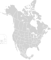
ਤਸਵੀਰ:North America second level political division 2.svg

ਪੰਨਾ ਸਮੱਗਰੀ ਹੋਰ ਭਾਸ਼ਾਵਾਂ ਵਿੱਚ ਸਮਰਥਿਤ ਨਹੀਂ ਹੈ।
ਵਿਕੀਪੀਡੀਆ, ਇੱਕ ਅਜ਼ਾਦ ਗਿਆਨਕੋਸ਼ ਤੋਂ

ਅਸਲ ਫ਼ਾਈਲ(SVG ਫ਼ਾਈਲ, ਆਮ ਤੌਰ ’ਤੇ 512 × 596 ਪਿਕਸਲ, ਫ਼ਾਈਲ ਦਾ ਅਕਾਰ: 132 KB)

ਇਹ ਫ਼ਾਈਲ Wikimedia Commons ਦੀ ਹੈ ਅਤੇ ਹੋਰ ਪਰਿਯੋਜਨਾਵਾਂ ਵਿੱਚ ਵੀ ਵਰਤੀ ਜਾ ਸਕਦੀ ਹੈ । ਇਸ ਫ਼ਾਈਲ ਦੇ ਵੇਰਵਾ ਸਫ਼ੇ ਵਿੱਚ ਮੌਜੂਦ ਵੇਰਵਾ ਹੇਠ ਦਿਸ ਰਿਹਾ ਹੈ।

ਸਾਰ

ਵੇਰਵਾ
English: Map of North America and its second-level political divisions. Canadian provinces, US and Mexican states. Canada, Mexico, United States.

Non-contiguous parts of a states/provinces are "grouped" together with the main area of the state/provinces, so any state/provinces can be coloured in completion with one click anywhere on the state/provinces's area.

Also, all states/provinces have a "id" attached to them, making them easy to find. Select "find" and then enter in the state/provinces's ISO 3166-2 code in the "id" field to find it. The codes can be found here (Canada), here (USA) and here (Mexico).
ਮਿਤੀ
ਸਰੋਤ

Canada and US map: BlankMap-USA-states-Canada-provinces, HI closer.svg by Lokal_Profil.
Mexico map: Mexico template.svg by Mario Fuente Cid
Combined by Alex Covarrubias.

 
The SVG code is valid.
 
This vector image was created with Inkscape, and then manually edited
.
 
W3C-validity not checked.
ਲਿਖਾਰੀ Alex Covarrubias
ਇਜਾਜ਼ਤ
(ਇਸ ਫ਼ਾਈਲ ਦੀ ਮੁੜਵਰਤੋਂ ਕਰੋ)
w:en:Creative Commons
ਗੁਣਾਂ ਦੀ ਦੱਸ ਸ਼ੇਅਰ ਅਲਾਈਕ
This file is licensed under the Creative Commons Attribution-Share Alike 2.5 Generic license.
ਤੁਹਾਨੂੰ ਖੁੱਲ੍ਹ ਹੈ:
  • ਸਾਂਝਾ ਕਰਨ ਦੀ – ਰਚਨਾ ਨੂੰ ਕਾਪੀ, ਵੰਡਣਾ ਅਤੇ ਭੇਜਣਾ
  • ਮੁੜ-ਰਲ਼ਾਉਣ ਦੀ – ਰਚਨਾ ਨੂੰ ਢਾਲਣਾ
ਥੱਲੇ ਲਿਖੀਆਂ ਸ਼ਰਤਾਂ ਹੇਠ:
  • ਗੁਣਾਂ ਦੀ ਦੱਸ – ਉਚਿਤ ਕ੍ਰੈਡਿਟ ਦੇਵੋ, ਲਾਇਸੰਸ ਦਾ ਇੱਕ ਲਿੰਕ ਪ੍ਰਦਾਨ ਕਰੋ ਅਤੇ ਇਹ ਦਰਸਾਓ ਕਿ ਕੀ ਤਬਦੀਲੀਆਂ ਕੀਤੀਆਂ ਗਈਆਂ ਸਨ। ਤੁਸੀਂ ਇਹ ਕਿਸੇ ਵੀ ਵਾਜਬ ਤਰੀਕੇ ਨਾਲ ਕਰ ਸਕਦੇ ਹੋ, ਪਰ ਇਹ ਤਰੀਕਾ ਅਜਿਹਾ ਨਹੀਂ ਹੋਣਾ ਚਾਹੀਦਾ ਜੋ ਇਹ ਦਰਸਾਵੇ ਕਿ ਲਾਇਸੰਸਕਰਤਾ ਤੁਹਾਨੂੰ ਜਾਂ ਤੁਹਾਡੀ ਵਰਤੋਂ ਦਾ ਸਮਰਥਨ ਕਰਦਾ ਹੈ।
  • ਸ਼ੇਅਰ ਅਲਾਈਕ – ਜੇਕਰ ਤੁਸੀਂ ਸਮੱਗਰੀ ਨੂੰ ਰੀਮਿਕਸ ਕਰਦੇ ਹੋ, ਬਦਲਦੇ ਹੋ ਜਾਂ ਬਣਾਉਂਦੇ ਹੋ, ਤਾਂ ਆਪਣੇ ਯੋਗਦਾਨ ਇੱਕੋ ਜਿਹੇ ਜਾਂ ਅਨੁਕੂਲ ਲਾਇਸੰਸ ਦੇ ਅਧੀਨ ਕਰੋ।
Other versions

Derivative works of this file:

Captions

Add a one-line explanation of what this file represents

Items portrayed in this file

ਚਿਤਰਨ

copyright status ਅੰਗਰੇਜ਼ੀ

copyrighted ਅੰਗਰੇਜ਼ੀ

7 ਅਕਤੂਬਰ 2007

ਫ਼ਾਈਲ ਦਾ ਅਤੀਤ

ਤਾਰੀਖ/ਸਮੇਂ ’ਤੇ ਕਲਿੱਕ ਕਰੋ ਤਾਂ ਉਸ ਸਮੇਂ ਦੀ ਫਾਈਲ ਪੇਸ਼ ਹੋ ਜਾਵੇਗੀ।

ਮਿਤੀ/ਸਮਾਂਨਮੂਨਾਨਾਪਵਰਤੋਂਕਾਰਟਿੱਪਣੀ
ਮੌਜੂਦਾ01:51, 23 ਨਵੰਬਰ 202001:51, 23 ਨਵੰਬਰ 2020 ਵੇਲੇ ਦੇ ਵਰਜਨ ਦਾ ਅੰਗੂਠਾਕਾਰ ਰੂਪ512 × 596 (132 KB)Ponderosapine210Added the prominent islands of Manitoulin (Ontario) and Isle Royale (Michigan) to the Great Lakes.
23:07, 1 ਜੂਨ 201923:07, 1 ਜੂਨ 2019 ਵੇਲੇ ਦੇ ਵਰਜਨ ਦਾ ਅੰਗੂਠਾਕਾਰ ਰੂਪ512 × 596 (130 KB)Fluffy89502added territories, made DC visible, adjusted mexican borders
12:23, 4 ਅਪਰੈਲ 201412:23, 4 ਅਪਰੈਲ 2014 ਵੇਲੇ ਦੇ ਵਰਜਨ ਦਾ ਅੰਗੂਠਾਕਾਰ ਰੂਪ1,712 × 1,992 (270 KB)Lommesmade the borders between the mexican subdivisions the same size as their canadian / us counterparts.
23:23, 8 ਦਸੰਬਰ 200723:23, 8 ਦਸੰਬਰ 2007 ਵੇਲੇ ਦੇ ਵਰਜਨ ਦਾ ਅੰਗੂਠਾਕਾਰ ਰੂਪ1,712 × 1,992 (327 KB)Lokal ProfilCode cleanup
07:55, 7 ਅਕਤੂਬਰ 200707:55, 7 ਅਕਤੂਬਰ 2007 ਵੇਲੇ ਦੇ ਵਰਜਨ ਦਾ ਅੰਗੂਠਾਕਾਰ ਰੂਪ1,712 × 1,992 (342 KB)AlexCovarrubias== Summary == {{Information |Description=Map of North America and its second-level political divisions. Canadian provinces, US and Mexican states. Canada, Mexico, United States. |Source=Canada and US map by Alan Rockefeller. Mexico map by Alex Covarrubias

ਇਸ ਫ਼ਾਈਲ ਦੀ ਵਰਤੋਂ ਕਰਨ ਵਾਲੇ ਕੋਈ ਪੰਨੇ ਨਹੀਂ ਹਨ।

ਫ਼ਾਈਲ ਦੀ ਵਿਆਪਕ ਵਰਤੋਂ

ਇਸ ਫ਼ਾਈਲ ਨੂੰ ਹੋਰ ਹੇਠ ਲਿਖੇ ਵਿਕੀ ਵਰਤਦੇ ਹਨ:

ਮੈਟਾਡੈਟਾ