
ਤਸਵੀਰ:Punjab locator map.svg

Size of this PNG preview of this SVG file: 556 × 599 ਪਿਕਸਲ. ਹੋਰ ਰੈਜ਼ੋਲਿਊਸ਼ਨਜ਼: 223 × 240 ਪਿਕਸਲ | 445 × 480 ਪਿਕਸਲ | 713 × 768 ਪਿਕਸਲ | 950 × 1,024 ਪਿਕਸਲ | 1,901 × 2,048 ਪਿਕਸਲ | 955 × 1,029 ਪਿਕਸਲ.
ਅਸਲ ਫ਼ਾਈਲ (SVG ਫ਼ਾਈਲ, ਆਮ ਤੌਰ ’ਤੇ 955 × 1,029 ਪਿਕਸਲ, ਫ਼ਾਈਲ ਦਾ ਅਕਾਰ: 174 KB)
| ਸਿਰਲੇਖ |
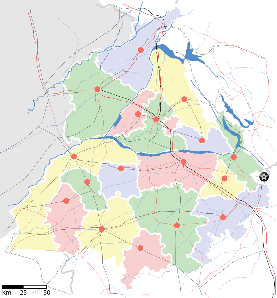
Punjab locator map |
||
| Description | |||
| ਮਿਤੀ | |||
| ਸਰੋਤ |
ਆਪਣਾ ਕੰਮ |
||
| Creator |
|
||
| ਇਜਾਜ਼ਤ (ਇਸ ਫ਼ਾਈਲ ਦੀ ਮੁੜਵਰਤੋਂ ਕਰੋ) |
I, the copyright holder of this work, hereby publish it under the following license: ਇਸ ਫ਼ਾਈਲ ਦਾ ਲਸੰਸ ਕ੍ਰਿਏਟਿਵ ਕਾਮਨਜ਼ ਐਟ੍ਰੀਬਿਊਸ਼ਨ-ਸ਼ੇਅਰ ਅਲਾਈਕ 3.0 ਅਨਪੋਰਟੇਡ ਹੈ।
|
||
| Geotemporal data | |||
| Date depicted | second half of 20 century ਅਤੇ 21 century | ||
| Georeferencing | If inappropriate please set warp_status = skip to hide. | ||
| Archival data | |||
| Notes | Part of WikiProject India Maps | ||
derivative works
Derivative works of this file: Districts of Punjab, India.svg
ਫ਼ਾਈਲ ਦਾ ਅਤੀਤ
ਤਾਰੀਖ/ਸਮੇਂ ’ਤੇ ਕਲਿੱਕ ਕਰੋ ਤਾਂ ਉਸ ਸਮੇਂ ਦੀ ਫਾਈਲ ਪੇਸ਼ ਹੋ ਜਾਵੇਗੀ।
| ਮਿਤੀ/ਸਮਾਂ | ਨਮੂਨਾ | ਨਾਪ | ਵਰਤੋਂਕਾਰ | ਟਿੱਪਣੀ | |
|---|---|---|---|---|---|
| ਮੌਜੂਦਾ | 18:27, 25 ਅਪਰੈਲ 2007 | | 955 × 1,029 (174 KB) | Planemad | reupload, forgot crop |
| 18:25, 25 ਅਪਰੈਲ 2007 |  | 2,393 × 1,956 (188 KB) | Planemad | {{WikiProject_India_Maps |Title=Punjab locator map |Description=Locator map of the state of w:Punjab, India with district boundaries, major highways, railways and water bodies. |Source=[www.punjabtourism.org/tt_maps.php Punjab Tourism - Ma |
ਫ਼ਾਈਲ ਦੀ ਵਰਤੋਂ
ਇਸ ਫ਼ਾਈਲ ਦੀ ਵਰਤੋਂ ਕਰਨ ਵਾਲੇ ਕੋਈ ਪੰਨੇ ਨਹੀਂ ਹਨ।
ਫ਼ਾਈਲ ਦੀ ਵਿਆਪਕ ਵਰਤੋਂ
ਇਸ ਫ਼ਾਈਲ ਨੂੰ ਹੋਰ ਹੇਠ ਲਿਖੇ ਵਿਕੀ ਵਰਤਦੇ ਹਨ:
- ar.wikipedia.org ਉੱਤੇ ਵਰਤੋਂ
- ast.wikipedia.org ਉੱਤੇ ਵਰਤੋਂ
- as.wikipedia.org ਉੱਤੇ ਵਰਤੋਂ
- awa.wikipedia.org ਉੱਤੇ ਵਰਤੋਂ
- bh.wikipedia.org ਉੱਤੇ ਵਰਤੋਂ
- bn.wikipedia.org ਉੱਤੇ ਵਰਤੋਂ
- ca.wikipedia.org ਉੱਤੇ ਵਰਤੋਂ
- ceb.wikipedia.org ਉੱਤੇ ਵਰਤੋਂ
- ckb.wikipedia.org ਉੱਤੇ ਵਰਤੋਂ
- de.wikipedia.org ਉੱਤੇ ਵਰਤੋਂ
- dty.wikipedia.org ਉੱਤੇ ਵਰਤੋਂ
- el.wikipedia.org ਉੱਤੇ ਵਰਤੋਂ
- eo.wikipedia.org ਉੱਤੇ ਵਰਤੋਂ
- es.wikipedia.org ਉੱਤੇ ਵਰਤੋਂ
- eu.wikipedia.org ਉੱਤੇ ਵਰਤੋਂ
- fa.wikipedia.org ਉੱਤੇ ਵਰਤੋਂ
- fr.wikipedia.org ਉੱਤੇ ਵਰਤੋਂ
- hi.wikipedia.org ਉੱਤੇ ਵਰਤੋਂ
- फिल्लौर
- साँचा:पंजाब के लोकसभा निर्वाचन क्षेत्र
- संगरूर लोक सभा निर्वाचन क्षेत्र
- अमृतसर लोक सभा निर्वाचन क्षेत्र
- भटिंडा लोक सभा निर्वाचन क्षेत्र
- फरीदकोट लोक सभा निर्वाचन क्षेत्र
- फतेहगढ़ साहिब लोक सभा निर्वाचन क्षेत्र
- आनंदपुर साहिब लोक सभा निर्वाचन क्षेत्र
- फिरोजपुर लोक सभा निर्वाचन क्षेत्र
- गुरदासपुर लोक सभा निर्वाचन क्षेत्र
- होशियारपुर लोक सभा निर्वाचन क्षेत्र
- जलंधर लोक सभा निर्वाचन क्षेत्र
- खडूर साहिब लोक सभा निर्वाचन क्षेत्र
- लुधियाना लोक सभा निर्वाचन क्षेत्र
- पटियाला लोक सभा निर्वाचन क्षेत्र
- थरियाल
- माधोपुर, पंजाब
- hu.wikipedia.org ਉੱਤੇ ਵਰਤੋਂ
- hy.wikipedia.org ਉੱਤੇ ਵਰਤੋਂ
- id.wikipedia.org ਉੱਤੇ ਵਰਤੋਂ
- ja.wikipedia.org ਉੱਤੇ ਵਰਤੋਂ
- kn.wikipedia.org ਉੱਤੇ ਵਰਤੋਂ
- mai.wikipedia.org ਉੱਤੇ ਵਰਤੋਂ
- mg.wikipedia.org ਉੱਤੇ ਵਰਤੋਂ
- ml.wikipedia.org ਉੱਤੇ ਵਰਤੋਂ
ਇਸ ਫ਼ਾਈਲ ਦੀ ਹੋਰ ਵਿਆਪਕ ਵਰਤੋਂ ਵੇਖੋ।