
ਤਸਵੀਰ:Txu-oclc-6614368-nl53-7-2nd-ed.jpg

ਇਸ ਝਾਤ ਦਾ ਅਕਾਰ: 780 × 600 ਪਿਕਸਲ. ਹੋਰ ਰੈਜ਼ੋਲਿਊਸ਼ਨਜ਼: 312 × 240 ਪਿਕਸਲ | 624 × 480 ਪਿਕਸਲ | 999 × 768 ਪਿਕਸਲ | 1,280 × 985 ਪਿਕਸਲ | 2,560 × 1,969 ਪਿਕਸਲ | 5,000 × 3,846 ਪਿਕਸਲ.
ਅਸਲ ਫ਼ਾਈਲ (5,000 × 3,846 ਪਿਕਸਲ, ਫ਼ਾਈਲ ਅਕਾਰ: 4.86 MB, MIME ਕਿਸਮ: image/jpeg)
ਸਾਰ
| ਵੇਰਵਾ |
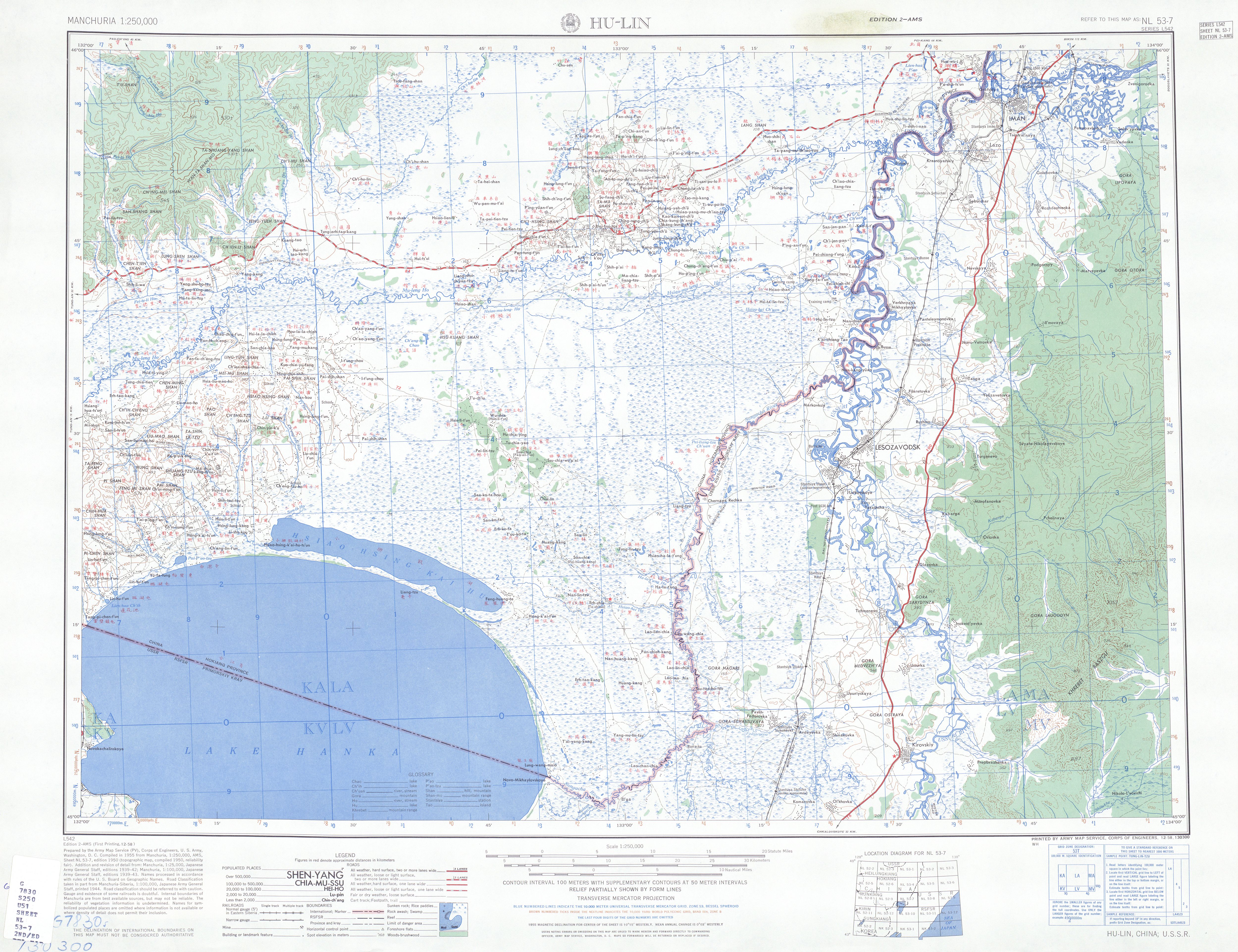
English: Map of Hulin (HU-LIN) area, Heilongjiang |
| ਮਿਤੀ | |
| ਸਰੋਤ | http://legacy.lib.utexas.edu/maps/ams/manchuria/txu-oclc-6614368-nl53-7-2nd-ed.jpg |
| ਲਿਖਾਰੀ | Army Map Serivce (PV), Corps of Engineers 1955 |
-
 Index Map

ਲਸੰਸ
This image or file is a work of a U.S. Army Corps of Engineers soldier or employee, taken or made as part of that person's official duties. As a work of the U.S. federal government, the image is in the public domain.
|
ਫ਼ਾਈਲ ਦਾ ਅਤੀਤ
ਤਾਰੀਖ/ਸਮੇਂ ’ਤੇ ਕਲਿੱਕ ਕਰੋ ਤਾਂ ਉਸ ਸਮੇਂ ਦੀ ਫਾਈਲ ਪੇਸ਼ ਹੋ ਜਾਵੇਗੀ।
| ਮਿਤੀ/ਸਮਾਂ | ਨਮੂਨਾ | ਨਾਪ | ਵਰਤੋਂਕਾਰ | ਟਿੱਪਣੀ | |
|---|---|---|---|---|---|
| ਮੌਜੂਦਾ | 10:49, 11 ਸਤੰਬਰ 2019 | | 5,000 × 3,846 (4.86 MB) | Geographyinitiative | User created page with UploadWizard |
ਫ਼ਾਈਲ ਦੀ ਵਰਤੋਂ
ਇਹ ਫਾਈਲ ਹੇਠਾਂ ਦਿੱਤਾ ਸਫ਼ਾ ਵਰਤਦਾ ਹੈ:
ਫ਼ਾਈਲ ਦੀ ਵਿਆਪਕ ਵਰਤੋਂ
ਇਸ ਫ਼ਾਈਲ ਨੂੰ ਹੋਰ ਹੇਠ ਲਿਖੇ ਵਿਕੀ ਵਰਤਦੇ ਹਨ:
- en.wikipedia.org ਉੱਤੇ ਵਰਤੋਂ
- he.wikipedia.org ਉੱਤੇ ਵਰਤੋਂ