
ਤਸਵੀਰ:Txu-oclc-6654394-nk-52-4th-ed.jpg

ਇਸ ਝਾਤ ਦਾ ਅਕਾਰ: 490 × 599 ਪਿਕਸਲ. ਹੋਰ ਰੈਜ਼ੋਲਿਊਸ਼ਨਜ਼: 196 × 240 ਪਿਕਸਲ | 392 × 480 ਪਿਕਸਲ | 628 × 768 ਪਿਕਸਲ | 837 × 1,024 ਪਿਕਸਲ | 1,674 × 2,048 ਪਿਕਸਲ | 4,087 × 5,000 ਪਿਕਸਲ.
ਅਸਲ ਫ਼ਾਈਲ (4,087 × 5,000 ਪਿਕਸਲ, ਫ਼ਾਈਲ ਅਕਾਰ: 6.55 MB, MIME ਕਿਸਮ: image/jpeg)
ਸਾਰ
| ਵੇਰਵਾ |
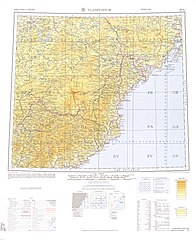
English: Map from the International Map of the World 1:1,000,000 (from map: "DELINEATION OF INTERNATIONAL BOUNDARIES MUST NOT BE CONSIDERED AUTHORITATIVE") |
| ਮਿਤੀ |
Compiled: 1967 Printed: October 1967 Scanned: 2007-04-03 06:33:57 |
| ਸਰੋਤ | Courtesy of the University of Texas Libraries, The University of Texas at Austin. ([1]) |
| ਲਿਖਾਰੀ | Army Map Serivce (LU), Corps of Engineers, 1967 |
![[1]](http://legacy.lib.utexas.edu/maps/imw/txu-oclc-6654394-nk-52-4th-ed.jpg)
ਲਸੰਸ
This image or file is a work of a U.S. Army Corps of Engineers soldier or employee, taken or made as part of that person's official duties. As a work of the U.S. federal government, the image is in the public domain.
|
ਫ਼ਾਈਲ ਦਾ ਅਤੀਤ
ਤਾਰੀਖ/ਸਮੇਂ ’ਤੇ ਕਲਿੱਕ ਕਰੋ ਤਾਂ ਉਸ ਸਮੇਂ ਦੀ ਫਾਈਲ ਪੇਸ਼ ਹੋ ਜਾਵੇਗੀ।
| ਮਿਤੀ/ਸਮਾਂ | ਨਮੂਨਾ | ਨਾਪ | ਵਰਤੋਂਕਾਰ | ਟਿੱਪਣੀ | |
|---|---|---|---|---|---|
| ਮੌਜੂਦਾ | 06:07, 7 ਦਸੰਬਰ 2019 | | 4,087 × 5,000 (6.55 MB) | Geographyinitiative | User created page with UploadWizard |
ਫ਼ਾਈਲ ਦੀ ਵਰਤੋਂ
ਇਹ ਫਾਈਲ ਹੇਠਾਂ ਦਿੱਤਾ ਸਫ਼ਾ ਵਰਤਦਾ ਹੈ:
ਫ਼ਾਈਲ ਦੀ ਵਿਆਪਕ ਵਰਤੋਂ
ਇਸ ਫ਼ਾਈਲ ਨੂੰ ਹੋਰ ਹੇਠ ਲਿਖੇ ਵਿਕੀ ਵਰਤਦੇ ਹਨ:
- ar.wikipedia.org ਉੱਤੇ ਵਰਤੋਂ
- en.wikipedia.org ਉੱਤੇ ਵਰਤੋਂ
- en.wiktionary.org ਉੱਤੇ ਵਰਤੋਂ
- es.wikipedia.org ਉੱਤੇ ਵਰਤੋਂ
- he.wikipedia.org ਉੱਤੇ ਵਰਤੋਂ
- it.wikipedia.org ਉੱਤੇ ਵਰਤੋਂ
- pnb.wikipedia.org ਉੱਤੇ ਵਰਤੋਂ
- th.wikipedia.org ਉੱਤੇ ਵਰਤੋਂ
- uz.wikipedia.org ਉੱਤੇ ਵਰਤੋਂ
- vi.wikipedia.org ਉੱਤੇ ਵਰਤੋਂ