
ਤਸਵੀਰ:USA Montana location map.svg

Size of this PNG preview of this SVG file: 800 × 595 ਪਿਕਸਲ. ਹੋਰ ਰੈਜ਼ੋਲਿਊਸ਼ਨਜ਼: 320 × 238 ਪਿਕਸਲ | 640 × 476 ਪਿਕਸਲ | 1,024 × 761 ਪਿਕਸਲ | 1,280 × 952 ਪਿਕਸਲ | 2,560 × 1,903 ਪਿਕਸਲ | 1,201 × 893 ਪਿਕਸਲ.
ਅਸਲ ਫ਼ਾਈਲ (SVG ਫ਼ਾਈਲ, ਆਮ ਤੌਰ ’ਤੇ 1,201 × 893 ਪਿਕਸਲ, ਫ਼ਾਈਲ ਦਾ ਅਕਾਰ: 636 KB)
ਸਾਰ
| ਵੇਰਵਾ |
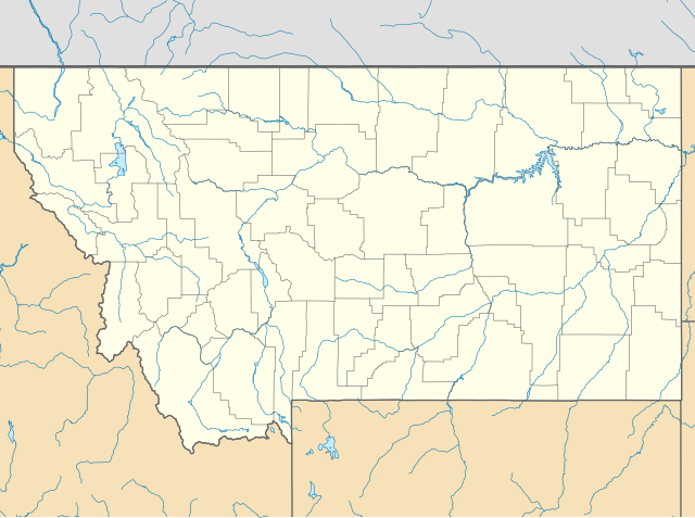
Quadratische Plattkarte, N-S-Streckung 150.0 %. Geographische Begrenzung der Karte:
Equirectangular projection, N/S stretching 150.0 %. Geographic limits of the map:
|
||
| ਮਿਤੀ | |||
| ਸਰੋਤ | ਆਪਣਾ ਕੰਮ | ||
| ਲਿਖਾਰੀ | Alexrk2 | ||
| Other versions |
Derivative works of this file:
|
||
| SVG genesis |
|


ਲਸੰਸ
I, the copyright holder of this work, hereby publish it under the following licenses:

|
ਇਸ ਸਫ਼ੇ ਨੂੰ ਗਨੂ ਲਸੰਸ, ਵਰਜ਼ਨ 1.2 ਜਾਂ ਫਰੀ ਸਾਫਟਵੇਅਰ ਫਾਊਂਡੇਸ਼ਨ ਦੁਆਰਾ ਪ੍ਰਕਾਸ਼ਿਤ ਕੀਤੇ ਨਵੇਂ ਵਰਜ਼ਨ ਤਹਿਤ ਕਾਪੀ ਕਰਨ, ਵੰਡਣ ਜਾਂ/ਅਤੇ ਤਬਦੀਲੀ ਕਰਨ ਦੀ ਖੁੱਲ ਹੈ; ਬਿਨਾ ਕਿਸੇ ਸਥਿਰ ਫਰੰਟ-ਕਵਰ ਜਾਂ ਬੈਕ ਕਵਰ ਲਿਖਤਾਂ ਤੋਂ ਬਿਨਾਂ। ਇਸ ਲਸੰਸ ਦੀ ਇੱਕ ਕਾਪੀ ਇਸ ਗਨੂ ਫਰੀ ਲਸੰਸ ਭਾਗ ਵਿੱਚ ਮੌਜੂਦ ਹੈ। |
This file is licensed under the Creative Commons Attribution 3.0 Unported license.
- ਤੁਹਾਨੂੰ ਖੁੱਲ੍ਹ ਹੈ:
- ਸਾਂਝਾ ਕਰਨ ਦੀ – ਰਚਨਾ ਨੂੰ ਕਾਪੀ, ਵੰਡਣਾ ਅਤੇ ਭੇਜਣਾ
- ਮੁੜ-ਰਲ਼ਾਉਣ ਦੀ – ਰਚਨਾ ਨੂੰ ਢਾਲਣਾ
- ਥੱਲੇ ਲਿਖੀਆਂ ਸ਼ਰਤਾਂ ਹੇਠ:
- ਗੁਣਾਂ ਦੀ ਦੱਸ – ਉਚਿਤ ਕ੍ਰੈਡਿਟ ਦੇਵੋ, ਲਾਇਸੰਸ ਦਾ ਇੱਕ ਲਿੰਕ ਪ੍ਰਦਾਨ ਕਰੋ ਅਤੇ ਇਹ ਦਰਸਾਓ ਕਿ ਕੀ ਤਬਦੀਲੀਆਂ ਕੀਤੀਆਂ ਗਈਆਂ ਸਨ। ਤੁਸੀਂ ਇਹ ਕਿਸੇ ਵੀ ਵਾਜਬ ਤਰੀਕੇ ਨਾਲ ਕਰ ਸਕਦੇ ਹੋ, ਪਰ ਇਹ ਤਰੀਕਾ ਅਜਿਹਾ ਨਹੀਂ ਹੋਣਾ ਚਾਹੀਦਾ ਜੋ ਇਹ ਦਰਸਾਵੇ ਕਿ ਲਾਇਸੰਸਕਰਤਾ ਤੁਹਾਨੂੰ ਜਾਂ ਤੁਹਾਡੀ ਵਰਤੋਂ ਦਾ ਸਮਰਥਨ ਕਰਦਾ ਹੈ।
ਤੁਸੀਂ ਆਪਣੀ ਮਰਜ਼ੀ ਦਾ ਲਸੰਸ ਚੁਣ ਸਕਦੇ ਹੋ।
ਫ਼ਾਈਲ ਦਾ ਅਤੀਤ
ਤਾਰੀਖ/ਸਮੇਂ ’ਤੇ ਕਲਿੱਕ ਕਰੋ ਤਾਂ ਉਸ ਸਮੇਂ ਦੀ ਫਾਈਲ ਪੇਸ਼ ਹੋ ਜਾਵੇਗੀ।
| ਮਿਤੀ/ਸਮਾਂ | ਨਮੂਨਾ | ਨਾਪ | ਵਰਤੋਂਕਾਰ | ਟਿੱਪਣੀ | |
|---|---|---|---|---|---|
| ਮੌਜੂਦਾ | 20:33, 20 ਜਨਵਰੀ 2019 | | 1,201 × 893 (636 KB) | Milenioscuro | Does not match with the color conventions |
| 23:52, 18 ਜਨਵਰੀ 2019 |  | 1,201 × 893 (657 KB) | Allice Hunter | Colours changed | |
| 15:39, 2 ਜੁਲਾਈ 2009 |  | 1,201 × 893 (636 KB) | Alexrk2 | == Beschreibung == {{Information |Description= {{de|Positionskarte von Montana, USA}} Quadratische Plattkarte, N-S-Streckung 150.0 %. Geographische Begrenzung der Karte: * N: 49.8° N * S: 43.6° N * W: 116.3° W * O: 103.8° W |
ਫ਼ਾਈਲ ਦੀ ਵਰਤੋਂ
ਇਹ ਫਾਈਲ ਹੇਠਾਂ ਦਿੱਤਾ ਸਫ਼ਾ ਵਰਤਦਾ ਹੈ:
ਫ਼ਾਈਲ ਦੀ ਵਿਆਪਕ ਵਰਤੋਂ
ਇਸ ਫ਼ਾਈਲ ਨੂੰ ਹੋਰ ਹੇਠ ਲਿਖੇ ਵਿਕੀ ਵਰਤਦੇ ਹਨ:
- an.wikipedia.org ਉੱਤੇ ਵਰਤੋਂ
- ar.wikipedia.org ਉੱਤੇ ਵਰਤੋਂ
- azb.wikipedia.org ਉੱਤੇ ਵਰਤੋਂ
- پیونیر جانکشن، مونتانا
- لیک مری رونن، مونتانا
- لیتل براوینق، مونتانا
- سانتا ریتا، مونتانا
- هبقن لیک استیتس، مونتانا
- وست کوتنای، مونتانا
- شامات، مونتانا
- ویکسویل، مونتانا
- فاکس، مونتانا
- کت کریک، مونتانا
- بل کریک، مونتانا
- ملویل، مونتانا
- آسویقو، مونتانا
- کورینت، مونتانا
- کربی، مونتانا
- هانقری جو، مونتانا
- کارترویل، مونتانا
- مکلیود، مونتانا
- کینزی، مونتانا
- ساوت قلستونبری، مونتانا
- هینزدیل، مانتانا
- کاریوون، مونتانا
- لیتل بیترروت لیک، مونتانا
- هپیز این، مونتانا
- بلومفیلد، مونتانا
- براکوی، مونتانا
- سدان، مونتانا
- مکسویل، مونتانا
- ریدر کریک، مونتانا
- لوتر، مونتانا
- سوان لیک، مونتانا
- ساوت هیلز، مونتانا
- راپلیی، مونتانا
- کوروین اسپرینقز، مونتانا
- هلنا فلتس، مونتانا
- دکر، مونتانا
- راکی بوی وست، مونتانا
- د سیلوس، مونتانا
- پاندرزا پاینز، مونتانا
- پیلتزویل، مونتانا
- کمس، مونتانا
- آکتون، مونتانا
- سیلوانیت، مونتانا
- کوندون، مونتانا
- میرز، مونتانا
ਇਸ ਫ਼ਾਈਲ ਦੀ ਹੋਰ ਵਿਆਪਕ ਵਰਤੋਂ ਵੇਖੋ।