
ਤਸਵੀਰ:Wiltshire UK location map.svg

Size of this PNG preview of this SVG file: 492 × 599 ਪਿਕਸਲ. ਹੋਰ ਰੈਜ਼ੋਲਿਊਸ਼ਨਜ਼: 197 × 240 ਪਿਕਸਲ | 394 × 480 ਪਿਕਸਲ | 630 × 768 ਪਿਕਸਲ | 840 × 1,024 ਪਿਕਸਲ | 1,681 × 2,048 ਪਿਕਸਲ | 1,039 × 1,266 ਪਿਕਸਲ.
ਅਸਲ ਫ਼ਾਈਲ (SVG ਫ਼ਾਈਲ, ਆਮ ਤੌਰ ’ਤੇ 1,039 × 1,266 ਪਿਕਸਲ, ਫ਼ਾਈਲ ਦਾ ਅਕਾਰ: 1.76 MB)
| ਵੇਰਵਾ |
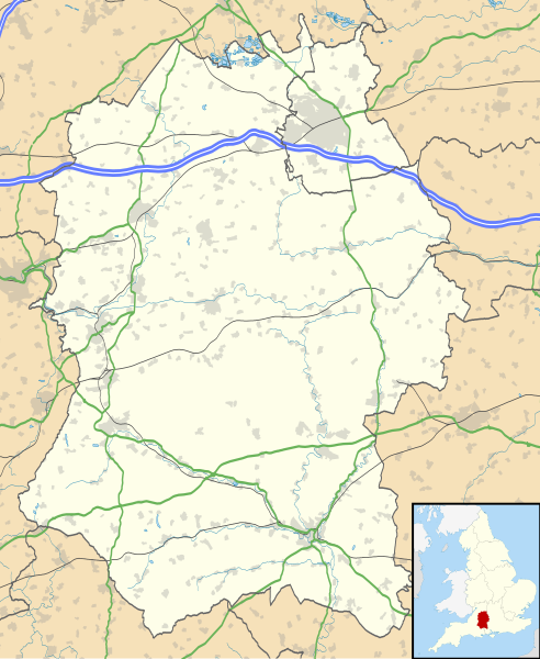
Map of Wiltshire, UK with the following information shown:
Equirectangular map projection on WGS 84 datum, with N/S stretched 160% Geographic limits:
|
| ਮਿਤੀ | |
| ਸਰੋਤ |
|
| ਲਿਖਾਰੀ | Nilfanion, created using Ordnance Survey data |
| ਇਜਾਜ਼ਤ (ਇਸ ਫ਼ਾਈਲ ਦੀ ਮੁੜਵਰਤੋਂ ਕਰੋ) |
ਇਸ ਫ਼ਾਈਲ ਦਾ ਲਸੰਸ ਕ੍ਰਿਏਟਿਵ ਕਾਮਨਜ਼ ਐਟ੍ਰੀਬਿਊਸ਼ਨ-ਸ਼ੇਅਰ ਅਲਾਈਕ 3.0 ਅਨਪੋਰਟੇਡ ਹੈ। ਐਟਰੀਬਿਊਸ਼ਨ: Contains Ordnance Survey data © Crown copyright and database right
|
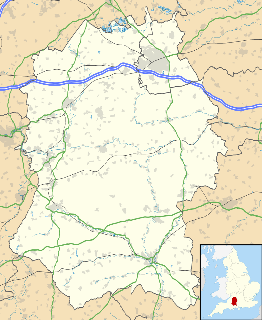
| Other versions | File:Wiltshire UK district map (blank).svg - Blank map |
.svg)
ਫ਼ਾਈਲ ਦਾ ਅਤੀਤ
ਤਾਰੀਖ/ਸਮੇਂ ’ਤੇ ਕਲਿੱਕ ਕਰੋ ਤਾਂ ਉਸ ਸਮੇਂ ਦੀ ਫਾਈਲ ਪੇਸ਼ ਹੋ ਜਾਵੇਗੀ।
| ਮਿਤੀ/ਸਮਾਂ | ਨਮੂਨਾ | ਨਾਪ | ਵਰਤੋਂਕਾਰ | ਟਿੱਪਣੀ | |
|---|---|---|---|---|---|
| ਮੌਜੂਦਾ | 19:19, 26 ਸਤੰਬਰ 2010 | | 1,039 × 1,266 (1.76 MB) | Nilfanion | {{Information |Description=Map of Wiltshire, UK with the following information shown: *Administrative borders *Coastline, lakes and rivers *Roads and railways *Urban areas Equirectangular map projection on WGS 84 datum, with N/S stretched |
ਫ਼ਾਈਲ ਦੀ ਵਰਤੋਂ
ਇਹ ਫਾਈਲ ਹੇਠਾਂ ਦਿੱਤੇ 2 ਸਫ਼ੇ ਵਰਤਦੇ ਹਨ:
ਫ਼ਾਈਲ ਦੀ ਵਿਆਪਕ ਵਰਤੋਂ
ਇਸ ਫ਼ਾਈਲ ਨੂੰ ਹੋਰ ਹੇਠ ਲਿਖੇ ਵਿਕੀ ਵਰਤਦੇ ਹਨ:
- ar.wikipedia.org ਉੱਤੇ ਵਰਤੋਂ
- bg.wikipedia.org ਉੱਤੇ ਵਰਤੋਂ
- ceb.wikipedia.org ਉੱਤੇ ਵਰਤੋਂ
- cy.wikipedia.org ਉੱਤੇ ਵਰਤੋਂ
- da.wikipedia.org ਉੱਤੇ ਵਰਤੋਂ
- en.wikipedia.org ਉੱਤੇ ਵਰਤੋਂ
- Stonehenge
- Talk:Stonehenge
- Swindon
- Salisbury
- Salisbury Cathedral
- Talk:Isambard Kingdom Brunel
- Talk:Aldhelm
- Talk:Box Tunnel
- Talk:Swindon
- Malmesbury Abbey
- Amesbury
- Lacock Abbey
- Lacock
- Talk:River Avon, Bristol
- Avebury (village)
- Odstock
- Silbury Hill
- Trowbridge
- Talk:Trowbridge
- Tiddleywink
- Talk:Robert Hallam
- Mere, Wiltshire
- Castle Hill, Mere
- Talk:Great Western Railway
- Chippenham
- Talk:Michael Ancram
- Marlborough, Wiltshire
- Talk:New Forest
- Bradford-on-Avon
- Warminster
- Brandier
- Talk:Brandier
- Devizes
- Talk:Swindon Town F.C.
- Talk:M4 motorway
- MOD Lyneham
- Pewsey
- Barbury Castle
- Wroughton
- Porton Down
- Talk:George Herbert
- Tidworth
- Edington, Wiltshire
- Talk:Battle of Badon
ਇਸ ਫ਼ਾਈਲ ਦੀ ਹੋਰ ਵਿਆਪਕ ਵਰਤੋਂ ਵੇਖੋ।