
ਤਸਵੀਰ:Nicaragua location map.svg

Size of this PNG preview of this SVG file: 704 × 599 ਪਿਕਸਲ. ਹੋਰ ਰੈਜ਼ੋਲਿਊਸ਼ਨਜ਼: 282 × 240 ਪਿਕਸਲ | 564 × 480 ਪਿਕਸਲ | 902 × 768 ਪਿਕਸਲ | 1,203 × 1,024 ਪਿਕਸਲ | 2,405 × 2,048 ਪਿਕਸਲ | 1,400 × 1,192 ਪਿਕਸਲ.
ਅਸਲ ਫ਼ਾਈਲ (SVG ਫ਼ਾਈਲ, ਆਮ ਤੌਰ ’ਤੇ 1,400 × 1,192 ਪਿਕਸਲ, ਫ਼ਾਈਲ ਦਾ ਅਕਾਰ: 192 KB)
ਸਾਰ
| ਵੇਰਵਾ |
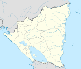
Deutsch: Positionskarte Nicaragua mit Departamentos, Quadratische Plattkarte, N-S-Streckung 100 %. Geographische Begrenzung der Karte:
English: Location map of Nicaragua with Departamentos, Equirectangular projection, N/S stretching 100 %. Geographic limits of the map:
|
| ਮਿਤੀ | |
| ਸਰੋਤ | ਆਪਣਾ ਕੰਮ,VMAP0,http://maplibrary.org |
| ਲਿਖਾਰੀ | Alexrk2 |
| Other versions |
Derivative works of this file:
|


|
This map has been made or improved in the German Kartenwerkstatt (Map Lab). You can propose maps to improve as well.
|
ਲਸੰਸ
I, the copyright holder of this work, hereby publish it under the following license:
ਇਸ ਫ਼ਾਈਲ ਦਾ ਲਸੰਸ ਕ੍ਰਿਏਟਿਵ ਕਾਮਨਜ਼ ਐਟ੍ਰੀਬਿਊਸ਼ਨ-ਸ਼ੇਅਰ ਅਲਾਈਕ 3.0 ਅਨਪੋਰਟੇਡ ਹੈ।
- ਤੁਹਾਨੂੰ ਖੁੱਲ੍ਹ ਹੈ:
- ਸਾਂਝਾ ਕਰਨ ਦੀ – ਰਚਨਾ ਨੂੰ ਕਾਪੀ, ਵੰਡਣਾ ਅਤੇ ਭੇਜਣਾ
- ਮੁੜ-ਰਲ਼ਾਉਣ ਦੀ – ਰਚਨਾ ਨੂੰ ਢਾਲਣਾ
- ਥੱਲੇ ਲਿਖੀਆਂ ਸ਼ਰਤਾਂ ਹੇਠ:
- ਗੁਣਾਂ ਦੀ ਦੱਸ – ਉਚਿਤ ਕ੍ਰੈਡਿਟ ਦੇਵੋ, ਲਾਇਸੰਸ ਦਾ ਇੱਕ ਲਿੰਕ ਪ੍ਰਦਾਨ ਕਰੋ ਅਤੇ ਇਹ ਦਰਸਾਓ ਕਿ ਕੀ ਤਬਦੀਲੀਆਂ ਕੀਤੀਆਂ ਗਈਆਂ ਸਨ। ਤੁਸੀਂ ਇਹ ਕਿਸੇ ਵੀ ਵਾਜਬ ਤਰੀਕੇ ਨਾਲ ਕਰ ਸਕਦੇ ਹੋ, ਪਰ ਇਹ ਤਰੀਕਾ ਅਜਿਹਾ ਨਹੀਂ ਹੋਣਾ ਚਾਹੀਦਾ ਜੋ ਇਹ ਦਰਸਾਵੇ ਕਿ ਲਾਇਸੰਸਕਰਤਾ ਤੁਹਾਨੂੰ ਜਾਂ ਤੁਹਾਡੀ ਵਰਤੋਂ ਦਾ ਸਮਰਥਨ ਕਰਦਾ ਹੈ।
- ਸ਼ੇਅਰ ਅਲਾਈਕ – ਜੇਕਰ ਤੁਸੀਂ ਸਮੱਗਰੀ ਨੂੰ ਰੀਮਿਕਸ ਕਰਦੇ ਹੋ, ਬਦਲਦੇ ਹੋ ਜਾਂ ਬਣਾਉਂਦੇ ਹੋ, ਤਾਂ ਆਪਣੇ ਯੋਗਦਾਨ ਇੱਕੋ ਜਿਹੇ ਜਾਂ ਅਨੁਕੂਲ ਲਾਇਸੰਸ ਦੇ ਅਧੀਨ ਕਰੋ।
ਫ਼ਾਈਲ ਦਾ ਅਤੀਤ
ਤਾਰੀਖ/ਸਮੇਂ ’ਤੇ ਕਲਿੱਕ ਕਰੋ ਤਾਂ ਉਸ ਸਮੇਂ ਦੀ ਫਾਈਲ ਪੇਸ਼ ਹੋ ਜਾਵੇਗੀ।
| ਮਿਤੀ/ਸਮਾਂ | ਨਮੂਨਾ | ਨਾਪ | ਵਰਤੋਂਕਾਰ | ਟਿੱਪਣੀ | |
|---|---|---|---|---|---|
| ਮੌਜੂਦਾ | 06:36, 25 ਮਈ 2021 | | 1,400 × 1,192 (192 KB) | Milenioscuro | corrected some errors |
| 06:30, 25 ਮਈ 2021 |  | 1,400 × 1,192 (192 KB) | Milenioscuro | corrected department boundaries | |
| 22:09, 17 ਫ਼ਰਵਰੀ 2010 |  | 1,400 × 1,192 (416 KB) | Alexrk2 | - | |
| 20:12, 16 ਫ਼ਰਵਰੀ 2010 |  | 1,400 × 1,192 (415 KB) | Alexrk2 | == Summary == {{Information |Description= {{de|Positionskarte Nicaragua mit Departamentos, Quadratische Plattkarte, N-S-Streckung 100 %. Geographische Begrenzung der Karte:}} {{en|Location map Nicaragua with Departament |
ਫ਼ਾਈਲ ਦੀ ਵਰਤੋਂ
ਇਹ ਫਾਈਲ ਹੇਠਾਂ ਦਿੱਤਾ ਸਫ਼ਾ ਵਰਤਦਾ ਹੈ:
ਫ਼ਾਈਲ ਦੀ ਵਿਆਪਕ ਵਰਤੋਂ
ਇਸ ਫ਼ਾਈਲ ਨੂੰ ਹੋਰ ਹੇਠ ਲਿਖੇ ਵਿਕੀ ਵਰਤਦੇ ਹਨ:
- af.wikipedia.org ਉੱਤੇ ਵਰਤੋਂ
- an.wikipedia.org ਉੱਤੇ ਵਰਤੋਂ
- ar.wikipedia.org ਉੱਤੇ ਵਰਤੋਂ
- ast.wikipedia.org ਉੱਤੇ ਵਰਤੋਂ
- Greytown (Nicaragua)
- Zapatera (volcán)
- Managua
- Matiguás
- Muy Muy
- Llagu Apanás
- Módulu:Mapa de llocalización/datos/Nicaragua
- Módulu:Mapa de llocalización/datos/Nicaragua/usu
- Aeropuertu Bonanza
- Aeropuertu Punta Huete
- Aeropuertu de Chinandega
- Aeropuertu de Juigalpa
- Aeropuertu de Los Brasiles
- Aeropuertu de Montelimar
- Aeropuertu de Nueva Guinea
- Aeropuertu d'Ometepe
- Aeropuertu de Rosita
- Aeropuertu de San Juan de Nicaragua
- Aeropuertu de Siuna
- Aeropuertu de Waspán
- Aeropuertu internacional Costa Esmeralda
- San Isidro (Nicaragua)
- ba.wikipedia.org ਉੱਤੇ ਵਰਤੋਂ
- be-tarask.wikipedia.org ਉੱਤੇ ਵਰਤੋਂ
- be.wikipedia.org ਉੱਤੇ ਵਰਤੋਂ
- bg.wikipedia.org ਉੱਤੇ ਵਰਤੋਂ
- bh.wikipedia.org ਉੱਤੇ ਵਰਤੋਂ
- bn.wikipedia.org ਉੱਤੇ ਵਰਤੋਂ
ਇਸ ਫ਼ਾਈਲ ਦੀ ਹੋਰ ਵਿਆਪਕ ਵਰਤੋਂ ਵੇਖੋ।