ਕੰਜੀਰਾਪੁਝਾ ਡੈਮ
| ਕੰਜੀਰਾਪੁਝਾ ਡੈਮ | |
|---|---|
 ਕੰਜੀਰਾਪੁਝਾ ਡੈਮ | |
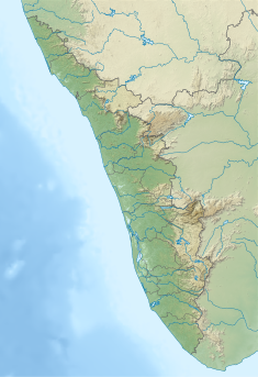
| ਟਿਕਾਣਾ | ਮੰਨਾਰੱਕੜ, ਪਲੱਕੜ ਜ਼ਿਲ੍ਹਾ, ਕੇਰਲਾ, ਭਾਰਤ |
| ਗੁਣਕ | 10°59.2′N 76°33.03′E / 10.9867°N 76.55050°E |
| ਉਸਾਰੀ ਸ਼ੁਰੂ ਹੋਈ | 1961 |
| ਉਦਘਾਟਨ ਮਿਤੀ | 1995 |
| ਓਪਰੇਟਰ | ਸਿੰਚਾਈ ਵਿਭਾਗ |
| Dam and spillways | |
| ਰੋਕਾਂ | ਕਾਕੀ ਸਹਾਇਕ ਨਦੀ |
| ਉਚਾਈ | 30.78 m (101.0 ft) |
| ਲੰਬਾਈ | 2,127 m (6,978 ft) |
| Reservoir | |
| ਪੈਦਾ ਕਰਦਾ ਹੈ | ਕੰਜੀਰਾਪੁਝਾ |
| ਕੁੱਲ ਸਮਰੱਥਾ | 70.83 MCM |
| Catchment area | 7,000 hectares (17,000 acres) |
| ਤਲ ਖੇਤਰਫਲ | 465 hectares (1,150 acres) |
| ਆਮ ਉਚਾਈ | 97.54 m (320.0 ft) |
ਗ਼ਲਤੀ: ਅਕਲਪਿਤ < ਚਾਲਕ।
ਕੰਜੀਰਾਪੁਝਾ ਡੈਮ, 24,000 ਏਕੜ ਦੇ ਇੱਕ ਸੱਭਿਆਚਾਰਕ ਕਮਾਂਡ ਖੇਤਰ (ਸੀਸੀਏ) ਨੂੰ ਪਾਣੀ ਦੇਣ ਲਈ ਬਣਾਇਆ ਗਿਆ ਇੱਕ ਚਿਣਾਈ ਧਰਤੀ ਡੈਮ, ਭਾਰਤ ਦੇ ਕੇਰਲਾ ਰਾਜ ਵਿੱਚ ਪਲੱਕੜ ਜ਼ਿਲ੍ਹੇ ਵਿੱਚ ਸਥਿਤ ਹੈ। [1] ਜਲ ਭੰਡਾਰ, ਜਿਸ ਦੇ ਅੰਦਰ ਤਿੰਨ ਟਾਪੂ ਹਨ, ਵਿੱਚ ਮੱਛੀ ਪਾਲਣ ਵਿਭਾਗ ਦੁਆਰਾ ਸੰਚਾਲਿਤ ਵਪਾਰਕ ਮੱਛੀ ਪਾਲਣ ਵਿਕਾਸ ਪ੍ਰੋਗਰਾਮ ਵੀ ਹੈ। [2]
ਭੂਗੋਲ
[ਸੋਧੋ]
ਕੰਜੀਰਾਪੁਝਾਨ ਡੈਮ ਕਾਂਜੀਰਾਪੁਝਾ ਨਦੀ 'ਤੇ ਸਥਿਤ ਹੈ, ਜੋ ਕਿ ਥੁਥਾਪੁਝਾ ਨਦੀ ਦੀ ਇੱਕ ਸਹਾਇਕ ਨਦੀ ਹੈ, ਜੋ ਆਪਣੇ ਆਪ ਵਿੱਚ ਭਰਤਪੁਝਾ ਨਦੀ ਨਾਲ ਜੁੜਦੀ ਹੈ, ਜੋ ਤਾਦਰੀ ਤੋਂ ਕੰਨਿਆਕੁਮਾਰੀ ਤੱਕ ਪੱਛਮ ਵੱਲ ਵਗਦੀਆਂ ਨਦੀਆਂ ਦਾ ਇੱਕ ਹਿੱਸਾ ਹੈ। ਡੈਮ ਦਾ 17,000 ਏਕੜ ਦਾ ਖੇਤਰ ਹੈ, ਜੋ ਪੂਰੀ ਤਰ੍ਹਾਂ ਕੇਰਲਾ ਰਾਜ ਦੀ ਸੀਮਾ ਦੇ ਅੰਦਰ ਹੈ। [3] [4] ਜਲਗਾਹ ਦੇ ਸੰਘਣੇ-ਢੱਕੇ ਹਰੇ ਜੰਗਲ ਕਰਕੇ ਇਸ ਖੇਤਰ ਨੂੰ "ਵੇਟੀਲਾਚੋਲਾ" ਵੀ ਕਿਹਾ ਜਾਂਦਾ ਹੈ। [5] ਇਹ ਇੱਕ ਬਹੁਤ ਸੁੰਦਰ ਥਾਂ ਹੈ।
ਡੈਮ ਦੀ ਜਗ੍ਹਾ ਦਾ ਸਭ ਤੋਂ ਨਜ਼ਦੀਕੀ ਸ਼ਹਿਰ ਮੰਨਾਰੱਕੜ ਡੈਮ ਤੋਂ 13 ਕਿਲੋਮੀਟਰ ਦੀ ਦੂਰੀ ਤੇ ਹੈ ਅਤੇ ਪਲੱਕੜ ਸ਼ਹਿਰ ਤੋਂ 43 ਕਿਲੋਮੀਟਰ ਦੀ ਦੂਰੀ 'ਤੇ ਹੈ। [3] [6] ਇਹ ਅਗਾਲੀ ਪਹਾੜੀਆਂ ਦੇ ਨੇੜੇ ਬਣਾਇਆ ਗਿਆ ਹੈ। ਵਾਕਕੋਦਨ ਮਾਲਾ ਇਕ ਹੋਰ ਟੂਰਿਜ਼ਮ ਦੀ ਥਾਂ ਹੈ।
ਡੈਮ
[ਸੋਧੋ]
ਭੰਡਾਰ
[ਸੋਧੋ]
ਹਵਾਲੇ
[ਸੋਧੋ]- ↑ "Salient Features of Kanhira Puzha (Id) Dam". Water Resources Information System of India, Government of India. Retrieved 14 May 2016.
- ↑ "Places Of Tourist Interest". National Informatics Center. Archived from the original on 10 May 2016. Retrieved 14 May 2016.
- ↑ 3.0 3.1 "Salient Features of Kanhira Puzha (Id) Dam". Water Resources Information System of India, Government of India. Retrieved 14 May 2016."Salient Features of Kanhira Puzha (Id) Dam". Water Resources Information System of India, Government of India. Retrieved 14 May 2016.
- ↑ "Kanhirapuzha Major Irrigation Project JI02675". Water Resources Information System of India, Government of India. Retrieved 14 May 2016."Kanhirapuzha Major Irrigation Project JI02675". Water Resources Information System of India, Government of India. Retrieved 14 May 2016.
- ↑ "Places Of Tourist Interest". National Informatics Center. Archived from the original on 10 May 2016. Retrieved 14 May 2016."Places Of Tourist Interest". National Informatics Center. Archived from the original on 10 May 2016. Retrieved 14 May 2016.
- ↑ "Kanhirapuzha Major Irrigation Project JI02675". Water Resources Information System of India, Government of India. Retrieved 14 May 2016.
ਬਾਹਰੀ ਲਿੰਕ
[ਸੋਧੋ] ਕੰਜੀਰਾਪੁਝਾ ਡੈਮ ਨਾਲ ਸੰਬੰਧਿਤ ਮੀਡੀਆ ਵਿਕੀਮੀਡੀਆ ਕਾਮਨਜ਼ ਉੱਤੇ ਹੈ


