
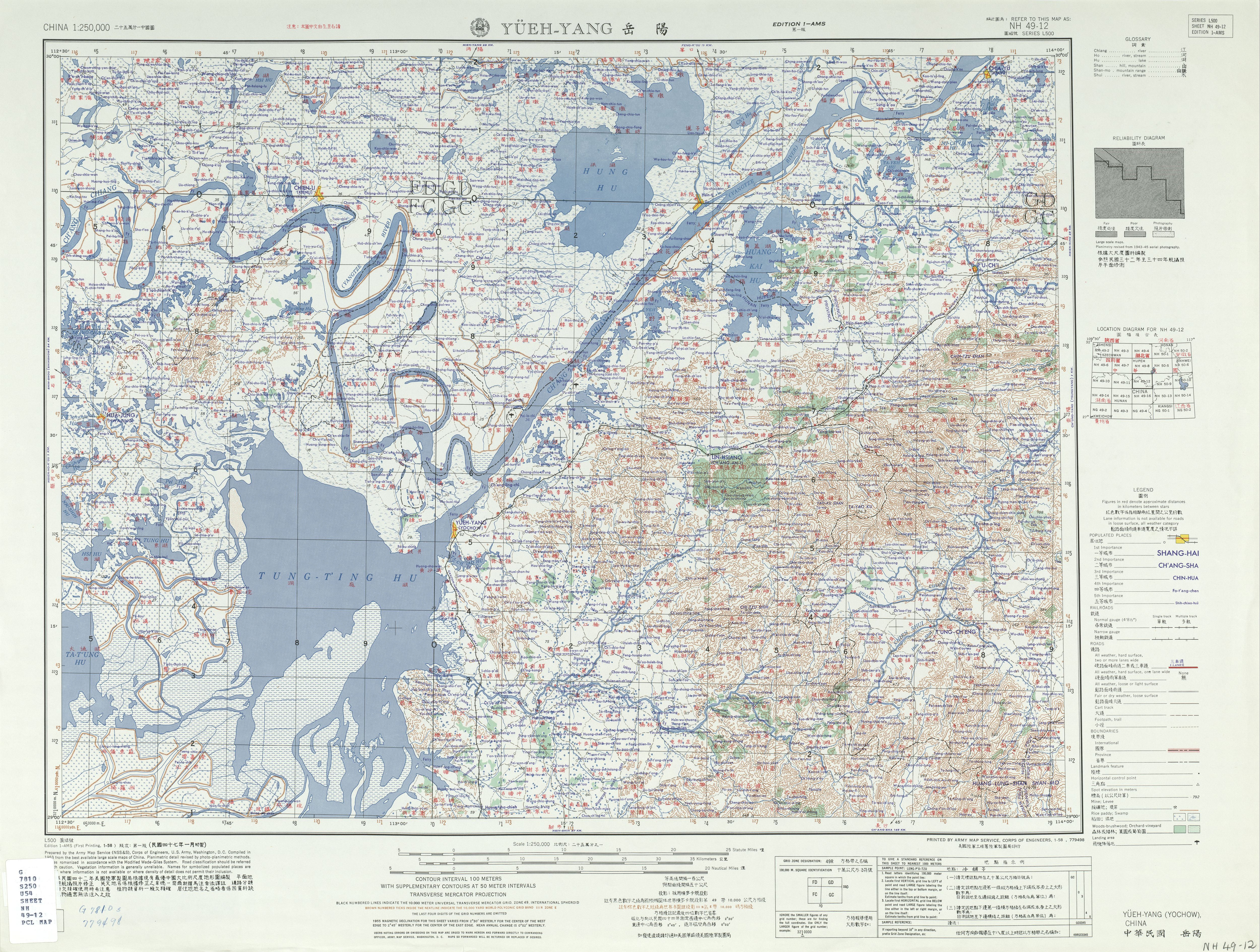
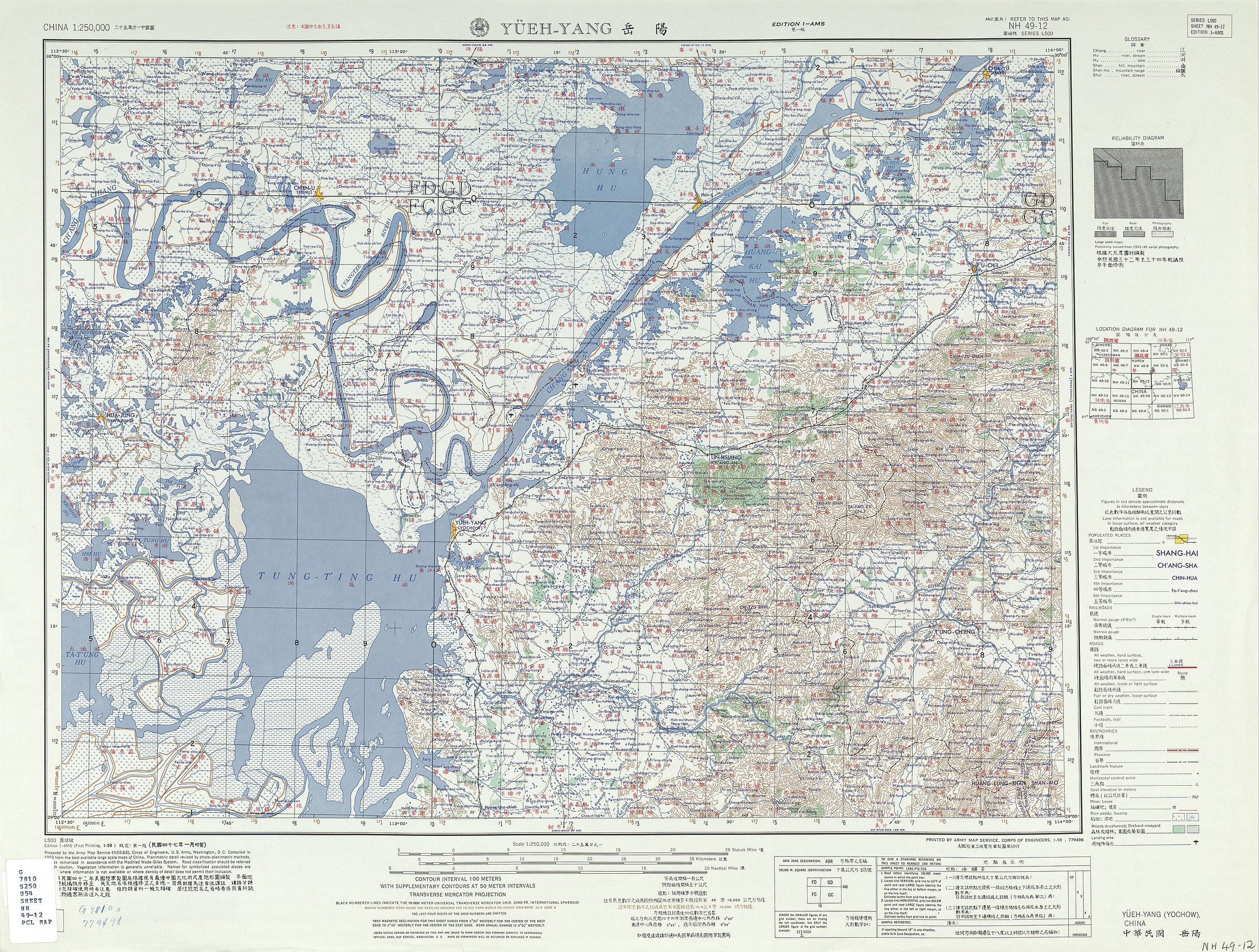
ਤਸਵੀਰ:Txu-oclc-10552568-nh49-12.jpg
ਇਸ ਝਾਤ ਦਾ ਅਕਾਰ: 793 × 600 ਪਿਕਸਲ. ਹੋਰ ਰੈਜ਼ੋਲਿਊਸ਼ਨਜ਼: 318 × 240 ਪਿਕਸਲ | 635 × 480 ਪਿਕਸਲ | 1,016 × 768 ਪਿਕਸਲ | 1,280 × 968 ਪਿਕਸਲ | 2,560 × 1,935 ਪਿਕਸਲ | 5,000 × 3,780 ਪਿਕਸਲ.
ਅਸਲ ਫ਼ਾਈਲ (5,000 × 3,780 ਪਿਕਸਲ, ਫ਼ਾਈਲ ਅਕਾਰ: 5.49 MB, MIME ਕਿਸਮ: image/jpeg)
ਸਾਰ
| ਵੇਰਵਾ |
English: China AMS Topographic Maps |
| ਮਿਤੀ | 1950s |
| ਸਰੋਤ | Courtesy of the University of Texas Libraries, The University of Texas at Austin. |
| ਲਿਖਾਰੀ | Army Map Service, Corps of Engineers |
ਲਸੰਸ
This image or file is a work of a U.S. Army Corps of Engineers soldier or employee, taken or made as part of that person's official duties. As a work of the U.S. federal government, the image is in the public domain.
|
ਫ਼ਾਈਲ ਦਾ ਅਤੀਤ
ਤਾਰੀਖ/ਸਮੇਂ ’ਤੇ ਕਲਿੱਕ ਕਰੋ ਤਾਂ ਉਸ ਸਮੇਂ ਦੀ ਫਾਈਲ ਪੇਸ਼ ਹੋ ਜਾਵੇਗੀ।
| ਮਿਤੀ/ਸਮਾਂ | ਨਮੂਨਾ | ਨਾਪ | ਵਰਤੋਂਕਾਰ | ਟਿੱਪਣੀ | |
|---|---|---|---|---|---|
| ਮੌਜੂਦਾ | 04:56, 13 ਸਤੰਬਰ 2019 | | 5,000 × 3,780 (5.49 MB) | Geographyinitiative | User created page with UploadWizard |
ਫ਼ਾਈਲ ਦੀ ਵਰਤੋਂ
ਇਹ ਫਾਈਲ ਹੇਠਾਂ ਦਿੱਤੇ 2 ਸਫ਼ੇ ਵਰਤਦੇ ਹਨ:
ਫ਼ਾਈਲ ਦੀ ਵਿਆਪਕ ਵਰਤੋਂ
ਇਸ ਫ਼ਾਈਲ ਨੂੰ ਹੋਰ ਹੇਠ ਲਿਖੇ ਵਿਕੀ ਵਰਤਦੇ ਹਨ:
- bn.wikipedia.org ਉੱਤੇ ਵਰਤੋਂ
- en.wikipedia.org ਉੱਤੇ ਵਰਤੋਂ