ਖ਼ਤਰੇ ਵਿਚ ਵਿਸ਼ਵ ਵਿਰਾਸਤ ਦੀ ਸੂਚੀ
ਦਿੱਖ
| ਇਸ ਹਿੱਸੇ/ਲੇਖ ਨੂੰ ਪੰਜਾਬੀ ਵਿੱਚ ਅਨੁਵਾਦ ਕਰਨ ਦੀ ਜਰੂਰਤ ਹੈ ਹੈ। ਤੁਸੀਂ ਇਸਦਾ ਪੰਜਾਬੀ ਵਿੱਚ ਅਨੁਵਾਦ ਕਰਕੇ ਵਿਕੀਪੀਡੀਆ ਦੀ ਮਦਦ ਕਰ ਸਕਦੇ ਹੋ। |
ਖ਼ਤਰੇ ਵਿੱਚ ਵਿਸ਼ਵ ਵਿਰਾਸਤ ਦੀ ਸੂਚੀ ਨੂੰ ਸੰਯੁਕਤ ਰਾਸ਼ਟਰ ਦੇ ਵਿਦਿਅਕ, ਵਿਗਿਆਨਕ ਅਤੇ ਸੱਭਿਆਚਾਰਕ ਸੰਗਠਨ (ਯੂਨੇਸਕੋ) ਦੀ ਵਿਰਾਸਤ ਵਰਲਡ ਕਮੇਟੀ ਦੁਆਰਾ 11.4 ਆਰਟੀਕਲ ਅਨੁਸਾਰ ਤਿਆਰ ਕੀਤਾ ਗਿਆ ਹੈ। ਲਿਸਟ ਵਿਚਲੇ ਇੰਦਰਾਜਾਂ ਨੂੰ ਵਰਲਡ ਹੈਰੀਟੇਜ ਸਾਈਟਸ ਦੀ ਸੁਰੱਖਿਆ ਲਈ ਕਿਹੜੇ ਵੱਡੇ ਮੁਹਿੰਮਾਂ ਦੀ ਲੋੜ ਹੈ ਅਤੇ ਜਿਸ ਲਈ "ਸਹਾਇਤਾ ਲਈ ਬੇਨਤੀ ਕੀਤੀ ਗਈ ਹੈ"।
ਵਰਤਮਾਨ ਵਿੱਚ ਸੂਚੀਬੱਧ ਸਥਾਨ
[ਸੋਧੋ]- ਟੇਬਲ ਲੀਜੈਂਡ
- ਨਾਮ: ਜਿਵੇਂ ਕਿ ਵਿਸ਼ਵ ਵਿਰਾਸਤੀ ਕਮੇਟੀ ਦੁਆਰਾ ਸੂਚੀਬੱਧ ਕੀਤਾ ਗਿਆ ਹੈ[1]
- ਸਥਿਤੀ: ਕੋਆਰਡੀਨੇਟ ਦੇ ਨਾਲ, ਸ਼ਹਿਰ ਜਾਂ ਸੂਬਾਈ ਪੱਧਰ ਅਤੇ ਦੇਸ਼ ਦੇ ਨਾਮ ਤੇ; ਰਾਜ ਦੁਆਰਾ ਕਾਲਮ ਦੀ ਕਿਸਮ[nb 1]
- ਮਾਪਦੰਡ: ਇਹ ਸਾਈਟ ਇਸ ਸੂਚੀ ਹੇਠ ਦਿੱਤੀ ਗਈ ਸੀ
- ਖੇਤਰ: ਯੂਕੇਸਕੋ ਦੁਆਰਾ ਮੁਹੱਈਆ ਕੀਤੇ ਗਏ ਹੈਕਟੇਅਰ ਅਤੇ ਏਕੜ ਵਿੱਚ
- ਸਾਲ (ਡਬਲਿਊਐਚਐਸ): ਉਹ ਸਾਲ ਜਿਸ ਵਿੱਚ ਇਹ ਵਰਲਡ ਵਿਸ਼ਵ ਵਿਰਾਸਤ ਸੂਚੀ ਵਿੱਚ ਦਰਜ ਕੀਤੀ ਗਈ ਸੀ
- ਸੂਚੀ ਵਿੱਚ ਸ਼ਾਮਿਲ ਕੀਤਾ ਗਿਆ: ਉਹ ਸਾਲ ਜਿਸ ਵਿੱਚ ਇਹ ਖਤਰਨਾਕ ਸਥਿਤੀ ਵਿੱਚ ਵਿਸ਼ਵ ਦੀ ਵਿਰਾਸਤ ਦੀ ਸੂਚੀ ਵਿੱਚ ਪ੍ਰਗਟ ਹੋਇਆ
- ਕਾਰਨ:ਡਰ ਜਿਸਨੇ ਯੂਨੇਸਕੋ ਨੂੰ ਸਾਈਟ ਨੂੰ ਖ਼ਤਰੇ ਦੇ ਰੂਪ ਵਿੱਚ ਸੂਚੀਬੱਧ ਕਰਨ ਲਈ ਪ੍ਰੇਰਿਆ
* ਟ੍ਰਾਂਸ-ਬਾਰਡਰ ਸਾਈਟ
| ਨਾਮ | ਤਸਵੀਰ | ਸਥਿਤੀ | ਮਾਪਦੰਡ | ਖੇਤਰ (ਏਕੜ) |
ਸਾਲ (ਡਬਲਿਊਐਚਐਸ) | ਸੂਚੀ ਵਿੱਚ ਇੰਦਰਾਜ਼ | ਕਾਰਨ | ਹਵਾਲਾ |
|---|---|---|---|---|---|---|---|---|
| ਅਬੁ ਮੇਨਾ | 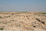
|
ਅਬੁਸ਼ੀਰ, ਫਰਮਾ:Country data Egypt 30°50′30″N 29°39′50″E / 30.84167°N 29.66389°E |
ਸੱਭਿਆਚਾਰਕ: (iv) |
182 (450) | 1979 | 2001- | ਸਤ੍ਹਾ ਤੇ ਮਿੱਟੀ ਦੇ ਕਾਰਨ ਖੇਤਰ ਵਿੱਚ ਗੁਫਾ-ਇਨ, ਜੋ "ਵਾਧੂ ਪਾਣੀ" ਦੇ ਨਾਲ ਮਿਲ ਕੇ ਸੈਮੀ-ਤਰਲ ਬਬਣਾਉਂਦਾ ਹੈ। | [2][3] [4] |
| ਏਅਰ ਅਤੇ ਟੇਨੇਰੇ ਨੈਚੂਰਲ ਰਿਜ਼ਰਵ | 
|
ਅਰਲੀਟ ਡਿਪਾਰਟਮੈਂਟ, ਫਰਮਾ:Country data Niger 18°17′N 8°0′E / 18.283°N 8.000°E |
ਸੱਭਿਆਚਾਰਕ: (vii), (ix), (x) |
7,736,000 (19,120,000) | 1991 | 1992- | ਇਸ ਖੇਤਰ ਵਿੱਚ ਮਿਲਟਰੀ ਵਿਵਾਦ ਅਤੇ ਨਾਗਰਿਕ ਅੜਿੱਕੇ ਦੇ ਨਾਲ ਨਾਲ ਜੰਗਲੀ ਜਾਨਵਰਾਂ ਦੀ ਆਬਾਦੀ ਵਿੱਚ ਕਮੀ ਅਤੇ ਖੇਤੀ ਦੇ ਘੇਰੇ ਨੂੰ ਘਟਾਉਣਾ। | [5][6] |
| ਅਲੇਪੋ ਦੇ ਪ੍ਰਾਚੀਨ ਸ਼ਹਿਰ | 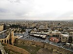
|
ਅਲੀਪੋ ਗਵਰਨੋਿਟ, 36°14′0″N 37°10′0″E / 36.23333°N 37.16667°E |
ਸੱਭਿਆਚਾਰਕ: (iii)(iv) |
350 (860) | 1986 | 2013- | ਸੀਰੀਆਈ ਘਰੇਲੂ ਯੁੱਧ, ਜੋ ਕੀ ਬਾਗ਼ੀਆਂ ਅਤੇ ਸਰਕਾਰ ਦੁਆਰਾ ਕੀਤਾ ਜਾ ਰਿਹਾ ਹੈ। ਸਰਕਾਰ ਵੱਲੋਂ ਲਗਾਤਾਰ ਬੰਬ ਧਮਾਕੇ, ਅਤੇ ਬਾਗ਼ੀਆਂ ਦੁਆਰਾ ਮਾਰਟੋਰ ਅਤੇ ਗੋਲੀਬਾਰੀ ਨੇ ਬੁਨਿਆਦੀ ਢਾਂਚੇ ਨੂੰ ਖ਼ਤਰੇ ਵਿੱਚ ਪਾ ਦਿੱਤਾ | [7] |
| ਬੋਸਰਾ ਦਾ ਪ੍ਰਾਚੀਨ ਸ਼ਹਿਰ | 
|
Daraa Governorate, 32°31′5″N 36°28′54″E / 32.51806°N 36.48167°E |
ਸੱਭਿਆਚਾਰਕ: (i)(iii)(vi) |
— | 1980 | 2013- | ਸੀਰੀਆਈ ਘਰੇਲੂ ਯੁੱਧ, ਸਰਕਾਰ ਦੁਆਰਾ ਚਲਾਈ ਗਈ। | [8] |
| ਦਮਿਸ਼ਕ ਦਾ ਪ੍ਰਾਚੀਨ ਸ਼ਹਿਰ | 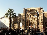
|
ਦੰਮਿਸਕ ਗਵਰਨੋਰੇਟ, 33°30′41″N 36°18′23″E / 33.51139°N 36.30639°E |
ਸੱਭਿਆਚਾਰਕ: (i)(ii)(iii)(iv)(vi) |
86 (210) | 1979 | 2013- | ਸੀਰੀਆਈ ਘਰੇਲੂ ਜੰਗ, ਬਾਗ਼ੀ ਗੋਲੀਬਾਰੀ ਅਤੇ ਮੋਰਟਾਰ ਗੋਲੀਬਾਰੀ, ਮੁੱਖ ਤੌਰ 'ਤੇ ਅਸੰਗਤ ਜੌਬਰਾਂ ਨੇ ਇਸਨੂੰ ਖਤਰੇ ਦੇ ਘੇਰੇ ਵਿੱਚ ਪਾ ਦਿੱਤਾ। | [9] |
| ਉੱਤਰੀ ਸੀਰੀਆ ਦੇ ਪ੍ਰਾਚੀਨ ਪਿੰਡ | 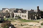
|
36°20′3″N 36°50′39″E / 36.33417°N 36.84417°E |
ਸੱਭਿਆਚਾਰਕ: (iii)(iv)(v) |
12,290 (30,400) | 2011 | 2013- | ਸੀਰੀਆਈ ਘਰੇਲੂ ਜੰਗ, ਕੁਝ ਵਿਦਰੋਹੀਆਂ ਦੁਆਰਾ। ਇਸਲਾਮਿਸਟ ਸਮੂਹ ਦੁਆਰਾ ਲੁੱਟ ਅਤੇ ਨਸ਼ਟ ਕਰਨ ਦੀਆਂ ਰਿਪੋਰਟਾਂ। | [10] |
| ਪੁਰਾਤੱਤਵ ਸਥਾਨ ਦੀ ਸਾਇਰੀਨ | 
|
ਜੇਬਲ ਅਖਤਰ
ਫਰਮਾ:Country data Libya |
ਸੱਭਿਆਚਾਰਕ: (ii), (iii), (vi) |
— | 1982 | 2016- | ਲਿਬੀਆ ਦੀ ਘਰੇਲੂ ਜੰਗ, ਹਥਿਆਰਬੰਦ ਸਮੂਹਾਂ ਦੀ ਮੌਜੂਦਗੀ, ਪਹਿਲਾਂ ਹੀ ਕੀਤੇ ਗਏ ਅਤੇ ਸੰਭਾਵੀ ਹੋਰ ਨੁਕਸਾਨ | [11][12] |
| ਲੈਪਟੀਸ ਮੈਗਨਾ ਦੀ ਪੁਰਾਤੱਤਵ ਸਾਈਟ | 
|
ਖੋਮਸ, ਫਰਮਾ:Country data Libya 32°38′18″N 14°17′35″E / 32.63833°N 14.29306°E |
ਸੱਭਿਆਚਾਰਕ: (i), (ii), (iii) |
— | 1982 | 2016- | ਲਿਬੀਆ ਦੀ ਘਰੇਲੂ ਜੰਗ, ਹਥਿਆਰਬੰਦ ਸਮੂਹਾਂ ਦੀ ਮੌਜੂਦਗੀ, ਪਹਿਲਾਂ ਹੀ ਕੀਤੇ ਗਏ ਅਤੇ ਸੰਭਾਵੀ ਹੋਰ ਨੁਕਸਾਨ | [12][13] |
| ਸਬਰਥਾ ਦੀ ਪੁਰਾਤੱਤਵ ਸਾਈਟ | 
|
ਸਬਰਥਾ, ਫਰਮਾ:Country data Libya 32°48′19″N 12°29′06″E / 32.80528°N 12.48500°E |
ਸੱਭਿਆਚਾਰਕ: (iii) |
— | 1982 | 2016- | ਲਿਬੀਆ ਦੀ ਘਰੇਲੂ ਜੰਗ, ਹਥਿਆਰਬੰਦ ਸਮੂਹਾਂ ਦੀ ਮੌਜੂਦਗੀ, ਪਹਿਲਾਂ ਹੀ ਕੀਤੇ ਗਏ ਅਤੇ ਸੰਭਾਵੀ ਹੋਰ ਨੁਕਸਾਨ | [12][14] |
| ਅਸ਼ੁਰ (ਕਾਲ'ਤੇ ਸ਼ੇਰਕਤ) | 
|
ਸਲਾਹਾ ਅਦ ਦਿਨ 35°27′24″N 43°15′45″E / 35.45667°N 43.26250°E |
ਸੱਭਿਆਚਾਰਕ: (iii), (iv) |
70 (170) | 2003 | 2003- | ਨਵੇਂ ਪ੍ਰਸ਼ਾਸਨ ਦੁਆਰਾ ਇਰਾਕ ਜੰਗ ਦੇ ਮੱਦੇਨਜ਼ਰ ਇੱਕ ਆਧੁਨਿਕ ਸਰੋਵਰ ਜਿਸ ਵਿੱਚ ਅੰਸ਼ਕ ਤੌਰ 'ਤੇ ਹੜ੍ਹ ਆਉਣਾ ਬੰਦ ਕਰ ਦਿੱਤਾ ਗਿਆ ਸੀ; ਢੁਕਵੀਂ ਸੁਰੱਖਿਆ ਦੀ ਘਾਟ | [15][16] |
| ਬਾਗਰਾਤੀ ਕੈਥੇਡ੍ਰਲ ਅਤੇ ਗਾਲੀਤੀ ਮੱਠ | 
|
ਇਮੇਰਟੀ, ਫਰਮਾ:Country data Georgia 42°15′44″N 42°42′59″E / 42.26222°N 42.71639°E |
ਸੱਭਿਆਚਾਰਕ: (iv) |
7.87 (19.4) | 1994 | 2010- | ਪ੍ਰਮੁੱਖ ਪੁਨਰ ਨਿਰਮਾਣ ਪ੍ਰੋਜੈਕਟ, ਜਿਸ ਦੇ ਨਤੀਜੇ ਵਜੋਂ ਅਢੁਕਵੇਂ ਦਖਲ ਦੀ ਸੰਭਾਵਨਾ ਪੈਦਾ ਹੋਵੇਗੀ ਅਤੇ ਸਾਈਟ ਦੀ ਪ੍ਰਮਾਣਿਕਤਾ ਅਤੇ ਅਖੰਡਤਾ ਨੂੰ ਕਮਜ਼ੋਰ ਕਰੇਗੀ। | [17][18] |
| ਬੇਲੀਜ਼ ਬੈਰੀਅਰ ਰੀਫ ਰਿਜ਼ਰਵ ਸਿਸਟਮ | 
|
ਬੇਲੀਜ਼, ਸਟੈਨਨ ਕ੍ਰੀਕ ਅਤੇ ਟਾਲੀਡੋ ਫਰਮਾ:Country data Belize 17°19′N 87°32′W / 17.317°N 87.533°W |
ਸੱਭਿਆਚਾਰਕ: (vii), (ix), (x) |
96,300 (238,000) | 1996 | 2009- | ਮੈਨਗਰੂਵ ਕੱਟਣ ਅਤੇ ਬਹੁਤ ਜ਼ਿਆਦਾ ਵਿਕਾਸ | [19][20] |
| ਚਾਨ ਚਾਨ ਪੁਰਾਤੱਤਵ ਖੇਤਰ | 
|
La Libertad, 8°6′40″S 79°04′30″W / 8.11111°S 79.07500°W |
ਸੱਭਿਆਚਾਰਕ: (i), (iii) |
600 (1,500) | 1986 | 1986- | ਕੁਦਰਤੀ ਖਸਤਾ | [21][22] |
| ਜਨਮ ਅਸਥਾਨ ਜੀਸਸ: ਚਰਚ ਆਫ਼ ਦਿ ਨੇਟੀਵਿਟੀ ਅਤੇ ਦੀ ਪਿਲਗ੍ਰਿਜ ਰੂਟ, ਬੈਤਲਹਮ | 
|
Bethlehem, 31°42′16″N 35°12′27″E / 31.70444°N 35.20750°E |
ਸੱਭਿਆਚਾਰਕ: (iv), (vi) |
2.98 (7.4) | 2012 | 2012- | ਪਾਣੀ ਦੀ ਲੀਕ ਕਾਰਨ ਨੁਕਸਾਨ - ਹਾਲਾਂਕਿ ਸਾਈਟ ਨੂੰ ਬਚਾਉਣ ਲਈ ਮੌਜੂਦਾ ਸੁਧਾਰ ਦਾ ਕੰਮ ਚੱਲ ਰਿਹਾ ਹੈ। | [23][24] |
| ਕੌਮੋਈ ਰਾਸ਼ਟਰੀ ਪਾਰਕ | 
|
Zanzan, ਫਰਮਾ:Country data Côte d'Ivoire 9°10′N 3°40′W / 9.167°N 3.667°W |
ਕੁਦਰਤੀ: (ix), (x) |
1,150,000 (2,800,000) | 1983 | 2003- | ਸਿਵਲ ਗੜਬੜ, ਸ਼ਿਕਾਰ ਅਤੇ ਪ੍ਰਭਾਵਸ਼ਾਲੀ ਪ੍ਰਬੰਧਨ ਤੰਤਰ ਦੀ ਘਾਟ | [25][26] |
| ਕੋਰੋ ਅਤੇ ਇਸਦਾ ਬੰਦਰਗਾਹ | 
|
Falcón, ਫਰਮਾ:Country data Venezuela 11°25′N 69°40′W / 11.417°N 69.667°W |
ਸੱਭਿਆਚਾਰਕ: (iv), (v) |
107 (260) | 1993 | 2005- | ਨਵੰਬਰ 2004 ਅਤੇ ਫ਼ਰਵਰੀ 2005 ਦਰਮਿਆਨ ਭਾਰੀ ਬਾਰਿਸ਼ ਦੇ ਕਾਰਨ ਦੇ ਨਾਲ ਨਾਲ ਇੱਕ ਨਵੇਂ ਸਮਾਰਕ, ਇੱਕ ਬੀਚ ਵਾਕਵੇਅ ਅਤੇ ਬਫਰ ਜ਼ੋਨ ਵਿੱਚ ਸ਼ਹਿਰ ਨੂੰ ਇੱਕ ਦਰਵਾਜ਼ਾ ਗੇਟ ਬਣਾਉਣਾ ਜਿਸ ਨਾਲ ਸਾਇਟ ਦੀ ਕੀਮਤ ਤੇ ਕਾਫ਼ੀ ਅਸਰ ਪੈ ਸਕਦਾ ਹੈ। | [27][28] |
| ਕਰਕ ਡੇਸ ਕੇਵਾਲੀਅਰਜ਼ ਅਤੇ ਕਾਲਤ ਸਲਾਹ ਅਲ-ਦੀਨ | 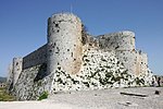
|
Homs and Latakia Governorates, 34°46′54″N 36°15′47″E / 34.78167°N 36.26306°E |
ਸੱਭਿਆਚਾਰਕ: (ii)(iv) |
9 (22) | 2006 | 2013- | ਸੀਰੀਆਈ ਘਰੇਲੂ ਯੁੱਧ, ਜੋ ਇੱਕ ਵਾਰ ਅਲ-ਨੂਸਰਾ ਫਰੰਟ ਅਤੇ ਹੋਰ ਈਸਾਈਵਾਦੀ ਸਮੂਹਾਂ ਦੁਆਰਾ ਆਯੋਜਿਤ ਸੀ, ਸੀਰੀਅਨ ਅਰਬ ਫੌਜ ਅਤੇ ਹਿਜਬੁੱਲਾ ਲੜਾਕੇ ਦੁਆਰਾ ਪੁਨਰ ਸੁਰਜਿਤ ਕੀਤਾ ਗਿਆ ਸੀ। ਸਰਕਾਰ ਦੁਆਰਾ ਇਸਲਾਮਿਕ ਸਮੂਹਾਂ ਦੇ ਕਾਰਨ ਹੋਏ ਨੁਕਸਾਨ ਅਤੇ ਲੁੱਟ ਦੀ ਰਿਪੋਰਟ ਜਾਰੀ ਕੀਤੀ ਗਈ ਸੀ। | [29] |
| ਬਹਾਰੀਆਂ ਵੈਲੀ ਦੀ ਸੱਭਿਆਚਾਰਕ ਲੈਂਡਸਕੇਪ ਅਤੇ ਆਰਕਾਈਓਲੌਜੀਕਲ ਸਥਾਨ | Bamyan, 34°49′55″N 67°49′36″E / 34.83194°N 67.82667°E |
ਸੱਭਿਆਚਾਰਕ: (i), (ii), (iii), (iv), (vi) |
159 (390) | 2003 | 2003- | ਫੌਜੀ ਕਾਰਵਾਈ ਅਤੇ ਡਾਇਨਾਮਾਈ ਧਮਾਕੇ ਕਾਰਨ ਨਾਪਾਕ ਬਚਾਅ ਰਾਜ; ਬੁੱਢੀਆਂ ਨੀਂਹਾਂ ਨੂੰ ਢਹਿਣ ਦੇ ਜੋਖਮ, ਗੁਫਾ ਭੰਡਾਵਲੀ ਦਾ ਹੋਰ ਵਿਗਾੜ, ਲੁੱਟਣਾ ਅਤੇ ਗੈਰ ਕਾਨੂੰਨੀ ਖੁਦਾਈ ਆਦਿ ਖ਼ਤਰਿਆਂ ਦਾ ਕਾਰਨ ਬਣਨਾ। ਉਹਨਾਂ ਦੀਆਂ ਸਿੱਖਿਆਵਾਂ ਕਾਰਨ ਤਾਲਿਬਾਨ ਦੇ ਸ਼ਾਸਨ ਦੌਰਾਨ ਨਸ਼ਟ ਕਰਨਾ ਮੂਰਤੀਆਂ ਨੂੰ ਇਸਲਾਮ ਦੇ ਘਿਣਾਉਣੇ ਕੰਮ ਹਨ। | [30][31] | |
| ਪੂਰਬੀ ਰੇਨੇਲ | 
|
Rennell and Bellona Province, ਫਰਮਾ:Country data Solomon।slands 11°40′59″S 160°10′59″E / 11.68306°S 160.18306°E |
ਕੁਦਰਤੀ: (ix) |
37,000 (91,000) | 1998 | 2013- | ਸਥਾਨਕ ਇਕੋਸਟਮ ਤੇ ਲਾਗਿੰਗ ਕਰਕੇ ਅਤੇ ਇਸਦੇ ਪ੍ਰਭਾਵ ਕਾਰਨ ਸਾਈਟ ਨੂੰ ਹੋਏ ਨੁਕਸਾਨ। | [32] |
| ਐਵਰਗਲਡੇਸ ਨੈਸ਼ਨਲ ਪਾਰਕ | 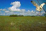
|
Florida, 25°19′N 80°56′W / 25.317°N 80.933°W |
ਕੁਦਰਤੀ: (viii), (ix), (x) |
592,920 (1,465,100) | 1979 | 1993–2007, 2010- | ਹਰੀਕੇਨ ਐਂਡਰਿਊ ਕਾਰਨ ਨੁਕਸਾਨ ਅਤੇ ਖੇਤੀਬਾੜੀ ਅਤੇ ਸ਼ਹਿਰੀ ਵਿਕਾਸ (1993) ਦੇ ਕਾਰਨ ਪਾਣੀ ਦੇ ਪ੍ਰਵਾਹ ਅਤੇ ਗੁਣਾਂ ਨੂੰ ਵਿਗਾੜ ਰਹੇ ਹਨ; ਸਾਈਟ ਦੇ ਲਗਾਤਾਰ ਪਤਨ ਦੇ ਨਤੀਜੇ ਵਜੋਂ ਸਮੁੰਦਰੀ ਨਿਵਾਸ ਦੇ ਨੁਕਸਾਨ ਅਤੇ ਸਮੁੰਦਰੀ ਜੀਵਾਂ ਵਿੱਚ ਗਿਰਾਵਟ (2010) | [33][34] [35] |
| ਪਨਾਮਾ ਦੇ ਕੈਰੇਬੀਅਨ ਸਾਈਡ ਤੇ ਪਾਬੰਦੀਆਂ: ਪੋਰਟੋਬੋਲੋ-ਸਾਨ ਲੋਰੇਂਜੋ | 
|
Colón Province, ਫਰਮਾ:Country data Panama 9°33′14″N 79°39′21″W / 9.55389°N 79.65583°W |
ਸੱਭਿਆਚਾਰਕ: (i), (iv) |
— | 1980 | 2012- | ਵਾਤਾਵਰਣ ਦੇ ਕਾਰਕ, ਦੇਖਭਾਲ ਦੀ ਘਾਟ ਅਤੇ ਸ਼ਹਿਰੀ ਵਿਕਾਸ | [36][37] |
| ਗਾਰੰਬਾ ਨੈਸ਼ਨਲ ਪਾਰਕ | 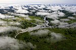
|
Orientale, ਫਰਮਾ:Country data Democratic Republic of the Congo 4°0′N 29°15′E / 4.000°N 29.250°E |
ਕੁਦਰਤੀ: (vii), (x) |
500,000 (1,200,000) | 1980 | 1984–1992, 1996- | ਉੱਤਰੀ ਗੋਰਾ ਰਾਈਨੋਸੋਰਸਸ ਦੀ ਅਬਾਦੀ ਦੀ ਕਮੀ (1984); ਦੋ ਸਫੇਦ ਰਾਈਨੋਸੋਰਸਸ ਦਾ ਸ਼ਿਕਾਰ, ਤਿੰਨ ਰੇਂਜਰਸ ਦੀ ਹੱਤਿਆ ਅਤੇ ਅਥਾਰਟੀਜ਼ ਦੁਆਰਾ ਸੁਧਾਰੀ ਉਪਾਵਾਂ ਦੀ ਕੋਈ ਯੋਜਨਾ ਨਹੀਂ (1996) | [38] [39] |
| ਹਾਤਰਾ | Nineveh Governorate, 35°35′17.016″N 42°43′5.988″E / 35.58806000°N 42.71833000°E |
ਸੱਭਿਆਚਾਰਕ: (ii), (iii), (iv), (vi) |
324 (800) | 1985 | 2015- | ਹਥਿਆਰਬੰਦ ਗਰੁੱਪਾਂ ਦੁਆਰਾ ਸੰਪਤੀ ਨੂੰ ਨੁਕਸਾਨ ਪਹੁੰਚਾਉਣਾ | [40] | |
| ਸ਼ਖਰੀਯਾਬਜ਼ ਦਾ ਇਤਿਹਾਸਕ ਕੇਂਦਰ | 
|
Qashqadaryo Region, 39°3′0″N 66°50′0″E / 39.05000°N 66.83333°E |
ਸੱਭਿਆਚਾਰਕ: (iii), (iv) |
240 (590) | 2000 | 2016- | ਮੱਧਯੁਗ ਦੇ ਆਂਢ-ਗੁਆਂਢਾਂ ਵਿੱਚ ਇਮਾਰਤਾਂ ਨੂੰ ਨਸ਼ਟ ਕਰਨਾ ਅਤੇ ਸ਼ਹਿਰੀ ਵਿਕਾਸ ਜਾਰੀ ਰੱਖਣਾ। | [41][42] |
| ਜ਼ਬੀਦ ਦਾ ਇਤਿਹਾਸਕ ਸ਼ਹਿਰ | Al Hudaydah, ਫਰਮਾ:Country data Yemen 14°12′N 43°19′E / 14.200°N 43.317°E |
ਸੱਭਿਆਚਾਰਕ: (ii), (iv), (vi) |
— | 1993 | 2000- | ਸਟੇਟ ਪਾਰਟੀ ਦੀ ਬੇਨਤੀ 'ਤੇ ਲਿਖਿਆ ਗਿਆ ਇਤਿਹਾਸਕ ਇਮਾਰਤਾਂ ਦੀ ਵਿਗੜ ਰਹੀ ਹਾਲਤ। | [43][44] | |
| ਹੈਂਬਰਸਟੋਨ ਅਤੇ ਸਾਂਟਾ ਲੌਰਾ ਸਲਟਪੇਟਰ ਵਰਕਸ | 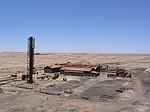
|
Tarapacá, 20°12′30″S 69°47′40″W / 20.20833°S 69.79444°W |
ਸੱਭਿਆਚਾਰਕ: (ii), (iii), (iv) |
— | 2005 | 2005- | 40 ਸਾਲਾਂ ਦੀ ਸਾਂਭ ਸੰਭਾਲ ਦੀ ਘਾਟ ਕਾਰਨ ਢਾਂਚਿਆਂ ਦੇ ਨਾਜ਼ੁਕ ਸੁਭਾਅ; ਨੁਕਸਾਨ ਵੀ, ਵਿਨਾਸ਼ਕਾਰੀ ਅਤੇ ਕੁਝ ਨੂੰ ਖ਼ਤਮ ਕਰਨਾ; ਲੁੱਟ | [45][46] |
| ਕਾਹੂਜ਼ੀ-ਬਿੱਗਾ ਨੈਸ਼ਨਲ ਪਾਰਕ | South Kivu and Maniema, ਫਰਮਾ:Country data Democratic Republic of the Congo 2°30′S 28°45′E / 2.500°S 28.750°E |
ਕੁਦਰਤੀ: (x) |
600,000 (1,500,000) | 1980 | 1997- | ਜੰਗਲਾਂ ਦੀ ਕਟਾਈ, ਲੜਾਈ ਦੇ ਨਾਲ ਨਾਲ ਜੰਗ ਅਤੇ ਸ਼ਹਿਰੀ ਝਗੜੇ | [47][48] | |
| ਲਿਵਰਪੂਲ-ਮੈਰੀਟਾਈਮ ਮਰਕੈਂਟਾਈਲ ਸਿਟੀ | Liverpool England, 53°24′24″N 2°50′40″W / 53.40667°N 2.84444°W |
ਸੱਭਿਆਚਾਰਕ: (ii), (iii), (iv) |
136 (340) | 2004 | 2012- | ਲੀਵਰਪੂਲ ਵਾਟਰਾਂ ਵਜੋਂ ਜਾਣੇ ਜਾਂਦੇ ਇਤਿਹਾਸਕ ਡੌਕਲੈਂਡਾਂ ਦੇ ਪ੍ਰਸਤਾਵਤ ਮੁੜ-ਵਿਕਾਸ ਦੇ ਕਾਰਨ | [49][50] | |
| ਮਾਨੋਵੋ-ਗੌਂਡਾ ਸੈਂਟ ਫੋਰਰਸ ਨੈਸ਼ਨਲ ਪਾਰਕ | 
|
Bamingui-Bangoran, ਫਰਮਾ:Country data Central African Republic 9°0′N 21°30′E / 9.000°N 21.500°E |
ਕੁਦਰਤੀ: (ix), (x) |
1,740,000 (4,300,000) | 1988 | 1997- | ਗ਼ੈਰਕਾਨੂੰਨੀ ਚਰਾਂਦ ਅਤੇ ਸ਼ਿਕਾਰ ਕਰਨਾ, ਵਿਗੜਦੀ ਸੁਰੱਖਿਆ ਸਥਿਤੀ | [51][52] |
| ਮੀਨਾਰੈਟ ਅਤੇ ਜਾਮ ਦੇ ਪੁਰਾਤੱਤਵ ਰਹਿੰਦ | 
|
Ghōr, 34°23′48″N 64°30′58″E / 34.39667°N 64.51611°E |
ਸੱਭਿਆਚਾਰਕ: (ii), (iii), (iv) |
70 (170) | 2002 | 2002- | ਕਾਨੂੰਨੀ ਸੁਰੱਖਿਆ ਦੀ ਘਾਟ, ਸੁਰੱਖਿਆ ਉਪਾਅ ਜਾਂ ਪ੍ਰਬੰਧਨ ਯੋਜਨਾ ਦੀ ਘਾਟ, ਸਾਈਟ ਦੀ ਮਾੜੀ ਹਾਲਤ | [53][54] |
| ਕੋਸੋਵੋ ਵਿੱਚ ਮੱਧਕਾਲੀਨ ਸਮਾਰਕ | 
|
Kosovo[lower-alpha 1] 42°39′40″N 20°15′56″E / 42.66111°N 20.26556°E |
ਸੱਭਿਆਚਾਰਕ: (ii), (iii), (iv) |
2.88 (7.1) | 2004 | 2006- | ਕਾਨੂੰਨੀ ਸੁਰੱਖਿਆ ਅਤੇ ਪ੍ਰਬੰਧਨ ਦੀ ਕਮੀ; ਸਿਆਸੀ ਅਸਥਿਰਤਾ ਅਤੇ ਸੁਰੱਖਿਆ | [55][56] |
| ਮਾਊਂਟ ਨਿਮਬਾ ਸਟ੍ਰੀਕਟ ਕੁਦਰਤੀ ਰਿਜ਼ਰਵ | 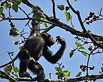
|
Lola Prefecture, ਫਰਮਾ:Country data Côte d'Ivoire* ਫਰਮਾ:Country data Guinea* 7°36′N 8°23′W / 7.600°N 8.383°W |
ਕੁਦਰਤੀ: (ix), (x) |
18,000 (44,000) | 1981 | 1992- | ਵਰਲਡ ਹੈਰੀਟੇਜ ਸਾਈਟ ਦੇ ਹਿੱਸੇ 'ਤੇ ਆਇਰਨ ਆਇਰ ਮਾਈਨਿੰਗ ਰਿਆਇਤ ਅਤੇ ਸਾਈਟ ਦੇ ਗੁਆਇਨੇਨ ਹਿੱਸੇ' ਤੇ ਵੱਡੀ ਗਿਣਤੀ 'ਚ ਸ਼ਰਨਾਰਥੀਆਂ ਦੀ ਆਵਾਜਾਈ | [57][58] |
| ਨੈਨ ਮਾਡੋਲ:ਪੂਰਬੀ ਮਾਈਕ੍ਰੋਨੇਸ਼ੀਆ ਦਾ ਸੇਰੀਮੋਨੀਅਲ ਸੈਂਟਰ | 
|
Temwen।sland, ਫਰਮਾ:Country data Micronesia 6°50′23″N 158°19′51″E / 6.83972°N 158.33083°E |
ਸੱਭਿਆਚਾਰਕ: (i), (iii), (iv), (vi) |
76.7 (190) | 2016 | 2016- | ਪਾਣੀ ਦਾ ਖਾਰਾ ਹੋਣਾ ਅਤੇ ਮੌਜੂਦਾ ਢਾਂਚਿਆਂ ਨੂੰ ਘਟਾਇਆ ਜਾ ਰਿਹਾ ਹੈ। | [59][60] |
| ਨਿਓਕੋਲੋ-ਕੋਬਾ ਨੈਸ਼ਨਲ ਪਾਰਕ | 
|
Tambacounda Region and Kédougou Region, ਫਰਮਾ:Country data Senegal 13°0′N 12°40′W / 13.000°N 12.667°W |
ਕੁਦਰਤੀ: (x) |
913,000 (2,260,000) | 1981 | 2007- | ਜਾਇਦਾਦ ਦੀ ਕਮੀ, ਘੱਟ ਸਮੱਰਥ ਆਬਾਦੀ, ਪ੍ਰਬੰਧਨ ਦੀਆਂ ਸਮੱਸਿਆਵਾਂ ਅਤੇ ਗਾਮਿਆ ਨਦੀ 'ਤੇ ਪ੍ਰਸਤਾਵਿਤ ਡੈਮ ਦੇ ਪ੍ਰਭਾਵ | [61][62] |
| ਓਕਾਪੀ ਵਾਈਲਡਲਾਈਫ ਰਿਜ਼ਰਵ | 
|
Orientale, ਫਰਮਾ:Country data Democratic Republic of the Congo 2°0′N 28°30′E / 2.000°N 28.500°E |
ਕੁਦਰਤੀ: (x) |
1,372,625 (3,391,830) | 1996 | 1997- | ਖੇਤਰ ਵਿੱਚ ਹਥਿਆਰਬੰਦ ਸੰਘਰਸ਼ ਦੇ ਨਤੀਜੇ ਵਜੋਂ ਪਾਰਕਾਂ ਦੀ ਸਹੂਲਤ ਅਤੇ ਹਾਥੀ ਦੀ ਹੱਤਿਆ ਦੇ ਲੁੱਟ | [63][64] |
| ਯਰੂਸ਼ਲਮ ਦਾ ਪੁਰਾਣਾ ਸ਼ਹਿਰ ਅਤੇ ਇਸ ਦੀਆਂ ਕੰਧਾਂ | 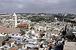
|
Jerusalem District (no nation named by UNESCO)[nb 2] 31°46′36″N 35°14′03″E / 31.77667°N 35.23417°E |
ਸੱਭਿਆਚਾਰਕ: (ii), (iii), (vi) |
— | 1981 | 1982- | ਬੇਰੋਕ ਸ਼ਹਿਰੀ ਵਿਕਾਸ, ਸੈਰ-ਸਪਾਟਾ ਅਤੇ ਰੱਖ-ਰਖਾਅ ਦੀ ਘਾਟ ਕਾਰਨ | [65][66][67] |
| ਸਾਨਾ ਦਾ ਪੁਰਾਣਾ ਸ਼ਹਿਰ | Sana'a Governorate, ਫਰਮਾ:Country data Yemen 15°21′20″N 44°12′29″E / 15.35556°N 44.20806°E |
ਸੱਭਿਆਚਾਰਕ: (iv), (v), (vi) |
— | 1986 | 2015- | ਯਮਨੀ ਦੇ ਘਰੇਲੂ ਯੁੱਧ, ਸਾਊਦੀ ਅਰਬ ਦੀ ਅਗਵਾਈ ਵਾਲੀ ਗਠਜੋੜ ਦੇ ਹਵਾਈ ਹਮਲੇ[68] | [69] | |
| ਘਦਮੇਜ਼ ਦਾ ਪੁਰਾਣਾ ਸ਼ਹਿਰ | 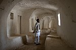
|
Ghadames, ਫਰਮਾ:Country data Libya 30°08′00″N 9°30′00″E / 30.13333°N 9.50000°E |
ਸੱਭਿਆਚਾਰਕ: (v) |
— | 1986 | 2016- | ਲਿਬੀਆ ਦੇ ਘਰੇਲੂ ਯੁੱਧ, ਹਥਿਆਰਬੰਦ ਸਮੂਹਾਂ ਦੀ ਮੌਜੂਦਗੀ, ਪਹਿਲਾਂ ਹੀ ਕੀਤੇ ਗਏ ਅਤੇ ਸੰਭਾਵੀ ਹੋਰ ਨੁਕਸਾਨ। | [12][70] |
| ਡੀਜੇਨੇ ਦਾ ਪੁਰਾਣਾ ਸ਼ਹਿਰ | 
|
Djenné, ਫਰਮਾ:Country data Mali 13°54′23″N 4°33′18″W / 13.90639°N 4.55500°W |
ਸੱਭਿਆਚਾਰਕ: (iii), (iv) |
— | 1988 | 2016- | ਖੇਤਰੀ ਅਸੁਰੱਖਿਆ, ਇਤਿਹਾਸਕ ਸ਼ਹਿਰ ਦੀ ਵਿਗੜਦੀ ਰਾਜ, ਸ਼ਹਿਰੀਕਰਨ ਅਤੇ ਕਟੌਤੀ। | [71][72] |
| ਪੁਰਾਣੀ ਕੰਧ ਸਿਟੀ ਆਫ ਸ਼ਿਬਾਮ | Hadhramaut Governorate, ਫਰਮਾ:Country data Yemen 15°55′36.984″N 48°37′36.012″E / 15.92694000°N 48.62667000°E |
ਸੱਭਿਆਚਾਰਕ: (iii), (iv), (v) |
— | 1982 | 2015- | ਹਥਿਆਰਬੰਦ ਸੰਘਰਸ਼ ਤੋਂ ਸੰਭਾਵਿਤ ਖਤਰੇ, ਸੁਰੱਖਿਆ ਅਤੇ ਪ੍ਰਬੰਧਨ ਦੀਆਂ ਸਮੱਸਿਆਵਾਂ ਨੂੰ ਸੁਲਝਾਉਣ ਲਈ, ਜੋ ਸਾਈਟ 'ਤੇ ਪਹਿਲਾਂ ਹੀ ਮੌਜੂਦ ਹਨ। | [69] | |
| ਐਟੀਸੀਨੇਨਾਆ ਦੇ ਵਰਖਾ ਜੰਗਲ | Eastern Madagascar, ਫਰਮਾ:Country data Madagascar 14°28′S 49°42′E / 14.467°S 49.700°E |
ਕੁਦਰਤੀ: (ix), (x) |
479,660 (1,185,300) | 2007 | 2010- | ਲਮੂਰਾਂ ਦਾ ਗੈਰ-ਕਾਨੂੰਨੀ ਸ਼ਿਕਾਰ | [73][74] | |
| ਰਿਓ ਪਲੈਟੋਨੋ ਬਾਇਓਸਫ਼ੀਅਰ ਰਿਜ਼ਰਵ | 
|
La Mosquitia, ਫਰਮਾ:Country data Honduras 15°44′40″N 84°40′30″W / 15.74444°N 84.67500°W |
ਕੁਦਰਤੀ: (vii), (viii), (ix), (x) |
— | 1982 | 1996–2007, 2011- | ਲੌਗਿੰਗ, ਫਿਸ਼ਿੰਗ ਅਤੇ ਜ਼ਮੀਨੀ ਕਬਜ਼ੇ; ਸਾਈਟ ਦਾ ਪ੍ਰਬੰਧ ਕਰਨ ਲਈ ਰਾਜ ਦੀ ਘਟੀਆ ਸਮਰੱਥਾ; ਮੁੱਖ ਤੌਰ 'ਤੇ ਕਾਨੂੰਨ ਦੀ ਸਮੱਰਥਾ ਅਤੇ ਨਸ਼ੀਲੇ ਪਦਾਰਥਾਂ ਦੇ ਤਸਕਰਾਂ ਦੀ ਮੌਜੂਦਗੀ ਕਾਰਨ | [75][76] |
| ਰਾਡ-ਆਰਟ ਸਾਈਟਾਂ ਆਫ ਟੈਡਾਰਟ ਏਕਾਕੁਸ | 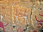
|
Fezzan, ਫਰਮਾ:Country data Libya 24°50′00″N 10°20′00″E / 24.83333°N 10.33333°E |
ਸੱਭਿਆਚਾਰਕ: (iii) |
— | 1985 | 2016- | ਲਿਬੀਆ ਦੀ ਘਰੇਲੂ ਜੰਗ, ਹਥਿਆਰਬੰਦ ਸਮੂਹਾਂ ਦੀ ਮੌਜੂਦਗੀ, ਪਹਿਲਾਂ ਹੀ ਕੀਤੇ ਗਏ ਅਤੇ ਸੰਭਾਵੀ ਹੋਰ ਨੁਕਸਾਨ | [12][77] |
| ਕਿੱਲਵਾ ਕਿਸਵਾਈਨੀ ਦੇ ਖੰਡਰ ਅਤੇ ਰੋਂਨਸ ਆਫ਼ ਸੋਂਗੋ ਮੈਨਰਾ | Kilwa District, ਫਰਮਾ:Country data Tanzania 8°57′28″S 39°31′22″E / 8.95778°S 39.52278°E |
ਸੱਭਿਆਚਾਰਕ: (iii) |
— | 1981 | 2004- | ਵੱਖ-ਵੱਖ ਏਜੰਟ ਜਿਵੇਂ ਕਿ ਐਰੋਜ਼ਨ ਜਾਂ ਪੌਦਿਆਂ ਦੀ ਵਜ੍ਹਾ ਕਰਕੇ ਸਾਈਟ ਦੀ ਗਿਰਾਵਟ ਜਾਰੀ ਰੱਖਣਾ | [78][79] | |
| ਸਲੋਂਗਾ ਨੈਸ਼ਨਲ ਪਾਰਕ | 
|
Équateur and Bandundu Province, ਫਰਮਾ:Country data Democratic Republic of the Congo 2°0′S 21°0′E / 2.000°S 21.000°E |
ਕੁਦਰਤੀ: (vii), (ix) |
3,600,000 (8,900,000) | 1984 | 1999- | ਸਿਵਲ ਆਰਡਰ ਦੀ ਵੰਡ | [80][81] |
| ਸਮਰਾ ਪੁਰਾਤੱਤਵ ਸਿਟੀ | 
|
Salah ad Din, 34°12′N 43°52′E / 34.200°N 43.867°E |
ਸੱਭਿਆਚਾਰਕ: (ii), (iii), (iv) |
15,058 (37,210) | 2007 | 2007- | ਇਰਾਕ ਯੁੱਧ ਅਤੇ ਸਾਈਟ ਦੀ ਸੁਰੱਖਿਆ ਜਾਂ ਪ੍ਰਬੰਧਨ ਲਈ ਰਾਜ ਦੇ ਕੰਟਰੋਲ ਦੀ ਘਾਟ ਤੋਂ ਬਾਅਦ ਸੁਰੱਖਿਆ ਸਥਿਤੀ | [82][83] |
| ਸਿਮੀਅਨ ਨੈਸ਼ਨਲ ਪਾਰਕ | 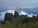
|
Amhara Region, ਫਰਮਾ:Country data Ethiopia 13°11′N 38°4′E / 13.183°N 38.067°E |
ਕੁਦਰਤੀ: (vii), (x) |
22,000 (54,000) | 1978 | 1996- | ਵਲੀਆ ਬੀਬੇਕਸ ਦੀ ਆਬਾਦੀ ਦਾ ਵਿਸਥਾਰ | [84][85] |
| ਪਾਲਮੀਰਾ ਦੀ ਸਾਇਟ | 
|
Homs Governorate, 34°33′15″N 38°16′0″E / 34.55417°N 38.26667°E |
ਸੱਭਿਆਚਾਰਕ: (i)(ii)(iv) |
0.36 (0.89) | 1980 | 2013- | ਸੀਰੀਆਈ ਘਰੇਲੂ ਯੁੱਧ, ਜੋ ਕਿ ਬਦਨਾਮ ਆਇਕਨ-ਇਲੈਕਟਲ ਸਟੇਟ ਅੱਤਵਾਦੀ ਸੰਗਠਨ (ਆਈਐਸਆਈਐਸ) ਦੁਆਰਾ ਫੜਿਆ ਗਿਆ ਸੀ | [86] |
| ਟਿਮਬੁਕਤੂ | 
|
Timbuktu, Timbuktu Region, ਫਰਮਾ:Country data Mali 16°46′24″N 2°59′58″W / 16.77333°N 2.99944°W |
ਸੱਭਿਆਚਾਰਕ: (ii), (iv), (v) |
— | 1988 | 2012- | ਇਸਲਾਮੀ ਮਘਰੇਬ, ਅੰਸਾਰ ਡਾਈਨ ਅਤੇ ਬੋਕੋ ਹਰਮ ਵਿੱਚ ਅਲ-ਕਾਇਦਾ ਵਰਗੇ ਇਸਲਾਮਿਕ ਸਮੂਹਾਂ ਦੁਆਰਾ ਵਿਨਾਸ਼ ਦੀ ਧਮਕੀ ਕੁਝ ਸਮਾਰਕਾਂ ਨੂੰ ਹੁਣ ਲੁੱਟਿਆ ਅਤੇ ਤਬਾਹ ਕਰ ਦਿੱਤਾ ਗਿਆ ਹੈ। | [87][88] |
| ਅਸੀਆ ਦੀ ਕਬਰ | 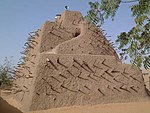
|
Gao, Gao Region, ਫਰਮਾ:Country data Mali 16°17′21.60″N 0°2′41.68″E / 16.2893333°N 0.0449111°E |
ਸੱਭਿਆਚਾਰਕ: (ii), (iii), (iv) |
4.24 (10.5) | 2004 | 2012- | ਇਸਲਾਮੀ ਮਘਰੇਬ ਅਤੇ ਅੰਸਾਰ ਡਾਈਨ ਵਿੱਚ ਅਲ-ਕਾਇਦਾ ਵਰਗੇ ਇਸਲਾਮਿਕ ਜਥੇਬੰਦੀਆਂ ਵਲੋਂ ਨੁਕਸਾਨ ਹੋਇਆ।ਅੰਸਾਰ ਡਾਈਨ ਦੁਆਰਾ ਨਸ਼ਟ ਕੀਤਾ ਗਿਆ ਰਿਪੋਰਟ ਜਦੋਂ ਉਹਨਾਂ ਨੇ ਟਿੰਬੂਕਟੂ ਨੂੰ ਫੜ ਲਿਆ | [88][89] |
| ਕਸਬੁਬੀ ਵਿਖੇ ਬੁਗੰਦਾ ਰਾਜਿਆਂ ਦੀ ਕਬਰ | 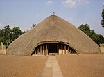
|
Kampala District, 0°19′45″N 32°33′12″E / 0.32917°N 32.55333°E |
ਸੱਭਿਆਚਾਰਕ: (i), (iii), (iv), (vi) |
27 (67) | 2001 | 2010- | ਮਾਰਚ 2010 ਵਿੱਚ ਅੱਗ ਦੀ ਭੇਟ ਚੜੀ ਮੁਜੀਬੁ ਅਜ਼ਾਲਾ ਮਾਪਾਂਗਾ ਦੀ ਸਾਈਟ ਦੀ ਮੁੱਖ ਇਮਾਰਤ | [90][91] |
| ਸੁਮਾਤਰਾ ਦੀ ਟ੍ਰਾਂਪੀਕਲ ਰੇਨਫੋਰਸਟ ਵਿਰਾਸਤ | Sumatra, 02°30′S 101°30′E / 2.500°S 101.500°E |
ਕੁਦਰਤੀ: (vii), (ix), (x) |
2,595,124 (6,412,690) | 2004 | 2011- | ਗੈਰ ਕਾਨੂੰਨੀ ਪੋਚਿੰਗ, ਖੇਤੀਬਾੜੀ ਦੇ ਕਬਜ਼ੇ ਅਤੇ ਸਾਈਟ ਰਾਹੀਂ ਸੜਕ ਬਣਾਉਣ ਦੀ ਯੋਜਨਾ | [92][93] | |
| ਵੀਰੰਗਾ ਨੈਸ਼ਨਲ ਪਾਰਕ | 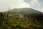
|
North Kivu and Orientale, ਫਰਮਾ:Country data Democratic Republic of the Congo 0°55′N 29°10′E / 0.917°N 29.167°E |
ਕੁਦਰਤੀ: (vii), (viii), (x) |
800,000 (2,000,000) | 1979 | 1994- | ਰਵਾਂਡਾ ਦੇ ਘਰੇਲੂ ਯੁੱਧ ਕਾਰਨ ਸ਼ਰਨਾਰਥੀਆਂ ਦੇ ਨਤੀਜੇ ਵਜੋਂ ਜੰਗਲਾਂ ਦੀ ਕਟਾਈ ਅਤੇ ਸ਼ਿਕਾਰ ਕਰਨਾ | [94][95] |
| ਫਲਸਤੀਨ:ਲੈਂਡ ਆਫ਼ ਓਲੀਵਜ਼ ਐਂਡ ਵਾਈਂਸ-ਸੱਭਿਆਚਾਰਕ ਲੈਂਡਸਕੇਪ ਆਫ ਸਾਉਥਰਨ, ਬੱਟੀਰ | 
|
Battir, 31°43′11″N 35°7′50″E / 31.71972°N 35.13056°E |
ਸੱਭਿਆਚਾਰਕ: (iv)(v) |
349 (860) | 2014 | 2014- | ਇਜ਼ਰਾਈਲ ਦੇ ਵੈਸਟ ਬੈਂਕ ਦੀ ਰੁਕਾਵਟ "ਉਹ ਸਦੀਆਂ ਤੋਂ ਖੇਤੀ ਕਰ ਰਹੇ ਕਿਸਾਨਾਂ ਨੂੰ ਆਪਣੀ ਜਮੀਨ ਤੋਂ ਅਲੱਗ ਕਰ ਸਕਦੀ ਹੈ". | [96][97] |
ਹਵਾਲੇ
[ਸੋਧੋ]- ↑ "ਖ਼ਤਰੇ ਵਿੱਚ ਵਿਸ਼ਵ ਵਿਰਾਸਤ ਦੀ ਸੂਚੀ". ਯੂਨੈਸਕੋ. Retrieved 10 ਦਿਸੰਬਰ 2010.
{{cite web}}: Check date values in:|accessdate=(help) - ↑ "Abu Mena". UNESCO. Retrieved 28 May 2010.
- ↑ "Abu Mena–Threats to the Site (2001)". UNESCO. Retrieved 27 August 2010.
- ↑ 25th session 2001, p. 134
- ↑ "Air and Ténéré Natural Reserves". UNESCO. Retrieved 28 May 2010.
- ↑ 16th session 1992, p. 29
- ↑ "Ancient City of Aleppo". UNESCO. Retrieved 17 Aug 2011.
- ↑ "Ancient City of Bosra". UNESCO. Retrieved 17 Aug 2011.
- ↑ "Ancient City of Damascus". UNESCO. Retrieved 17 Aug 2011.
- ↑ "Ancient Villages of Northern Syria". UNESCO. Retrieved 17 Aug 2011.
- ↑ "Archaeological Site of Cyrene". UNESCO. Retrieved 17 July 2016.
- ↑ 12.0 12.1 12.2 12.3 12.4 "Libya's five World Heritage sites put on List of World Heritage in Danger". UNESCO. 13 July 2016. Retrieved 17 July 2016.
- ↑ "Archaeological Site of Leptis Magna". UNESCO. Retrieved 17 July 2016.
- ↑ "Archaeological Site of Sabratha". UNESCO. Retrieved 17 July 2016.
- ↑ "Ashur (Qal'at Sherqat)". UNESCO. Retrieved 28 May 2010.
- ↑ 27th session 2003, pp. 123–124
- ↑ "Bagrati Cathedral and Gelati Monastery". UNESCO. Retrieved 3 December 2010.
- ↑ 34th session 2010, pp. 130–133
- ↑ "Belize Barrier Reef Reserve System". UNESCO. Retrieved 28 May 2010.
- ↑ 33rd session 2009, pp. 81–82
- ↑ "Chan Chan Archaeological Zone". UNESCO. Retrieved 28 May 2010.
- ↑ "World Heritage Committee: Tenth session" (PDF). UNESCO. p. 6. Retrieved 26 June 2011.
- ↑ "Birthplace of Jesus: Church of the Nativity and the Pilgrimage Route, Bethlehem". UNESCO. Retrieved 30 June 2012.
- ↑ "Church of the Nativity and the Pilgrimage Route in Bethlehem, Palestine, inscribed on UNESCO World Heritage List along with sites from।srael, Palau,।ndonesia and Morocco". UNESCO. Retrieved 30 June 2012.
- ↑ "Comoé National Park". UNESCO. Retrieved 28 May 2010.
- ↑ 27th session 2003, p. 30
- ↑ "Coro and its Port". UNESCO. Retrieved 28 May 2010.
- ↑ 29th session 2005, pp. 102–103
- ↑ "Crac des Chevaliers and Qal'at Salah El-Din". UNESCO. Retrieved 17 Aug 2011.
- ↑ "Cultural Landscape and Archaeological Remains of the Bamiyan Valley". UNESCO. Retrieved 28 May 2010.
- ↑ 27th session 2003, pp. 122–123
- ↑ World Heritage Committee. "World Heritage Committee inscribes East Rennell on the List of World Heritage in Danger". United Nations Educational, Scientific and Cultural Organization. Retrieved 2013-08-13.
- ↑ "Everglades National Park". UNESCO. Retrieved 28 May 2010.
- ↑ "World Heritage Committee: Seventeenth session" (PDF). UNESCO. pp. 20–21. Retrieved 26 June 2011.
- ↑ 34th session 2010, pp. 82–83
- ↑ "Fortifications on the Caribbean Side of Panama: Portobelo-San Lorenzo". UNESCO. Retrieved 27 October 2012.
- ↑ "Panamanian fortifications inscribed on List of World Heritage in Danger". UNESCO. Retrieved 27 October 2012.
- ↑ "Garamba National Park". UNESCO. Retrieved 28 May 2010.
- ↑ 20th session 1996, p. 32
- ↑ World Heritage Committee. "The।raqi site of Hatra added to the List of World Heritage in Danger". United Nations Educational, Scientific and Cultural Organization. Retrieved 2015-07-14.
- ↑ "Historic Centre of Shakhrisyabz". UNESCO. Retrieved 17 July 2016.
- ↑ "Historic Centre of Shakhrisyabz, Uzbekistan, added to List of World Heritage in Danger". UNESCO. 13 July 2016. Retrieved 17 July 2016.
- ↑ "Historic Town of Zabid". UNESCO. Retrieved 3 December 2010.
- ↑ 24th session 2000, pp. 26–27
- ↑ "Humberstone and Santa Laura Saltpeter Works". UNESCO. Retrieved 28 May 2010.
- ↑ 29th session 2005, pp. 142–143
- ↑ "Kahuzi-Biega National Park". UNESCO. Retrieved 28 May 2010.
- ↑ 21st session 1997, pp. 19–20
- ↑ "Liverpool – Maritime Mercantile City". UNESCO. Retrieved 27 October 2012.
- ↑ "World Heritage Committee places Liverpool on List of World Heritage in Danger". UNESCO. Retrieved 27 October 2012.
- ↑ "Manovo-Gounda St Floris National Park". UNESCO. Retrieved 28 May 2010.
- ↑ 21st session 1997, pp. 18–19
- ↑ "Minaret and Archaeological Remains of Jam". UNESCO. Retrieved 28 May 2010.
- ↑ "World Heritage Committee: Twenty-sixth session" (PDF). UNESCO. p. 55. Retrieved 26 June 2011.
- ↑ "Medieval Monuments in Kosovo". UNESCO. Retrieved 3 December 2010.
- ↑ 30th session 2006, pp. 157–158
- ↑ "Mount Nimba Strict Nature Reserve". UNESCO. Retrieved 28 May 2010.
- ↑ 16th session 1992, pp. 26–28
- ↑ "Nan Madol: Ceremonial Centre of Eastern Micronesia". UNESCO. Retrieved 18 July 2016.
- ↑ "Four sites inscribed on UNESCO's World Heritage List". UNESCO. 15 July 2016. Retrieved 18 July 2016.
- ↑ "Niokolo-Koba National Park". UNESCO. Retrieved 28 May 2010.
- ↑ 31st session 2007, pp. 41–43
- ↑ "Okapi Wildlife Reserve". UNESCO. Retrieved 28 May 2010.
- ↑ 21st session 1997, p. 19
- ↑ "Old City of Jerusalem and its Walls". UNESCO. Retrieved 28 May 2010.
- ↑ "World Heritage Committee: Sixth session" (PDF). UNESCO. pp. 10–12. Retrieved 26 June 2011.
- ↑ "UNESCO replies to allegations". UNESCO. 15 July 2011. Retrieved 20 October 2011.
- ↑ "Bombs Level 'Magnificent' Homes in 2,500-Year-Old City". NBC News. Retrieved 2016-10-12.
- ↑ 69.0 69.1 World Heritage Committee. "Yemen's Old City of Sana'a and Old Walled City of Shibam added to List of World Heritage in Danger". United Nations Educational, Scientific and Cultural Organization. Retrieved 2015-07-15.
- ↑ "Old Town of Ghadamès". UNESCO. Retrieved 17 July 2016.
- ↑ "Old Towns of Djenné". UNESCO. Retrieved 17 July 2016.
- ↑ "Mali's Old Towns of Djenné on List of World Heritage in Danger". UNESCO. 13 July 2016. Retrieved 17 July 2016.
- ↑ "Rainforests of the Atsinanana". UNESCO. Retrieved 28 May 2010.
- ↑ 34th session 2010, pp. 57–58
- ↑ "Río Plátano Biosphere Reserve". UNESCO. Retrieved 25 June 2011.
- ↑ 20th session 1996, p. 29
- ↑ "Rock-Art Sites of Tadrart Acacus". UNESCO. Retrieved 17 July 2016.
- ↑ "Ruins of Kilwa Kisiwani and Ruins of Songo Mnara". UNESCO. Retrieved 28 May 2010.
- ↑ 28th session 2004, pp. 96–97
- ↑ "Salonga National Park". UNESCO. Retrieved 28 May 2010.
- ↑ 8th session 1984, p. 14
- ↑ "Samarra Archaeological City". UNESCO. Retrieved 28 May 2010.
- ↑ 31st session 2007, pp. 152–153
- ↑ "Simien National Park". UNESCO. Retrieved 1 August 2010.
- ↑ 20th session 1996, pp. 28–29
- ↑ "Site of Palmyra". UNESCO. Retrieved 17 Aug 2011.
- ↑ "Timbuktu". UNESCO. Retrieved 27 October 2012.
- ↑ 88.0 88.1 "Heritage sites in northern Mali placed on List of World Heritage in Danger". UNESCO. Retrieved 27 October 2012.
- ↑ "Tomb of Askia". UNESCO. Retrieved 27 October 2012.
- ↑ "Tombs of Buganda Kings at Kasubi". UNESCO. Retrieved 28 May 2010.
- ↑ 34th session 2010, pp. 103–105
- ↑ "Tropical Rainforest Heritage of Sumatra". UNESCO. Retrieved 25 June 2011.
- ↑ "Danger listing for।ndonesia's Tropical Rainforest Heritage of Sumatra". UNESCO. Retrieved 26 July 2011.
- ↑ "Virunga National Park". UNESCO. Retrieved 28 May 2010.
- ↑ "World Heritage Committee: Eighteenth session" (PDF). UNESCO. pp. 21, 51. Retrieved 26 June 2011.
- ↑ "Palestine: Land of Olives and Vines – Cultural Landscape of Southern Jerusalem, Battir". UNESCO. Retrieved 25 February 2015.
- ↑ "Palestine: Land of Olives and Vines - Cultural Landscape of Southern Jerusalem, Battir, inscribed on World Heritage List and on List of World Heritage in Danger". UNESCO. Retrieved 25 February 2015.
ਹਵਾਲੇ ਵਿੱਚ ਗ਼ਲਤੀ:<ref> tags exist for a group named "nb", but no corresponding <references group="nb"/> tag was found
ਹਵਾਲੇ ਵਿੱਚ ਗ਼ਲਤੀ:<ref> tags exist for a group named "lower-alpha", but no corresponding <references group="lower-alpha"/> tag was found


