ਨਿਊਜ਼ੀਲੈਂਡ
ਨਿਊਜ਼ੀਲੈਂਡ ਆਉਟਿਆਰੋਆ (ਮਾਉਰੀ) | |||||
|---|---|---|---|---|---|
| |||||
ਐਨਥਮਾਂ:
| |||||
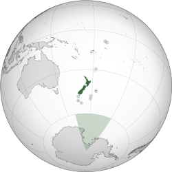
 ਦੁਨੀਆ ਦੇ ਨਕਸ਼ੇ ਉੱਤੇ ਨਿਊਜ਼ੀਲੈਂਡ ਦੇ ਸਲਤਨਤ ਵਿੱਚ ਨਿਊਜ਼ੀਲੈਂਡ | |||||
| ਰਾਜਧਾਨੀ | ਵੈਲਿੰਗਟਨ 41°17′S 174°27′E / 41.283°S 174.450°E | ||||
| ਸਭ ਤੋਂ ਵੱਡਾ ਸ਼ਹਿਰ | ਔਕਲੈਂਡ | ||||
| ਅਧਿਕਾਰਤ ਭਾਸ਼ਾਵਾਂ | |||||
| ਨਸਲੀ ਸਮੂਹ (2013) |
| ||||
| ਵਸਨੀਕੀ ਨਾਮ | ਨਿਊਜ਼ੀਲੈਂਡਰ ਕੀਵੀ (ਆਮ) | ||||
| ਸਰਕਾਰ | ਯੂਨਿਟੇਰੀ ਪਾਰਲੀਮੈਂਟਰੀ ਕੌਨਸਟੀਟੂਸ਼ਨਲ ਮੌਨਆਰਕੀ | ||||
• ਮੌਨਆਰਕ | ਇਲਿਜ਼ਾਬਿਥ II | ||||
• ਗਵਰਨਰ ਜਰਨੈਲ | ਡੈਮ ਪੈਟਸੀ ਰੇਡੀ | ||||
• ਪ੍ਰਾਈਮ ਮਿਨਿਸਟਰ | ਜਸਿੰਡਾ ਆਰਡਰਨ | ||||
| ਵਿਧਾਨਪਾਲਿਕਾ | ਪਾਰਲੀਮੈਂਟ (ਨੁਮਾਇੰਦਾ ਸਭਾ) | ||||
| ਯੂਨਾਈਟਡ ਕਿੰਗਡਮ ਤੋਂ ਅਜ਼ਾਦੀ ਦੇ ਪੜਾਅ | |||||
• ਜ਼ਿਮੇਵਾਰ ਸਰਕਾਰ | 7 ਮਈ 1856 | ||||
• ਡੋਮਿਨੀਅਨ ਐਲਾਨਿਆ | 26 ਸਤੰਬਰ 1907 | ||||
• ਵੈਸਟਮਿਨਸਟਰ ਦੇ ਸਟੈਟੂਟ ਨੂੰ ਇਖਤਿਆਰ ਕੀਤਾ | 25 ਨਵੰਬਰ 1947 | ||||
| ਖੇਤਰ | |||||
• ਕੁੱਲ | 268,021 km2 (103,483 sq mi) (75ਵਾਂ) | ||||
• ਜਲ (%) | 1.6[n 4] | ||||
| ਆਬਾਦੀ | |||||
• ਅਨੁਮਾਨ | ਫਰਮਾ:Poptoday[4] | ||||
• 2013 ਜਨਗਣਨਾ | 4,242,048 | ||||
| ਜੀਡੀਪੀ (ਪੀਪੀਪੀ) | 2018 ਅਨੁਮਾਨ | ||||
• ਕੁੱਲ | $198.52 ਬਿਲੀਅਨ[5] | ||||
• ਪ੍ਰਤੀ ਵਿਅਕਤੀ | $40,118[5] | ||||
| ਜੀਡੀਪੀ (ਨਾਮਾਤਰ) | 2018 ਅਨੁਮਾਨ | ||||
• ਕੁੱਲ | $220.89 ਬਿਲੀਅਨ[5] | ||||
• ਪ੍ਰਤੀ ਵਿਅਕਤੀ | $44,639[5] | ||||
| ਗਿਨੀ (2014) | 33.0[6] ਮੱਧਮ | ||||
| ਐੱਚਡੀਆਈ (2015) | ਬਹੁਤ ਉੱਚਾ · 13ਵਾਂ | ||||
| ਮੁਦਰਾ | ਨਿਊਜ਼ੀਲੈਂਡ ਡਾਲਰ ($) (NZD) | ||||
| ਸਮਾਂ ਖੇਤਰ | UTC+12 (NZST[n 5]) | ||||
• ਗਰਮੀਆਂ (DST) | UTC+13 (NZDT[n 6]) | ||||
| ਮਿਤੀ ਫਾਰਮੈਟ | ਦਦ/ਮਮ/ਸਸਸਸ | ||||
| ਡਰਾਈਵਿੰਗ ਸਾਈਡ | ਖੱਬਾ | ||||
| ਕਾਲਿੰਗ ਕੋਡ | +64 | ||||
| ਇੰਟਰਨੈੱਟ ਟੀਐਲਡੀ | .nz | ||||
ਨਿਊਜ਼ੀਲੈਂਡ (ਮਾਉਰੀ:ਆਉਟਿਆਰੋਆ) ਦੱਖਣ-ਲਹਿੰਦੇ ਪਸਿਫਕ ਸਮੁੰਦਰ ਵਿੱਚ ਇੱਕ ਸੌਵਰਨ ਆਈਲੈਂਡ ਮੁਲਕ ਹੈ। ਇਸ ਦੇਸ਼ ਦੇ ਜੀਉਗ੍ਰੈਫਕਲੀ ਦੋ ਜ਼ਮੀਨੀ ਹਿਸੇ ਨੇ-ਨੌਰਥ ਆਈਲੈਂਡ (ਟੇ ਇਕਾ-ਆ-ਮਾਉਈ), ਅਤੇ ਸਾਊਥ ਆਈਲੈਂਡ (ਟੇ ਵਾਇਪੌਨਾਮੂ)-ਅਤੇ 600 ਛੋਟੇ ਆਈਲੈਂਡ। ਨਿਊਜ਼ੀਲੈਂਡ ਆਸਟ੍ਰੇਲੀਆ ਦੇ ਚੜ੍ਹਦੇ ਵੱਲ ਤਕਰੀਬਨ 1500 ਕਿਲੋਮੀਟਰ (900 ਮੀਲ) ਟੈਜ਼ਮਨ ਸੀਅ ਦੇ ਪਾਰ ਮੌਜੂਦ ਹੈ ਅਤੇ ਨਿਊਕੈਲਾਡੋਨੀਆ ਦੇ ਪਸਿਫਕ ਆਈਲੈਂਡ ਖੇਤਰਾਂ, ਫੀਜੀ ਅਤੇ ਟੌਂਗਾ ਤੋਂ ਤਕਰੀਬਨ 1000 ਕਿਲੋਮੀਟਰ (600 ਮੀਲ) ਦੇ ਦੱਖਣ ਵੱਲ। ਇਸਦੇ ਫਾਸਲੇ ਕਾਰਨ, ਇਹ ਇਨਸਾਨਾਂ ਵੱਲੋਂ ਆਖਰ ਅਬਾਦ ਹੋਏ ਜ਼ਮੀਨਾਂ ਵਿੱਚੋਂ ਸੀ। ਆਈਸੋਲੇਸ਼ਨ ਦੇ ਲੰਬੇ ਵਕਵੇ ਦੌਰਾਨ, ਨਿਉਜ਼ੀਲੈਂਡ ਵਿੱਚ ਜਾਨਵਰਾਂ, ਫੰਗਲ ਅਤੇ ਬੂਟਿਆਂ ਦੀ ਨਿਆਰੀ ਬਾਇਉਡਵਰਸਟੀ ਤਿਆਰ ਹੋਈ। ਮੁਲਕ ਦੇ ਜ਼ਮੀਨੀ ਉਤਾ-ਚੜਾਹ ਅਤੇ ਪਹਾੜਾਂ ਦੇ ਤਿੱਖੇ ਸਿਖਰ, ਜਿਵੇਂ ਸਦਰਨ ਐਲਪਸ, ਦਾ ਵਜੂਦ ਟਿਕਟੌਨਕ ਪਲੇਟਾਂ ਦੇ ਜ਼ਮੀਨੀ ਉਚਾਅ ਅਤੇ ਜੁਆਲਾਮੁਖੀ ਸਫੋਟ ਕਾਰਨ ਹੈ। ਨਿਊਜ਼ੀਲੈਂਡ ਦੀ ਰਾਜਧਾਨੀ ਵੈਲਿੰਗਟਨ ਹੈ, ਜੱਦਕਿ ਔਕਲੈਂਡ ਸਭ ਤੋਂ ਜ਼ਿਆਦਾ ਅਬਾਦੀ ਵਾਲ਼ਾ ਸ਼ਹਿਰ।
ਨਾਮ
[ਸੋਧੋ]
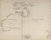
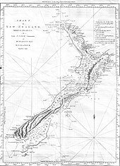
ਡੱਚ ਖੋਜਕਾਰ ਏਬਲ ਟੈਜ਼ਮਨ ਨੇ ਨਿਊਜ਼ੀਲੈਂਡ ਨੂੰ 1642 ਵਿੱਚ ਤੱਕਿਆ ਅਤੇ ਸਟੇਟ ਜਰਨੈਲ (ਡੱਚ ਪਾਰਲੀਮੈਂਟ) ਦੇ ਆਨ ਵਿੱਚ ਨਾਮ ਰੱਖਿਆ ਸਟੇਟਨ ਲੈਂਡ। ਉਹਨੇ ਲਿਖਿਆ, "ਹੋ ਸਕਦਾ ਕਿ ਇਹ ਜ਼ਮੀਨ ਸਟੇਟਨ ਲੈਂਡ ਦਾ ਹਿੱਸਾ ਹੋਵੇ ਭਰ ਇਸ ਬਾਰੇ ਪੱਤਾ ਨਹੀਂ",[9] 1616 ਵਿੱਚ ਜੇਕਬ ਲੇ ਮੈਰਿ ਵਲੋਂ ਖੋਜ ਕੀਤੇ ਗਏ, ਦੱਖਣੀ ਅਮਰੀਕਾ ਦੇ ਦੱਖਣ ਕੰਡੇ ਵਿੱਚ ਓਵੇਂ ਦੇ ਨਾਮ ਵਾਲੇ ਜ਼ਮੀਨੀਹੁਜਮ ਬਾਰੇ ਜ਼ਿਕਰ।[10] 1645 ਵਿੱਚ, ਡੱਚ ਕਾਰਟੋਗ੍ਰਾਫਰ ਨੇ ਡੱਚ ਸੂਬੇ ਜ਼ੀਲੈਂਡ ਉੱਤੇ ਜ਼ਮੀਨ ਦਾ ਨਾਮ "ਨੋਵਾ ਜ਼ੀਲੈਂਡੀਆ" ਤਬਦੀਲ ਕਰ ਦਿੱਤਾ।[11][12] ਬ੍ਰਿਟਿਸ਼ ਖੋਜਕਾਰ ਜੇਮਜ਼ ਕੁੱਕ ਨੇ ਬਾਅਦ ਵਿੱਚ ਇਸਨੂੰ ਨਿਊਜ਼ੀਲੈਂਡ ਨਾਂਅ ਦਿੱਤਾ।[13]
ਆਉਟਿਆਰੋਆ (ਅਕਸਰ "ਲੰਬੇ ਚਿੱਟੇ ਬੱਦਲ ਵਾਲ਼ੀ ਜ਼ਮੀਨ" ਵਜੋਂ ਤਰਜ਼ਮਾ ਕੀਤਾ ਜਾਂਦਾ ਹੈ)[14] ਨਿਊਜ਼ੀਲੈਂਡ ਲਈ ਮੌਜੂਦਾ ਮਾਉਰੀ ਨਾਮ ਹੈ। ਇਸਦਾ ਇਲਮ ਨਹੀਂ ਕਿ ਯੂਰੋਪੀਆਂ ਦੇ ਆਉਣ ਤੋਂ ਪਹਿਲਾਂ ਸਾਰੇ ਮੁਲਕ ਦਾ ਕੋਈ ਮਾਉਰੀ ਨਾਮ ਸੀ ਜਾਂ ਨਹੀਂ, ਆਉਟਿਆਰੋਆ ਅਸਲ ਵਿੱਚ ਸਿਰਫ ਨੌਰਥ ਆਈਲੈਂਡ ਦੇ ਜ਼ਿਕਰ ਲਈ ਸੀ।[15] ਮਾਉਰੀ ਵਿੱਚ ਦੋ ਮੁੱਖ ਆਈਲੈਂਡਾਂ ਦੇ ਕਈ ਰਿਵਾਇਤੀ ਨਾਮ ਸਨ ਜਿਨ੍ਹਾਂ ਵਿੱਚ ਟੇ ਇਕਾ-ਆ-ਮਾਉਈ (ਮਾਉਈ ਦੀ ਮੱਛੀ) ਅਤੇ ਨੌਰਥ ਆਈਲੈਂਡ ਲਈ ਟੇ ਵਾਇਪੌਨਾਮੂ (ਹਰੇਪੱਥਰ ਦੇ ਆਬ) ਜਾਂ ਟੇ ਵਾਕਾ ਓ ਆਓਰਾਕੀ (ਅਰੋਕੀ ਦਾ ਸ਼ਿਕਾਰਾ) ਸਾਊਥ ਆਈਲੈਂਡ ਲਈ।[16] ਪੁਰਾਤਨ ਯੂਰੋਪੀ ਨਕਸ਼ਿਆਂ ਵਿੱਚ ਉੱਤਰ (ਨੌਰਥ ਆਈਲੈਂਡ), ਵਿੱਚਕਾਰ (ਸਾਊਥ ਆਈਲੈਂਡ) ਅਤੇ ਦੱਖਣ (ਸਟੂਵਰਟ ਆਈਲੈਂਡ / ਰਾਕੀਊਰਾ) ਲੇਬਲ ਕੀਤਾ ਜਾਂਦਾ ਰਿਹਾ।[17] 1830 ਵਿੱਚ, ਸਭ ਤੋਂ ਵੱਡੇ ਆਈਲੈਂਡਾਂ ਦੇ ਪਛਾਣ ਲਈ ਨਕਸ਼ਿਆਂ ਉੱਤੇ ਨੌਰਥ (ਉੱਤਰ) ਅਤੇ ਸਾਊਥ (ਦੱਖਣ) ਵਰਤਿਆ ਜਾਣ ਲਗਾ ਅਤੇ 1907 ਤੱਕ ਇਹ ਅਵਾਮ ਵਿੱਚ ਆਮ ਹੋ ਗਏ। ਨਿਊਜ਼ੀਲੈਂਡ ਜੀਉਗ੍ਰੈਫਿਕ ਬੋਰਡ ਨੇ 2009 ਵਿੱਚ ਖੋਜਿਆ ਕਿ ਨੌਰਥ ਆਈਲੈਂਡ ਅਤੇ ਸਾਊਥ ਆਈਲੈਂਡ ਨਾਮ ਹਮੇਸ਼ਾ ਗੈਰ-ਸਰਕਾਰੀ ਸਨ, ਅਤੇ 2013 ਵਿੱਚ ਇਹ ਨਾਮ, ਅਤੇ ਹੋਰ ਨਾਮ ਸਾਰੇ ਸਰਕਾਰੀ ਬਣਾਏ ਗਏ। ਇਸਨੇ ਨੌਰਥ ਆਈਲੈਂਡ ਜਾਂ ਟੇ ਇਕਾ-ਆ-ਮਾਉਈ ਅਤੇ ਸਾਊਥ ਆਈਲੈਂਡ ਜਾਂ ਟੇ ਵਾਇਪੌਨਾਮੂ ਨੂੰ ਪੱਕਾ ਕੀਤਾ।[18] ਹਰੇਕ ਆਈਲੈਂਡ ਲਈ, ਉਸਦਾ ਇੰਗਲਿਸ਼ ਜਾਂ ਮਾਉਰੀ ਨਾਮ, ਜਾਂ ਦੋਹਾਂ ਨੂੰ ਇੱਕਠਾ ਵਰਤਿਆ ਜਾ ਸਕਦਾ।[18]
ਇਤਿਹਾਸ
[ਸੋਧੋ]
ਨਿਊਜ਼ੀਲੈਂਡ ਇਨਸਾਨਾਂ ਵੱਲੋਂ ਆਖਰ ਅਬਾਦ ਹੋਏ ਖ਼ਾਸ ਜ਼ਮੀਨੀਹਜੂਮਾਂ ਵਿੱਚੋਂ ਸੀ। ਰੇਡੀਓ ਕਾਰਬਨ ਡੇਟਿੰਗ, ਜੰਗਲ ਕਟਾਈ ਦਾ ਸਬੂਤ[19] ਅਤੇ ਮਾਉਰੀ ਅਬਾਦੀ ਵਿੱਚ ਮਾਟੋਕੌਨਡ੍ਰੀਅਲ ਡੀਐਨਏ ਦੀ ਬੇਤਬਦੀਲੀ[20] ਸਿਫ਼ਾਰਸ਼ ਹੈ ਕਿ ਨਿਊਜ਼ੀਲੈਂਡ ਪਹਿਲਾਂ ਚੜ੍ਹਦੇ ਪੌਲੀਨੀਸ਼ਨਾਂ ਵਲੋਂ 1250 ਅਤੇ 1300 ਵਿੱਚਕਾਰ ਅਬਾਦ ਕੀਤਾ ਗਿਆ,[16][21] ਇਹ ਸਿੱਟਾ ਸੀ ਦੱਖਣੀ ਪਸਿਫਕ ਆਈਲੈਂਡਾਂ ਵਿੱਚੋਂ ਕਈ ਸਮੁੰਦਰੀ ਸਫ਼ਰਾਂ ਦਾ।[22] ਕਈ ਸਦੀਆਂ ਦੇ ਮਗਰੋਂ, ਇਹ ਅਬਾਦਕਾਰਾਂ ਨੇ ਨਿਆਰਾ ਕਲਚਰ ਸਿਰਜਿਆ ਜੋ ਹੁਣ ਮਾਉਰੀ ਵਜੋਂ ਜਾਣਿਆ ਜਾਂਦਾ। ਅਬਾਦੀ ਈਵੀ (ਜ਼ਾਤਾਂ) ਅਤੇ ਹਪੂ (ਬਰਾਦਰੀਆਂ) ਵਿੱਚ ਵੰਡੇ ਗਏ ਜੋ ਕਦੇ ਮਿਲਵਰਤਨ, ਕਦੇ ਮੁਕਾਬਲੇ ਕਰਨ, ਕਦੇ ਆਪਸ ਵਿੱਚ ਭਿੜ ਜਾਣ।[23] ਕਿਸੇ ਵਕ਼ਤ ਮਾਉਰੀ ਗਰੁੱਪ ਰੀਕੋਹੂ, ਜੋ ਹੁਣ ਕੈਥਮ ਆਈਲੈਂਡਜ਼ ਵਜੋਂ ਜਾਣਿਆ ਜਾਂਦਾ ਹੈ ਨੂੰ ਮਾਈਗ੍ਰੇਟ ਕਰ ਗਏ, ਜਿਥੇ ਉਹਨਾ ਦਾ ਨਿਆਰਾ ਮਾਉਰੀ ਕਲਚਰ ਤਰੱਕੀਯਾਫਤ ਹੋਇਆ।[24][25] ਤਕਰੀਬਨ ਸਾਰੀ ਮੋਰੀਓਰੀ ਅਬਾਦੀ 1835 ਅਤੇ 1862 ਵਿੱਚਕਾਰ ਨੇਸਤੋਨਾਬੂਦ ਹੋ ਗਈ, ਇਸਦਾ ਮੁੱਖ ਕਾਰਨ 1930 ਦੇ ਦਹਾਕੇ ਵਿੱਚ ਟਾਰਾਨਾਕੀ ਮਾਉਰੀ ਹਮਲੇ ਅਤੇ ਗ਼ੁਲਾਮੀ, ਭਾਵੇਂ ਯੂਰੋਪੀ ਬਮਾਰੀਆਂ ਵੀ ਹਿੱਸੇਦਾਰ ਸਨ। 1862 ਵਿੱਚ ਸਿਰਫ਼ 101 ਰਹਿ ਗਏ, ਅਤੇ ਖਾਲਸ ਮੋਰੀਓਰੀ ਖ਼ੂਨ ਵਾਲੇ਼ ਆਖਰੀ ਜ਼ਾਹਿਰ ਇਨਸਾਨ ਦਾ ਦਿਹਾਂਤ ਹੋ ਗਿਆ।[26]
ਫੁਟਨੋਟ
[ਸੋਧੋ]- ↑ "God Save the Queen" (ਰੱਬਾ ਰਾਣੀ ਨੂੰ ਬਚਾਅ) ਐਲਾਨੀਆ ਕੌਮੀ ਐਨਥਮ ਹੈ ਭਰ ਸਿਰਫ਼ ਸ਼ਾਹੀ ਮੌਕਿਆਂ ਵੇਲੇ ਵਰਤਿਆ ਜਾਂਦਾ।[1]
- ↑ ਇੰਗਲਿਸ਼ ਦਾ ਫੈਲਾ ਹੋਣ ਕਾਰਨ "ਡੀ ਫੈਕਟੋ" ਐਲਾਨੀਆ ਭਾਸ਼ਾ ਹੈ।[2]
- ↑ ਅਵਾਮ ਨੂੰ ਇੱਕ ਨਾਲੋ ਵੱਧ ਜ਼ਾਤ ਦਾ ਹਿੱਸਾ ਹੋਣ ਦੀ ਖੁਲ੍ਹ ਕਾਰਨ ਜ਼ਾਤਾਂ ਦੇ ਅੰਕੜੇ ਦਾ ਜੋੜ 100% ਨਾਲੋਂ ਜ਼ਿਆਦਾ ਬਣ ਜਾਂਦਾ।
- ↑ ਨਿਊਜ਼ੀਲੈਂਡ ਦੇ ਖੇਤਰਫਲ ਉੱਤੇ (ਇਸਟੋਆਰਾਈਨ ਬਿਨਾ) ਦਰਿਆਵਾਂ, ਝੀਲਾਂ, ਤਲਾਬਾਂ ਦਾ ਹਿੱਸਾ ਨਿਊਜ਼ੀਲੈਂਡ ਜ਼ਮੀਨ ਕਵਰ ਡਾਟਾਬੇਸ ਮੁਤਾਬਕ,[3] ਹੈ (357526 + 81936) / (26821559 – 92499–26033 – 19216) = 1.6%। ਜੇ ਇਸਟੋਆਰਾਈਨ ਖੁੱਲ੍ਹਾ ਆਬ, ਮੈਨਗਰੂਵ ਅਤੇ ਹਰਬਾਕਸ ਸਲਾਈਨ ਹਰਿਆਲੀ ਸ਼ਾਮਿਲ ਕੀਤੇ ਜਾਣ, ਅੰਕੜਾ ਹੈ 2.2%।
- ↑ ਕੈਥਮ ਆਈਲੈਂਡਾਂ ਦਾ ਵੱਖਰਾ ਟਾਈਮ ਜ਼ੋਨ ਹੈ, ਬਾਕੀ ਨਿਊਜ਼ੀਲੈਂਡ ਤੋਂ 45 ਮਿੰਟ ਅੱਗੇ।
- ↑ ਸਤੰਬਰ ਦੇ ਆਖਰੀ ਐਤਵਾਰ ਤੋਂ ਅਪ੍ਰੈਲ ਦੇ ਪਹਿਲੇ ਐਤਵਾਰ ਤੱਕ ਘੜੀਆਂ ਇੱਕ ਘੰਟਾ ਅੱਗੇ ਕੀਤੀਆਂ ਜਾਂਦੀਆਂ।[8] ਡੇਲਾਈਟ ਸੇਵਿੰਗ ਟਾਈਮ ਕੈਥਮ ਆਈਲੈਂਡਾਂ ਵਿੱਚ ਵੀ ਲਾਗੂ ਹੁੰਦਾ, 45 ਮਿੰਟ ਅੱਗੇ।
ਹਵਾਲੇ
[ਸੋਧੋ]- ↑ "Protocol for using New Zealand's National Anthems". Ministry for Culture and Heritage. Archived from the original on 11 ਮਈ 2011. Retrieved 17 February 2008.
- ↑ New Zealand Government (21 December 2007). International Covenant on Civil and Political Rights Fifth Periodic Report of the Government of New Zealand (Report). p. 89. Archived from the original on 24 January 2015. https://web.archive.org/web/20150124193521/http://mfat.govt.nz/downloads/humanrights/5th-ICCPR-report.pdf. Retrieved 18 November 2015. "In addition to the Māori language, New Zealand Sign Language is also an official language of New Zealand. The New Zealand Sign Language Act 2006 permits the use of NZSL in legal proceedings, facilitates competency standards for its interpretation and guides government departments in its promotion and use. English, the medium for teaching and learning in most schools, is a de facto official language by virtue of its widespread use. For these reasons, these three languages have special mention in the New Zealand Curriculum."
- ↑ "The New Zealand Land Cover Database". New Zealand Land Cover Database 2. Ministry for the Environment. 1 July 2009. Archived from the original on 14 ਮਾਰਚ 2011. Retrieved 26 April 2011.
{{cite web}}: Unknown parameter|dead-url=ignored (|url-status=suggested) (help) - ↑ "Population clock". Statistics New Zealand. Archived from the original on 12 ਜੁਲਾਈ 2017. Retrieved 14 April 2016. The population estimate shown is automatically calculated daily at 00:00 UTC and is based on data obtained from the population clock on the date shown in the citation.
- ↑ 5.0 5.1 5.2 5.3 "New Zealand". International Monetary Fund. Retrieved 19 May 2018.
- ↑ "Income inequality". Statistics New Zealand. Retrieved 14 June 2015.
- ↑ Lua error in ਮੌਡਿਊਲ:Citation/CS1 at line 3162: attempt to call field 'year_check' (a nil value).
- ↑ "New Zealand Daylight Time Order 2007 (SR 2007/185)" (in New Zealand English). New Zealand Parliamentary Counsel Office. 6 July 2007. Retrieved 6 March 2017.
- ↑ Tasman, Abel. "JOURNAL or DESCRIPTION By me Abel Jansz Tasman, Of a Voyage from Batavia for making Discoveries of the Unknown South Land in the year 1642". Project Gutenberg Australia. Retrieved 26 March 2018.
{{cite web}}: Cite has empty unknown parameter:|month=(help) - ↑ Wilson, John (March 2009). "European discovery of New Zealand – Tasman's achievement". Te Ara: The Encyclopedia of New Zealand. Retrieved 24 January 2011.
- ↑ Wilson, John (September 2007). "Tasman's achievement". Te Ara: The Encyclopedia of New Zealand. Retrieved 16 February 2008.
- ↑ Lua error in ਮੌਡਿਊਲ:Citation/CS1 at line 3162: attempt to call field 'year_check' (a nil value).
- ↑ McKinnon, Malcolm (November 2009). "Place names – Naming the country and the main islands". Te Ara: The Encyclopedia of New Zealand. Retrieved 24 January 2011.
- ↑ King 2003, p. 41.
- ↑ Hay, Maclagan & Gordon 2008, p. 72.
- ↑ 16.0 16.1 Mein Smith 2005, p. 6.
- ↑ Lua error in ਮੌਡਿਊਲ:Citation/CS1 at line 3162: attempt to call field 'year_check' (a nil value).
- ↑ 18.0 18.1 Williamson, Maurice (10 October 2013). Names of NZ’s two main islands formalised (Press release). New Zealand Government. http://www.beehive.govt.nz/release/names-nz%E2%80%99s-two-main-islands-formalised. Retrieved 1 May 2017.
- ↑ Lua error in ਮੌਡਿਊਲ:Citation/CS1 at line 3162: attempt to call field 'year_check' (a nil value).
- ↑ Lua error in ਮੌਡਿਊਲ:Citation/CS1 at line 3162: attempt to call field 'year_check' (a nil value).
- ↑ Lua error in ਮੌਡਿਊਲ:Citation/CS1 at line 3162: attempt to call field 'year_check' (a nil value).
- ↑ Lua error in ਮੌਡਿਊਲ:Citation/CS1 at line 3162: attempt to call field 'year_check' (a nil value).
- ↑ Ballara, Angela (1998). Iwi: The Dynamics of Māori Tribal Organisation from C.1769 to C.1945 (1st ed.). Wellington: Victoria University Press. ISBN 9780864733283.
- ↑ Lua error in ਮੌਡਿਊਲ:Citation/CS1 at line 3162: attempt to call field 'year_check' (a nil value).
- ↑ Davis, Denise (September 2007). "The impact of new arrivals". Te Ara: The Encyclopedia of New Zealand. Retrieved 30 April 2010.
- ↑ Davis, Denise; Solomon, Māui (March 2009). "'Moriori – The impact of new arrivals'". Te Ara: The Encyclopedia of New Zealand. Retrieved 23 March 2011.
- Lua error in ਮੌਡਿਊਲ:Citation/CS1 at line 3162: attempt to call field 'year_check' (a nil value).
- Lua error in ਮੌਡਿਊਲ:Citation/CS1 at line 3162: attempt to call field 'year_check' (a nil value).
- Lua error in ਮੌਡਿਊਲ:Citation/CS1 at line 3162: attempt to call field 'year_check' (a nil value).
- Lua error in ਮੌਡਿਊਲ:Citation/CS1 at line 3162: attempt to call field 'year_check' (a nil value).
- Lua error in ਮੌਡਿਊਲ:Citation/CS1 at line 3162: attempt to call field 'year_check' (a nil value).
- Lua error in ਮੌਡਿਊਲ:Citation/CS1 at line 3162: attempt to call field 'year_check' (a nil value).
- Lua error in ਮੌਡਿਊਲ:Citation/CS1 at line 3162: attempt to call field 'year_check' (a nil value).
- Lua error in ਮੌਡਿਊਲ:Citation/CS1 at line 3162: attempt to call field 'year_check' (a nil value).
`
ਅਗਾਹ ਪੜ੍ਹਾਈ
[ਸੋਧੋ]- Lua error in ਮੌਡਿਊਲ:Citation/CS1 at line 3162: attempt to call field 'year_check' (a nil value).
- Lua error in ਮੌਡਿਊਲ:Citation/CS1 at line 3162: attempt to call field 'year_check' (a nil value).
- Statistics New Zealand. New Zealand Official Yearbook (annual). ISBN 1-86953-776-9 (2010).
ਬਾਹਰੀ ਕੜੀਆਂ
[ਸੋਧੋ]- ਸਰਕਾਰੀ
- ਨਿਊਜ਼ੀਲੈਂਡ ਸਰਕਾਰ ਫਾਟਕ
- ਕਲਚਰ ਅਤੇ ਵਿਰਾਸਤ ਦੀ ਮਿਨਿਸਟਰੀ – ਝੰਡੇ, ਐਨਥਮ ਅਤੇ ਮੋਹਰ ਬਾਰੇ ਜਾਣਕਾਰੀ ਮੌਜੂਦ
- Statistics New Zealand (ਅੰਕੜੇ ਨਿਊਜ਼ੀਲੈਂਡ) Archived 2011-02-26 at the Wayback Machine.
- ਸਫ਼ਰ
- ਆਮ ਜਾਣਕਾਰੀ
- ਨਿਊਜ਼ੀਲੈਂਡ Archived 2019-09-18 at the Wayback Machine. ਬਾਰੇ The World Factbook (ਦੁਨੀਆ ਦੀ ਹਕੀਕਤ ਕਿਤਾਬ) ਵਲੋਂ। ਸੈਂਟਰਲ ਇਟੈਲਜਨਸ ਏਜੰਸੀ।
- ਨਿਊਜ਼ੀਲੈਂਡ ਕਰਲੀ ਉੱਤੇ
- ਨਿਊਜ਼ੀਲੈਂਡ ਵਲੋਂ ਬੀਬੀਸੀ ਖ਼ਬਰਾਂ
- ਟੀ ਆਰਾ: ਨਿਊਜ਼ੀਲੈਂਡ ਦਾ ਇਨਸਾਈਕਲੋਪੀਡੀਆ
- ਨਿਊਜ਼ੀਲੈਂਡ Organisation for Economic Co-operation and Development
- ਨਿਊਜ਼ੀਲੈਂਡ, ਡਰੈਕਟਰੀ ਵਲੋਂ UCB Libraries GovPubs (ਯੂਸੀਬੀ ਲਾਇਬ੍ਰੇਰੀ ਗੌਵਪੱਬਜ਼)
- ਨਿਊਜ਼ੀਲੈਂਡ Encyclopædia Britannica (ਇਨਸਾਈਕਲੋਪੀਡੀਆ ਬ੍ਰਿਤਾਨੀਕਾ) ਉੱਤੇ
- ਨਿਊਜ਼ੀਲੈਂਡ ਮੌਸਮ
- Key Development Forecasts for New Zealand from International Futures
 ਵਿਕੀਮੀਡੀਆ ਨਕਸ਼ਾ New Zealand
- ਨੰਬਰ ਰੱਦ ਛੇਦ ਕਰਨ ਦੇ ਫਲਨ ਦੇ ਮੁੱਲ ਨੰਬਰ ਨਹੀਂ ਹੈ
- CS1 errors: unsupported parameter
- CS1 New Zealand English-language sources (en-nz)
- CS1 errors: empty unknown parameters
- Pages using infobox country with unknown parameters
- Pages using Sister project links with hidden wikidata
- Pages using Sister project links with default search
- Flagicons with missing country data templates
- ਓਸ਼ੇਨੀਆ ਦੇ ਦੇਸ਼


