
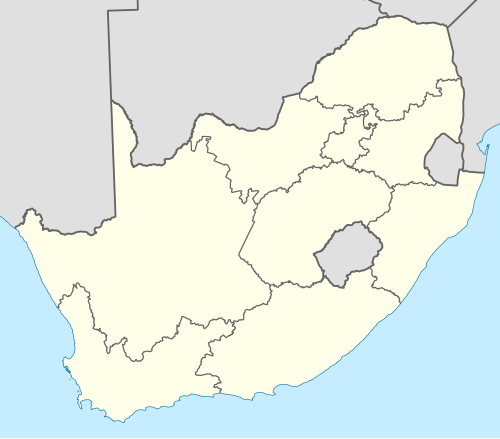
ਦੱਖਣੀ ਅਫ਼ਰੀਕਾ ਦੇ ਸੂਬੇ
ਦੱਖਣੀ ਅਫ਼ਰੀਕਾ ਨੂੰ ਨੌਂ ਸੂਬਿਆਂ ਵਿੱਚ ਵੰਡਿਆ ਹੋਇਆ ਹੈ। 1994 ਦੀਆਂ ਸਧਾਰਨ ਚੋਣਾਂ ਮੌਕੇ ਦੱਖਣੀ ਅਫ਼ਰੀਕਾ ਦੀਆਂ ਪੂਰਵਲੀਆਂ ਮਾਤ-ਭੂਮੀਆਂ, ਜਿਹਨਾਂ ਨੂੰ ਬੰਤੂਸਤਾਨ ਵੀ ਕਿਹਾ ਜਾਂਦਾ ਹੈ, ਦਾ ਮੁੜ-ਏਕੀਕਰਨ ਕੀਤਾ ਗਿਆ ਸੀ ਅਤੇ ਉਸ ਵਕਤ ਦੇ ਚਾਰ ਸੂਬਿਆਂ ਨੂੰ ਨੌਂ ਵਿੱਚ ਵੰਡ ਦਿੱਤਾ ਗਿਆ ਸੀ। ਸੰਵਿਧਾਨ ਦੀ ਬਾਰ੍ਹਵੀਂ, ਤੇਰ੍ਹਵੀਂ ਅਤੇ ਸੋਲ੍ਹਵੀਂ ਸੋਧਾਂ ਨੇ ਸੱਤ ਸੂਬਿਆਂ ਦੀਆਂ ਸਰਹੱਦਾਂ ਨੂੰ ਬਦਲਿਆ। ਇਹ ਸੂਬੇ ਹੇਠ ਲਿਖੇ ਹਨ:
| ਸੂਬਾ | ਰਾਜਧਾਨੀ | ਸਭ ਤੋਂ ਵੱਡਾ ਸ਼ਹਿਰ | ਖੇਤਰਫਲ[1] (ਵਰਗ ਕਿਲੋਮੀਟਰ & ਵਰਗ ਮੀਲ) | ਅਬਾਦੀ (2011)[2] | ਅਬਾਦੀ ਘਣਤਾ (2011) | ਮਨੁੱਖੀ ਵਿਕਾਸ ਸੂਚਕ (2003)[3] |
|---|---|---|---|---|---|---|
| ਪੂਰਬੀ ਅੰਤਰੀਪ | ਬੀਸ਼ੋ | ਪੋਰਟ ਐਲਿਜ਼ਾਬੈਥ | 168,966 km2 (65,238 sq mi) | 6,562,053 | 38.8/km2 (100/sq mi) | 0.62 |
| ਅਜ਼ਾਦ ਰਾਜ | ਬਲੂਮਫ਼ੋਂਟੇਨ | ਬਲੂਮਫ਼ੋਂਟੇਨ | 129,825 km2 (50,126 sq mi) | 2,745,590 | 21.1/km2 (55/sq mi) | 0.67 |
| ਗਾਊਟੰਗ * | ਜਾਹਨਸਬਰਗ | ਜਾਹਨਸਬਰਗ | 18,178 km2 (7,019 sq mi) | 12,272,263 | 675.1/km2 (1,749/sq mi) | 0.74 |
| ਕਵਾਜ਼ੁਲੂ-ਨਾਟਾਲ | ਪੀਟਰਮਾਰਿਟਜ਼ਬਰਗ ‡ | ਡਰਬਨ | 94,361 km2 (36,433 sq mi) | 10,267,300 | 108.8/km2 (282/sq mi) | 0.63 |
| ਲਿਮਪੋਪੋ ** | ਪੋਲੋਕਵੇਨ (ਪੀਟਰਸਬਰਗ) | ਪੋਲੋਕਵਾਨੇ | 125,754 km2 (48,554 sq mi) | 5,404,868 | 43.0/km2 (111/sq mi) | 0.59 |
| ਮਪੂਮਾਲਾਂਗਾ *** | ਮਬੋਮਬੇਲਾ (ਨੈਲਸਪਰੂਈਟ) | ਮਬੋਮਬੇਲਾ | 76,495 km2 (29,535 sq mi) | 4,039,939 | 52.8/km2 (137/sq mi) | 0.65 |
| ਉੱਤਰ-ਪੱਛਮ | ਮਾਹੀਕੰਗ (ਮਾਫ਼ੇਕੰਗ) | ਰਸਟਨਬਰਗ | 104,882 km2 (40,495 sq mi) | 3,509,953 | 33.5/km2 (87/sq mi) | 0.61 |
| ਉੱਤਰੀ ਅੰਤਰੀਪ | ਕਿੰਬਰਲੀ | ਕਿੰਬਰਲੀ | 372,889 km2 (143,973 sq mi) | 1,145,861 | 3.1/km2 (8.0/sq mi) | 0.69 |
| ਪੱਛਮੀ ਅੰਤਰੀਪ † | ਕੇਪਟਾਊਨ | ਕੇਪਟਾਊਨ | 129,462 km2 (49,986 sq mi) | 5,822,734 | 45.0/km2 (117/sq mi) | 0.77 |
| ਦੱਖਣੀ ਅਫ਼ਰੀਕਾ ਦਾ ਗਣਰਾਜ | ਪ੍ਰਿਟੋਰੀਆ, ਕੇਪ ਟਾਊਨ, ਬਲੂਮਫ਼ੋਂਟੇਨ | ਜਾਹਨਸਬਰਗ | 1,220,813 km2 (471,359 sq mi) | 51,770,560 | 42.4/km2 (110/sq mi) | 0.67 |
ਪਗਨੋਟ:
- * Gauteng began as Pietersburg-Witwatersrand-Vereeniging (PWV) in April 1994 and was renamed in December 1994.
- ** Limpopo was at first named the Northern Transvaal in 1994 and then the Northern Province from 1995 to 2003.
- *** Mpumalanga was first named the Eastern Transvaal in April 1994, and renamed in August 1995.
- † The Prince Edward Islands, South African territories in the sub-Antarctic Indian Ocean that are part of the Western Cape for legal purposes, are not included in these statistics.
- ‡ Pietermaritzburg and Ulundi were joint capitals of KwaZulu-Natal from 1994 to 2004.
ਹਵਾਲੇ[ਸੋਧੋ]
- ↑ Census 2011: Census in brief. Pretoria: Statistics South Africa. 2012. p. 9. ISBN 9780621413885. Archived from the original (PDF) on 2018-12-25. Retrieved 2013-05-20.
{{cite book}}: Unknown parameter|dead-url=ignored (|url-status=suggested) (help) - ↑ Census 2011: Census in brief. Pretoria: Statistics South Africa. 2012. p. 18. ISBN 9780621413885. Archived from the original (PDF) on 2018-12-25. Retrieved 2013-05-20.
{{cite book}}: Unknown parameter|dead-url=ignored (|url-status=suggested) (help) - ↑ Adelzadeh, Asghar; et al. South Africa Human Development Report 2003 (PDF). Cape Town: Oxford University Press. p. 282. ISBN 978-0-19-578418-3. Archived from the original (PDF) on 2016-01-19. Retrieved 2013-05-20.
{{cite book}}: Explicit use of et al. in:|author=(help); Unknown parameter|dead-url=ignored (|url-status=suggested) (help)