
ਪੰਜਾਬ
ਪੰਜਾਬ پنجاب | |
|---|---|
ਖੇਤਰ | |
_with_cities.png) ਪੰਜਾਬ ਦੀ ਦੱਖਣੀ ਏਸ਼ੀਆ ਵਿੱਚ ਜਗ੍ਹਾ | |
| ਮੁਲਕ |
|
| ਏਰਿਏ | ਹੇਠਾਂ ਵੇਖੋ |
| ਵਸਨੀਕੀ ਨਾਂ | ਪੰਜਾਬੀ |
| Time zones | ਯੂਟੀਸੀ+5 (PKT (ਪਾਕਸਿਤਾਨ ਟਾਈਮ)) |
| UTC+05:30 (IST (ਇੰਡੀਅਨ ਸਟੈਂਡਰਡ ਟਾਈਮ)) | |
| ਜ਼ੁਬਾਨ | ਪੰਜਾਬੀ |
| ਉੱਤੇ ਲੜ੍ਹੀ ਦਾ ਹਿੱਸਾ |
| ਪੰਜਾਬੀਆਂ |
|---|
 |
 |
ਪੰਜਾਬ (ਸ਼ਾਹਮੁਖੀ: پنجاب) ਉੱਤਰ-ਦੱਖਣੀ ਏਸ਼ੀਆ ਵਿੱਚ ਇੱਕ ਭੂਗੋਲਿਕ, ਸੱਭਿਆਚਾਰਕ ਅਤੇ ਇਤਿਹਾਸਕ ਖਿੱਤਾ ਹੈ। ਪੰਜਾਬ ਖ਼ਿੱਤੇ ਵਿੱਚ ਚੜ੍ਹਦਾ ਪੰਜਾਬ, ਲਹਿੰਦਾ ਪੰਜਾਬ, ਕਸ਼ਮੀਰ, ਚੰਡੀਗੜ੍ਹ, ਹਰਿਆਣਾ, ਹਿਮਾਚਲ ਪ੍ਰਦੇਸ਼, ਦਿੱਲੀ, ਉੱਤਰੀ ਰਾਜਸਥਾਨ, ਇਸਲਾਮਾਬਾਦ ਕੈਪਟਲ ਟੇਰਾਟੋਰੀ ਅਤੇ ਖ਼ੈਬਰ ਪਖ਼ਤੁਨਖ਼ਵਾ ਸ਼ਾਮਲ ਹਨ।
ਨਿਰੁਕਤੀ
[ਸੋਧੋ]ਖੇਤਰ ਦਾ ਨਾਮ, ਪੰਜਾਬ, ਦੋ ਫ਼ਾਰਸੀ ਦੇ ਲਫ਼ਜ਼ਾਂ ਦਾ ਮੇਲ ਹੈ,[1][2] ਪੰਜ ਅਤੇ ਆਬ (ਪਾਣੀ), ਜਿਸਦਾ ਤਆਰਫ਼ ਖੇਤਰ ਵਿੱਚ ਆਏ ਤੁਰਕੀ-ਫ਼ਾਰਸੀ ਬੋਲਾਰਿਆਂ ਨੇ ਕੀਤਾ,[3] ਅਤੇ ਜਿਸਨੂੰ ਮੁਗ਼ਲ ਸਲਤਨਤ ਵਲੋਂ ਹੋਰ ਬਕਾਇਦਾ ਮਕਬੂਲੀਅਤ ਹਾਸਲ ਹੋਈ।[4][5] ਇਸ ਮੁਤਾਬਕ ਪੰਜਾਬ ਦਾ ਮਤਲਬ ਹੈ "ਪੰਜ ਦਰਿਆਵਾਂ ਵਾਲ਼ੀ ਜ਼ਮੀਨ", ਜ਼ਿਕਰ ਜੇਹਲਮ, ਚਨਾਬ, ਰਾਵੀ, ਸਤਲੁਜ ਅਤੇ ਬਿਆਸ ਦਰਿਆਵਾਂ ਦਾ।[6] ਯੂਨਾਨੀਆਂ ਵਲੋਂ ਇਸ ਖੇਤਰ ਦਾ ਜ਼ਿਕਰ ਪੇਂਤਾਪੋਟੇਮੀਆ ਅਤੇ ਵੇਦਕ ਸੋਸਾਇਟੀ ਵਲੋਂ ਸਪਤ ਸਿੰਧੂ ਨਾਵਾਂ ਨਾਲ਼ ਕੀਤਾ ਜਾਂਦਾ ਸੀ।[7][8][9]
ਸਿਆਸੀ ਜੁਗਰਾਫ਼ੀਆ
[ਸੋਧੋ]ਪੰਜਾਬ ਖੇਤਰ ਦੇ ਦੋ ਮੁੱਖ ਡੈਫ਼ੀਨਿਸ਼ਨ ਨੇ, ੧੯੪੭ ਡੈਫ਼ੀਨਿਸ਼ਨ ਅਤੇ ਉਸਤੋਂ ਪੁਰਾਤਨ 1846–1849 ਡੈਫ਼ੀਨਿਸ਼ਨ। ਇੱਕ ਤੀਜੀ ਡੈਫ਼ੀਨਿਸ਼ਨ ਵਿੱਚ ਦੋਵੇਂ 1947 ਡੈਫ਼ੀਨਿਸ਼ਨ ਅਤੇ 1846–1849 ਡੈਫ਼ੀਨਿਸ਼ਨ ਨੂੰ ਮਿਲਾ, ਭਾਸ਼ਾ ਦੀ ਸਾਂਝ ਅਤੇ ਕਦੀਮ ਦਰਿਆਵੀ ਹਿਲਜੁਲ ਦੇ ਲਿਹਾਜ਼ ਨਾਲ਼ ਉੱਤਰੀ ਰਾਜਿਸਥਾਨ ਨੂੰ ਸ਼ਾਮਲ ਕੀਤਾ ਜਾਂਦਾ।
੧੯੪੭ ਡੈਫ਼ੀਨਿਸ਼ਨ
[ਸੋਧੋ]੧੯੪੭ ਡੈਫ਼ੀਨਿਸ਼ਨ ਪੰਜਾਬ ਖਿੱਤੇ ਨੂੰ ਬ੍ਰਿਟਿਸ਼ ਪੰਜਾਬ ਦੇ ਹਵਾਲੇ ਨਾਲ਼ ਡਫ਼ਾਈਨ ਕਰਦਾ ਹੈ ਜੋ ਭਾਰਤ ਅਤੇ ਪਾਕਿਸਤਾਨ ਵਿਚਾਲੇ਼ ਤਕਸੀਮ ਹੋਇਆ ਸੀ। ਪਾਕਿਸਤਾਨ ਵਿੱਚ, ਖੇਤਰ ਦੇ ਹਿੱਸੇ ਪੰਜਾਬ ਸੂਬਾ ਅਤੇ ਇਸਲਾਮਾਬਾਦ ਕੈਪਟਲ ਟੇਰਾਟੋਰੀ ਸ਼ਾਮਲ ਹਨ । ਭਾਰਤ ਵਿੱਚ, ਸ਼ਾਮਲ ਹਨ ਪੰਜਾਬ ਸੂਬਾ, ਚੰਡੀਗੜ੍ਹ, ਹਰਿਆਣਾ,[10] ਅਤੇ ਹਿਮਾਚਲ ਪ੍ਰਦੇਸ਼।
1947 ਡੈਫ਼ੀਨਿਸ਼ਨ ਵਰਤਦਿਆਂ, ਲਹਿੰਦੇ ਵੱਲ ਬਲੋਚਿਸਤਾਨ ਅਤੇ ਖ਼ੈਬਰ ਪਖ਼ਤੁਨਖ਼ਵਾ ਖਿੱਤੇ, ਉੱਤਰ ਨੂੰ ਕਸ਼ਮੀਰ, ਚੜ੍ਹਦੇ ਵੱਲ ਹਿੰਦੀ ਬੈਲਟ ਅਤੇ ਦੱਖਣ ਨੂੰ ਰਾਜਿਸਥਾਨ ਅਤੇ ਸਿੰਧ ਨਾਲ਼ ਪੰਜਾਬ ਦੀ ਹੱਦ ਲਗਦੀ ਹੈ। ਇਸ ਮੁਤਾਬਕ, ਪੰਜਾਬ ਖੇਤਰ ਬਹੁਤ ਕਿਸਮੀ ਹੈ ਅਤੇ ਜਿਸਦੀ ਖਿੱਚ ਕਾਂਗੜਾ ਦੇ ਪਹਾੜਾਂ ਤੋਂ ਮੈਦਾਨੀ ਜ਼ਮੀਨ ਤੋਂ ਚੋਲਿਸਤਾਨ ਦੇ ਰੇਗਿਸਤਾਨ ਤੱਕ ਹੈ।
ਮੌਜੂਦਾ ਨਕਸ਼ੇ
[ਸੋਧੋ]-
 ਪੰਜਾਬ, ਪਾਕਿਸਤਾਨ
 -
 ਪੰਜਾਬ, ਇੰਡੀਆ
 -
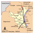 ਹਰਿਆਣਾ, ਇੰਡੀਆ
 -
 ਹਿਮਾਚਲ ਪ੍ਰਦੇਸ਼, ਇੰਡੀਆ


ਵੱਡੇ ਸ਼ਹਿਰ
[ਸੋਧੋ]-
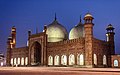 ਬਾਦਸ਼ਾਹੀ ਮਸੀਤ, ਲਹੌਰ
 -
 ਦਰਬਾਰ ਸਾਹਿਬ, ਅਮ੍ਰਿਤਸਰ
 -
 ਘੈਂਟਾ ਘਰ, ਫ਼ੈਸਲਾਬਾਦ
 -
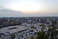 ਮੁਲਤਾਨ ਘੈਂਟਾ ਘਰ ਚੌਂਕ ਦੀ ਹਵਾਈ ਨਜ਼ਰ
 -
 ਓਪਨ ਹੈਂਡ ਮੁੱਜਸਮਾ, ਚੰਡੀਗੜ੍ਹ
 -
 ਫ਼ੈਸਲ ਮਸੀਤ
.jpg)


1846–1849 ਡੈਫ਼ੀਨਿਸ਼ਨ
[ਸੋਧੋ]

1846–1849 ਡੈਫ਼ੀਨਿਸ਼ਨ ਦਾ ਫ਼ੋਕਸ ਖ਼ਾਲਸਾ ਰਾਜ ਹੈ। ਇਸ ਡੈਫ਼ੀਨਿਸ਼ਨ ਮੁਤਾਬਕ, ਪੰਜਾਬ ਖਿੱਤੇ ਦੇ ਇਲਾਕੇ ਹਨ, ਪਾਕਿਸਤਾਨ ਵਿੱਚ, ਲਹਿੰਦਾ ਪੰਜਾਬ, ਇਸਲਾਮਾਬਾਦ ਕੈਪਟਲ ਟੇਰਾਟੋਰੀ, ਅਜ਼ਾਦ ਕਸ਼ਮੀਰ ਸ਼ਾਮਲ ਭਿਮਬਰ ਅਤੇ ਮੀਰਪੁਰ[11] ਅਤੇ ਖ਼ੈਬਰ ਪਖ਼ਤੁਨਖ਼ਵਾ ਦੇ ਕੁਜ ਹਿੱਸੇ (ਖ਼ਾਸਕਰ ਪੇਸ਼ਾਵਰ[12] ਪੰਜਾਬ ਵਿੱਚ ਪਿਸ਼ੌਰ ਨਾਮ ਨਾਲ਼ ਮਲੂਕ)[13] ਅਤੇ ਭਾਰਤ ਵਿੱਚ, ਚੜ੍ਹਦਾ ਪੰਜਾਬ, ਚੰਡੀਗੜ੍ਹ, ਹਰਿਆਣਾ, ਹਿਮਾਚਲ ਪ੍ਰਦੇਸ਼, ਦਿੱਲੀ ਅਤੇ ਜੰਮੂ ਅਤੇ ਕਸ਼ਮੀਰ|ਜੰਮੂ ਦਵਿਜਨ।[14][15][16]
ਖ਼ਾਲਸਾ ਰਾਜ ਡੈਫ਼ੀਨਿਸ਼ਨ ਵਰਤਦਿਆਂ, ਪੰਜਾਬ ਖਿੱਤਾ ਵੱਡਾ ਇਲਾਕਾ ਕੱਜਦਾ ਹੈ ਜਿਸਨੂੰ ਪੰਜ ਕੁਦਰਤੀ ਰਕਬਿਆਂ ਵਿੱਚ ਤਕਸੀਮ ਕੀਤਾ ਜਾ ਸਕਦਾ।[1]
- ਚੜ੍ਹਦਾ ਪਹਾੜ੍ਹੀ ਖੇਤਰ ਵਿੱਚ ਸ਼ਾਮਲ ਜੰਮੂ ਦਵਿਜਨ ਅਤੇ ਅਜ਼ਾਦ ਕਸ਼ਮੀਰ;
- ਵਿਚਕਾਰ ਇੰਡਸ ਖੇਤਰ ਵਿੱਚ ਸ਼ਾਮਲ ਪੇਸ਼ਾਵਰ;
- ਗਬਲਾ ਮਦਾਨ ਨਾਲ਼ ਉਸਦੇ ਪੰਜ ਦਰਿਆ;
- ਉੱਤਰ-ਲਹਿੰਦਾ ਖੇਤਰ, ਗਬਲੇ ਮਦਾਨ ਤੋਂ ਜੇਹਲਮ ਅਤੇ ਇੰਡਸ ਵਿਚਾਲ਼ੇ ਲੂਣ ਕੋਹਸਤਾਨ ਕਰਕੇ ਵੱਖ;
- ਸਤਲੁਜ ਦਰਿਆ ਦੇ ਦੱਖਣ ਨੂੰ ਸੈਮੀ-ਰੇਗਿਸਤਾਨ।
ਪੰਜਾਬ ਦੇ ਚੜ੍ਹਦੇ ਤੋਂ ਉੱਤਰ-ਚੜ੍ਹਦੇ ਵੱਲ ਹਿਮਾਲਿਆ ਕੋਹਸਤਾਨ ਪਹਾੜਾਂ ਦਾ ਅਕਾਰ ਉੱਤਰ-ਹਿੱਲ ਰਹੇ ਇੰਡੋ-ਆਸਟ੍ਰੇਲੀਅਨ ਪਲੇਟ ਅਤੇ ਯੋਰੇਸ਼ੀਆ ਪਲੇਟ ਵਿਚਾਲ਼ੇ ਟੱਕਰ ਦਾ ਅੰਜਾਮ ਹੈ। ਪਲੇਟਾਂ ਹਜੇ ਵੀ ਇਕੱਠੀਆਂ ਹਿੱਲ ਰਹੀਆਂ ਨੇ, ਅਤੇ ਹਿਮਾਲਿਆ ਹਰ ਸਾਲ 5 millimetres (0.2 in) ਤਾਹਾਂ ਜਾ ਰਿਹਾ।
ਉੱਪਰਲਾ ਖੇਤਰੀ ਹਿੱਸਾ ਸਾਰਾ ਸਾਲ ਬਰਫ਼-ਕੱਜਿਆ ਰਹਿੰਦਾ ਹੈ। ਟਿੱਲੇ ਹੇਠਲੇ ਕੋਹਸਤਾਨ ਪਹਾੜਾ ਨਾਲ਼ ਮੁਤਵਾਜ਼ੀ ਜਾਂਦੇ ਹਨ। ਹੇਠਲਾ ਹਿਮਾਲਿਆ ਕੋਹਸਤਾਨ ਰਾਵਲਪਿੰਡੀ ਦੇ ਉੱਤਰ, ਜੰਮੂ ਅਤੇ ਕਸ਼ਮੀਰ, ਹਿਮਾਚਲ ਪ੍ਰਦੇਸ਼ ਅਤੇ ਅਗਾਹਾਂ ਦੱਖਣ ਵਿਚੋਂ ਜਾਂਦਾ ਹੈ। ਇਹ ਪਹਾੜ ਕਾਫ਼ੀ ਨਿਆਣੇ ਹਨ, ਅਤੇ ਜਲਦੀ ਰੁੜ੍ਹ ਰਹੇ ਨੇ। ਪੰਜਾਬ ਦੇ ਇੰਡਸ ਅਤੇ ਪੰਜਾਬ ਦਰਿਆਵਾਂ ਦੇ ਜ਼ਰੀਏ ਪਹਾੜੀ ਕੋਹਸਤਾਨ ਵਿੱਚ ਹਨ ਅਤੇ ਜਿਸ ਵਿੱਚ ਢੋਇਆ ਲੋਮ, ਮਿਨਰਲ ਅਤੇ ਗਾਰਾ ਅਲੂਵੀਅਲ ਅਮੀਰ ਮਦਾਨੀ ਜ਼ਮੀਨ, ਜੋ ਬਹੁਤ ਜ਼ਰਖੇਜ਼ ਹੈ ਤੱਕ ਆਹ ਜਾਂਦਾ।[17]
ਵੱਡੇ ਸ਼ਹਿਰ
[ਸੋਧੋ]1846–1849 ਡੈਫ਼ੀਨਿਸ਼ਨ ਮੁਤਾਬਕ, ਕੁਜ ਮੇਜਰ ਸ਼ਹਿਰ ਵਿੱਚ ਸ਼ਾਮਲ ਜੰਮੂ, ਪੇਸ਼ਾਵਰ ਅਤੇ ਦਿੱਲੀ ਦੇ ਕੁਜ ਹਿੱਸੇ।
-
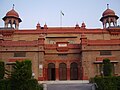
 ਬਹੂ ਕਿਲ੍ਹਾ, ਜੰਮੂ
 -
 ਪੇਸ਼ਾਵਰ ਆਜਿਬ ਘਰ
 -
 ਜਾਮਾ ਮਸੀਤ, ਦਿੱਲੀ
 -
 ਸ਼ਹਿਰ ਦੀ ਨਜ਼ਰ, ਮੀਰਪੁਰ


ਅਜ਼ੀਮ ਪੰਜਾਬ
[ਸੋਧੋ]ਪੰਜਾਬ ਖੇਤਰ ਦੀ ਤੀਜੀ ਡੈਫ਼ੀਨਿਸ਼ਨ ਵਿੱਚ ਤਾਹਾਂ ਜ਼ਿਕਰ ਹੋਏ ਡੈਫ਼ੀਨਿਸ਼ਨਾਂ ਨਾਲ਼ ਰਾਜਸਥਾਨ ਦੇ ਕੁਜ ਹਿਸਿਆਂ ਨੂੰ[18][19][20][21] ਭਾਸ਼ਾਈ ਸਾਂਝ ਅਤੇ ਕਦੀਮ ਵੇਲਿਆਂ ਵਿੱਚ ਪੰਜਾਬ ਦਰਿਆਵਾਂ ਦੀ ਲੋਕੇਸ਼ਨ ਦੇ ਲਿਹਾਜ਼ ਨਾਲ਼ ਸ਼ਾਮਲ ਕੀਤਾ ਜਾਂਦਾ। ਖ਼ਾਸਕਰ, ਗੰਗਾਨਗਰ ਅਤੇ ਹਨੂੰਮਾਨਗੜ੍ਹ ਜਿੱਲ੍ਹੇ ਪੰਜਾਬ ਖਿੱਤੇ ਵਿੱਚ ਸ਼ਾਮਲ ਹਨ।[22]
-
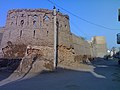 ਅਨੂਪਗੜ੍ਹ ਸ਼ਹਿਰ ਵਿੱਚ ਅਨੂਪਗੜ੍ਹ ਕਿੱਲਾ
 -
 ਹਨੂੰਮਾਨਗੜ੍ਹ ਸ਼ਹਿਰ ਵਿੱਚ ਭੱਟਨਰ ਕਿੱਲਾ


ਭੂਗੋਲ
[ਸੋਧੋ]"ਪੰਜਾਬ" ਸ਼ਬਦ ਦੀ ਭੂਗੋਲਿਕ ਪਰਿਭਾਸ਼ਾ ਸਮੇਂ ਦੇ ਨਾਲ ਬਦਲ ਗਈ ਹੈ। 16ਵੀਂ ਸਦੀ ਵਿੱਚ ਮੁਗਲ ਸਾਮਰਾਜ ਵਿੱਚ ਇਹ ਸਿੰਧ ਅਤੇ ਸਤਲੁਜ ਦਰਿਆਵਾਂ ਦੇ ਵਿਚਕਾਰ ਇੱਕ ਮੁਕਾਬਲਤਨ ਛੋਟੇ ਖੇਤਰ ਦਾ ਹਵਾਲਾ ਦਿੰਦਾ ਸੀ। [23][24]
ਸਿੱਖ ਸਾਮਰਾਜ
[ਸੋਧੋ]19ਵੀਂ ਸਦੀ ਵਿੱਚ ਮਹਾਰਾਜਾ ਰਣਜੀਤ ਸਿੰਘ ਨੇ ਪੰਜਾਬ ਵਿੱਚ ਸਿੱਖ ਸਾਮਰਾਜ ਦੀ ਸਥਾਪਨਾ ਕੀਤੀ। [25] ਸਾਮਰਾਜ 1799 ਤੋਂ ਹੋਂਦ ਵਿੱਚ ਸੀ, ਜਦੋਂ ਰਣਜੀਤ ਸਿੰਘ ਨੇ ਲਾਹੌਰ ਉੱਤੇ ਕਬਜ਼ਾ ਕੀਤਾ, 1849 ਤੱਕ, ਜਦੋਂ ਇਹ ਦੂਜੀ ਐਂਗਲੋ-ਸਿੱਖ ਜੰਗ ਵਿੱਚ ਹਾਰ ਗਿਆ ਅਤੇ ਜਿੱਤਿਆ ਗਿਆ। ਇਹ ਖੁਦਮੁਖਤਿਆਰ ਸਿੱਖ ਮਿਸਲਾਂ ਦੇ ਸੰਗ੍ਰਹਿ ਤੋਂ ਖਾਲਸੇ ਦੀ ਨੀਂਹ 'ਤੇ ਬਣਾਈ ਗਈ ਸੀ। [26][27] 19ਵੀਂ ਸਦੀ ਵਿੱਚ ਆਪਣੇ ਸਿਖਰ 'ਤੇ, ਸਾਮਰਾਜ ਪੱਛਮ ਵਿੱਚ ਖੈਬਰ ਦੱਰੇ ਤੋਂ ਪੂਰਬ ਵਿੱਚ ਪੱਛਮੀ ਤਿੱਬਤ ਤੱਕ ਅਤੇ ਦੱਖਣ ਵਿੱਚ ਮਿਥਨਕੋਟ ਤੋਂ ਉੱਤਰ ਵਿੱਚ ਕਸ਼ਮੀਰ ਤੱਕ ਫੈਲਿਆ ਹੋਇਆ ਸੀ। ਇਹ ਚਾਰ ਸੂਬਿਆਂ ਵਿੱਚ ਵੰਡਿਆ ਗਿਆ ਸੀ: ਲਾਹੌਰ, ਪੰਜਾਬ ਵਿੱਚ, ਜੋ ਸਿੱਖ ਰਾਜਧਾਨੀ ਬਣ ਗਿਆ; ਮੁਲਤਾਨ, ਪੰਜਾਬ ਵਿੱਚ ਵੀ; ਪੇਸ਼ਾਵਰ ; ਅਤੇ ਕਸ਼ਮੀਰ 1799 ਤੋਂ 1849 ਤੱਕ। 3.5 ਦੀ ਅੰਦਾਜ਼ਨ ਆਬਾਦੀ ਦੇ ਨਾਲ, ਧਾਰਮਿਕ ਤੌਰ 'ਤੇ ਵਿਭਿੰਨ 1831 ਵਿੱਚ ਮਿਲੀਅਨ (ਇਸ ਨੂੰ ਉਸ ਸਮੇਂ ਦਾ 19ਵਾਂ ਸਭ ਤੋਂ ਵੱਧ ਆਬਾਦੀ ਵਾਲਾ ਦੇਸ਼ ਬਣਾਉਂਦੇ ਹੋਏ ),[28] ਇਹ ਭਾਰਤੀ ਉਪ ਮਹਾਂਦੀਪ ਦਾ ਆਖ਼ਰੀ ਪ੍ਰਮੁੱਖ ਖੇਤਰ ਸੀ ਜਿਸਨੂੰ ਬ੍ਰਿਟਿਸ਼ ਸਾਮਰਾਜ ਦੁਆਰਾ ਮਿਲਾਇਆ ਗਿਆ ਸੀ।

ਸਿੱਖ ਸਾਮਰਾਜ ਕੁੱਲ 200,000 ਤੱਕ ਫੈਲਿਆ ਹੋਇਆ ਸੀ ਆਪਣੇ ਸਿਖਰ 'ਤੇ। [29][30][31]
ਪੰਜਾਬ ਭਾਰਤ ਅਤੇ ਅਫਗਾਨ ਦੁਰਾਨੀ ਸਾਮਰਾਜ ਨਾਲ ਘਿਰਿਆ ਹੋਇਆ ਖੇਤਰ ਸੀ। ਸਿੱਖ ਸਾਮਰਾਜ ਦੇ ਦੌਰਾਨ ਇਤਿਹਾਸਕ ਪੰਜਾਬ ਖੇਤਰ ਨੂੰ ਹੇਠ ਲਿਖੀਆਂ ਆਧੁਨਿਕ-ਦਿਨ ਦੀਆਂ ਸਿਆਸੀ ਵੰਡਾਂ ਨੇ ਬਣਾਇਆ:
- ਪੰਜਾਬ ਖੇਤਰ, ਦੱਖਣ ਵਿੱਚ ਮਿਠਨਕੋਟ ਤੱਕ
- ਪੰਜਾਬ, ਪਾਕਿਸਤਾਨ, ਬਹਾਵਲਪੁਰ ਰਾਜ ਨੂੰ ਛੱਡ ਕੇ
- ਪੰਜਾਬ, ਭਾਰਤ, ਦੱਖਣ ਤੋਂ ਸਤਲੁਜ ਦਰਿਆ ਦੇ ਬਿਲਕੁਲ ਪਾਰ ਦੇ ਖੇਤਰ
- ਹਿਮਾਚਲ ਪ੍ਰਦੇਸ਼, ਭਾਰਤ, ਦੱਖਣ ਤੋਂ ਸਤਲੁਜ ਦਰਿਆ ਦੇ ਬਿਲਕੁਲ ਪਾਰ ਦੇ ਖੇਤਰ
- ਜੰਮੂ ਡਿਵੀਜ਼ਨ, ਜੰਮੂ ਅਤੇ ਕਸ਼ਮੀਰ (ਕੇਂਦਰ ਸ਼ਾਸਿਤ ਪ੍ਰਦੇਸ਼)|ਜੰਮੂ ਅਤੇ ਕਸ਼ਮੀਰ, ਭਾਰਤ ਅਤੇ ਪਾਕਿਸਤਾਨ (1808-1846)
- ਕਸ਼ਮੀਰ, 5 ਜੁਲਾਈ 1819 ਤੋਂ 15 ਮਾਰਚ 1846 ਤੱਕ, ਭਾਰਤ/ਪਾਕਿਸਤਾਨ/ਚੀਨ [32][33]
- ਕਸ਼ਮੀਰ ਘਾਟੀ, ਭਾਰਤ 1819 ਤੋਂ 1846 ਤੱਕ
- ਗਿਲਗਿਤ, ਗਿਲਗਿਤ-ਬਾਲਟਿਸਤਾਨ, ਪਾਕਿਸਤਾਨ, 1842 ਤੋਂ 1846 ਤੱਕ[ਹਵਾਲਾ ਲੋੜੀਂਦਾ]
- ਲੱਦਾਖ, ਭਾਰਤ 1834-1846 [34][35]
- ਖੈਬਰ ਪਾਸ, ਪਾਕਿਸਤਾਨ/ਅਫਗਾਨਿਸਤਾਨ [36]
- ਪੇਸ਼ਾਵਰ, ਪਾਕਿਸਤਾਨ [37] (1818 ਵਿੱਚ ਲਿਆ ਗਿਆ, 1834 ਵਿੱਚ ਮੁੜ ਲਿਆ ਗਿਆ)
- ਖੈਬਰ ਪਖਤੂਨਖਵਾ ਅਤੇ ਸੰਘੀ ਪ੍ਰਸ਼ਾਸਿਤ ਕਬਾਇਲੀ ਖੇਤਰ, ਪਾਕਿਸਤਾਨ ( ਹਜ਼ਾਰਾ ਤੋਂ ਦਸਤਾਵੇਜ਼ੀ (1818 ਵਿੱਚ ਲਿਆ ਗਿਆ, ਦੁਬਾਰਾ 1836 ਵਿੱਚ ਬੰਨੂ ) [38]
- ਪੱਛਮੀ ਤਿੱਬਤ ਦੇ ਹਿੱਸੇ, [39] ਚੀਨ (1841 ਵਿੱਚ, ਤਕਲਾਕੋਟ ਤੱਕ ),[40]
1839 ਵਿਚ ਰਣਜੀਤ ਸਿੰਘ ਦੀ ਮੌਤ ਤੋਂ ਬਾਅਦ, ਸਾਮਰਾਜ ਅੰਦਰੂਨੀ ਵੰਡਾਂ ਅਤੇ ਰਾਜਨੀਤਿਕ ਕੁਪ੍ਰਬੰਧਾਂ ਦੁਆਰਾ ਬੁਰੀ ਤਰ੍ਹਾਂ ਕਮਜ਼ੋਰ ਹੋ ਗਿਆ ਸੀ। ਇਸ ਮੌਕੇ ਦੀ ਵਰਤੋਂ ਈਸਟ ਇੰਡੀਆ ਕੰਪਨੀ ਨੇ ਪਹਿਲੀ ਅਤੇ ਦੂਜੀ ਐਂਗਲੋ-ਸਿੱਖ ਜੰਗਾਂ ਸ਼ੁਰੂ ਕਰਨ ਲਈ ਕੀਤੀ ਸੀ। 1849 ਵਿਚ ਦੂਜੀ ਐਂਗਲੋ-ਸਿੱਖ ਜੰਗ ਦੇ ਅੰਤ ਵਿਚ ਦੇਸ਼ ਨੂੰ ਅੰਤ ਵਿਚ ਸ਼ਾਮਲ ਕਰ ਲਿਆ ਗਿਆ ਅਤੇ ਵੱਖ-ਵੱਖ ਰਿਆਸਤਾਂ ਅਤੇ ਪੰਜਾਬ ਸੂਬੇ ਵਿਚ ਭੰਗ ਕਰ ਦਿੱਤਾ ਗਿਆ। ਆਖਰਕਾਰ, ਤਾਜ ਦੇ ਸਿੱਧੇ ਪ੍ਰਤੀਨਿਧੀ ਵਜੋਂ ਲਾਹੌਰ ਵਿੱਚ ਇੱਕ ਲੈਫਟੀਨੈਂਟ ਗਵਰਨਰਸ਼ਿਪ ਬਣਾਈ ਗਈ ਸੀ। [41] 1839 ਵਿਚ ਰਣਜੀਤ ਸਿੰਘ ਦੀ ਮੌਤ ਤੋਂ ਬਾਅਦ, ਸਾਮਰਾਜ ਅੰਦਰੂਨੀ ਵੰਡਾਂ ਅਤੇ ਰਾਜਨੀਤਿਕ ਕੁਪ੍ਰਬੰਧਾਂ ਦੁਆਰਾ ਬੁਰੀ ਤਰ੍ਹਾਂ ਕਮਜ਼ੋਰ ਹੋ ਗਿਆ ਸੀ। ਇਸ ਮੌਕੇ ਦੀ ਵਰਤੋਂ ਈਸਟ ਇੰਡੀਆ ਕੰਪਨੀ ਨੇ ਪਹਿਲੀ ਅਤੇ ਦੂਜੀ ਐਂਗਲੋ-ਸਿੱਖ ਜੰਗਾਂ ਸ਼ੁਰੂ ਕਰਨ ਲਈ ਕੀਤੀ ਸੀ। 1849 ਵਿਚ ਦੂਜੀ ਐਂਗਲੋ-ਸਿੱਖ ਜੰਗ ਦੇ ਅੰਤ ਵਿਚ ਦੇਸ਼ ਨੂੰ ਅੰਤ ਵਿਚ ਸ਼ਾਮਲ ਕਰ ਲਿਆ ਗਿਆ ਅਤੇ ਵੱਖ-ਵੱਖ ਰਿਆਸਤਾਂ ਅਤੇ ਪੰਜਾਬ ਸੂਬੇ ਵਿਚ ਭੰਗ ਕਰ ਦਿੱਤਾ ਗਿਆ। ਆਖਰਕਾਰ, ਤਾਜ ਦੇ ਸਿੱਧੇ ਪ੍ਰਤੀਨਿਧੀ ਵਜੋਂ ਲਾਹੌਰ ਵਿੱਚ ਇੱਕ ਲੈਫਟੀਨੈਂਟ ਗਵਰਨਰਸ਼ਿਪ ਬਣਾਈ ਗਈ ਸੀ। [42] : 221
ਇਤਿਹਾਸ
[ਸੋਧੋ]ਟਾਈਮਲਾਈਨ
[ਸੋਧੋ]- 3300–1500 BCE: ਸਿੰਧੂ ਵਾਦੀ ਤਹਿਜ਼ੀਬ
- 1500–1000 BCE: (ਰਿਗਵੇਦਕ) ਵੇਦਕ ਤਹਿਜ਼ੀਬ
- 1000–500 BCE: ਅੱਧ ਅਤੇ ਅਖੀਰ ਵੇਦਕ ਜ਼ਮਾਨਾ
- 599 BCE: ਮਹਾਵੀਰ ਦਾ ਜਨਮ
- 567–487 BCE: ਗੌਤਮ ਬੁੱਧ ਦਾ ਵਕ਼ਤ
- 550 BCE – 600 CE: ਬੁੱਧਮੱਤ ਰਿਹਾ ਜਾਰੀ
- 326 BCE: ਸਿਕੰਦਰ ਵਲੋਂ ਪੰਜਾਬ ਵੱਲ ਧਾਵਾ
- 322–298 BCE: ਚੰਦ੍ਰਾਗੁਪਤਾ 1, ਮੌਰੀਆ ਜ਼ਮਾਨਾ
- 273–232 BCE: ਅਸ਼ੋਕਾ ਦਾ ਅਹਿਦ
- 125–160 BCE: ਸਾਕਿਆਂ ਦੀ ਚੜ੍ਹਾਈ
- 2 BCE: ਸਾਕਿਆਂ ਦੀ ਹਕੂਮਤ ਦਾ ਅਗਾਜ਼
- 45–180: ਕੁਸ਼ਾਣਾਂ ਦਾ ਰਾਜ
- 320–550: ਗੁਪਤ ਸਾਮਰਾਜ
- 500: ਹੰਨਕ ਧਾਵਾ
- 510–650: ਹਰਸ਼ਵਰਧਨ ਜ਼ਮਾਨਾ
- 711–713: ਮੁਹੰਮਦ ਬਿਨ ਕਾਸਿਮ ਵਲੋਂ ਸਿੰਧ ਅਤੇ ਪੰਜਾਬ ਦੇ ਰਤਾ ਹਿੱਸੇ ਦਾ ਕਬਜ਼ਾ
- 713–1200: ਰਾਜਪੂਤ ਸੂਬਿਆਂ, [[ਕਾਬੁ'
- 'ਲ ਸ਼ਾਹੀ]] ਅਤੇ ਨਿੱਕੀਆਂ ਮੁਸਲਮਾਨ ਬਾਦਸ਼ਾਹੀਆਂ
- 1206–1290: ਮੁਹੰਮਦ ਗ਼ੌਰੀ ਵਲੋਂ ਮਮਲੁਕ ਘਰਾਣਾਸ਼ਾਹੀ ਦੀ ਕਾਇਮੀ
- 1290–1320: ਜਲਾਲੁੱਦੀਨ ਖ਼ਿਲਜੀ ਵਲੋਂ ਖ਼ਿਲਜੀ ਸਲਤਨਤ ਦੀ ਕਾਇਮੀ
- 1320–1413: ਗ਼ਿਆਸੁੱਦੀਨ ਤੁਗ਼ਲਕ ਵਲੋਂ ਤੁਗ਼ਲਕ ਸਲਤਨਤ ਦੀ ਕਾਇਮੀ
- 1414–1451: ਖ਼ਿਜ਼ਰ ਖ਼ਾਨ ਵਲੋਂ ਸਇਦ ਸਲਤਨਤ ਦੀ ਕਾਇਮੀ
- 1451–1526: ਬਹਿਲੋਲ ਲੋਧੀ ਵਲੋਂ ਲੋਧੀ ਸਲਤਨਤ ਦੀ ਕਾਇਮੀ
- 1469–1539: ਗੁਰੂ ਨਾਨਕ
- 1526–1707: ਮੁਗ਼ਲ ਰਾਜ
- 1526–1530: ਜ਼ਹੀਰੁੱਦੀਨ ਮੁਹੰਮਦ ਬਾਬਰ
- 1530–1540: ਨਾਸਿਰੁੱਦੀਨ ਮੁਹੰਮਦ ਹੁਮਾਯੂੰ
- 1540–1545: ਅਫ਼ਗ਼ਾਨਿਸਤਾਨ ਦਾ ਸ਼ੇਰ ਸ਼ਾਹ ਸੂਰੀ
- 1545–1554: ਇਸਲਾਮ ਸ਼ਾਹ ਸੂਰੀ
- 1555–1556: ਨਾਸਿਰੁੱਦੀਨ ਮੁਹੰਮਦ ਹੁਮਾਯੂੰ
- 1556–1556: ਹੇਮ ਚੰਦਰ ਵਿਕਰਮਾਦਿੱਤ
- 1556–1605: ਜਲਾਲੁਦੀਨ ਮੁਹੰਮਦ ਅਕਬਰ
- 1605–1627: ਨੂਰੁੱਦੀਨ ਸਲੀਮ ਜਹਾਂਗੀਰ
- 1627–1658: ਸ਼ਾਹਅੱਬੂਦੀਨ ਮੁਹੰਮਦ ਸ਼ਾਹ ਜਹਾਨ
- 1658–1707: ਮੁਹਿਦੀਨ ਮੁਹੰਮਦ ਔਰੰਗਜ਼ੇਬ
- 1539–1675: ਗੁਰੂ ਅੰਗਦ ਤੋਂ ਗੁਰੂ ਤੇਗ ਬਹਾਦਰ ਤੱਕ 8 ਸਿੱਖ ਗੁਰੂਆਂ ਦਾ ਦੌਰ
- 1675–1708: ਗੁਰੂ ਗੋਬਿੰਦ ਸਿੰਘ (10ਵਾਂ ਸਿੱਖ ਗੁਰੂ)
- 1699: ਖ਼ਾਲਸਾ ਜ਼ਾਹਰ
- 1708–1713: ਬੰਦਾ ਸਿੰਘ ਬਹਾਦਰ ਦੀ ਤਸਖ਼ੀਰ
- 1714–1759: ਸਿੱਖ ਸਰਦਾਰਾਂ ਵਲੋਂ ਅਫ਼ਗ਼ਾਨ ਅਤੇ ਮੁਗ਼ਲਾਂ ਖਿਲਾਫ਼ ਜੰਗ
- 1739: ਨਾਦਰ ਸ਼ਾਹ ਵਲੋਂ ਧਾਵਾ ਅਤੇ ਕਮਜ਼ੋਰ ਹੋਏ ਮੁਗ਼ਲ ਸਲਤਨਤ ਦਾ ਖ਼ਾਤਮਾ
- 1747–1772: ਅਹਿਮਦ ਸ਼ਾਹ ਅਬਦਾਲੀ ਦੇ ਅਧੀਨ ਦੁਰਾਨੀ ਸਲਤਨਤ
- 1756–1759: ਸਿੱਖ ਅਤੇ ਮਰਾਠਾ ਸਾਮਰਾਜ ਦਾ ਪੰਜਾਬ ਵਿੱਚ ਤਾਲਮੇਲ
- 1761: ਪਾਣੀਪਤ ਦੀ ਤੀਜੀ ਲੜਾਈ, ਦੁਰਾਨੀ ਸਲਤਨਤ ਅਤੇ ਮਰਾਠਾ ਸਾਮਰਾਜ ਵਿਚਕਾਰ
- 1762: ਅਹਿਮਦ ਸ਼ਾਹ ਵਲੋਂ 2ਜੇ ਧਾਵੇ ਵਕ਼ਤ 2ਜਾ ਘੱਲੂਘਾਰਾ
- 1765–1801: ਸਿੱਖ ਮਿਸਲਾਂ ਦੀ ਚੜ੍ਹਤ ਜਿਨ੍ਹਾ ਨੇ ਪੰਜਾਬ ਦੇ ਖ਼ਾਸਾ ਹਿਸਿਆਂ ਵਿੱਚ ਇਖਤਿਆਰ ਹਾਸਲ ਕੀਤਾ
- 1801–1839: ਮਹਾਰਾਜਾ ਰਣਜੀਤ ਸਿੰਘ ਲੀਡਰੀ ਅਧੀਰ ਖ਼ਾਲਸਾ ਰਾਜ ਕਾਇਮ[43]
- 1845–1846: ਪਹਿਲੀ ਐਂਗਲੋ-ਸਿੱਖ ਜੰਗ
- 1846: ਜੰਮੂ ਨਵੇਂ ਸੂਬੇ ਜੰਮੂ ਅਤੇ ਕਸ਼ਮੀਰ ਦਾ ਹਿੱਸਾ ਬਣਿਆ
- 1848–1849: ਦੂਜੀ ਐਂਗਲੋ-ਸਿੱਖ ਜੰਗ
- 1849: ਪੰਜਾਬ ਉੱਤੇ ਬ੍ਰਿਟਿਸ਼ ਇੰਡੀਆ ਮੁਕਮਲ ਕਬਜ਼ਾ
- 1849–1947: ਬ੍ਰਿਟਿਸ਼ ਰਾਜ
- 1901: ਪੇਸ਼ਾਵਰ ਅਤੇ ਨਾਲ਼ ਦੇ ਜ਼ਿਲ੍ਹੇ ਪੰਜਾਬ ਸੂਬੇ ਤੋਂ ਵੱਖ ਕੀਤੇ ਗਏ
- 1911: ਦਿੱਲ੍ਹੀ ਦੇ ਕੁੱਜ ਹਿੱਸੇ ਪੰਜਾਬ ਸੂਬੇ ਤੋਂ ਵੱਖ ਕੀਤੇ ਗਏ
- 1947: ਬ੍ਰਿਟਿਸ਼ ਇੰਡੀਆ ਦੇ ਵੰਡ ਨੇ ਪੰਜਾਬ ਨੂੰ ਦੋ ਹਿਸਿਆਂ ਵਿੱਚ ਤਕਸੀਮ ਕੀਤਾ, ਚੜ੍ਹਦਾ ਹਿੱਸਾ (ਦੋ ਦਰਿਆਵਾਂ ਨਾਲ਼) ਚੜ੍ਹਦਾ ਪੰਜਾਬ ਬਣਿਆ ਅਤੇ ਲਹਿੰਦਾ ਹਿੱਸਾ (ਤਿੰਨ ਦਰਿਆ) ਲਹਿੰਦਾ ਪੰਜਾਬ
- 1966: ਚੜ੍ਹਦਾ ਪੰਜਾਬ ਤਿੰਨ ਹਿਸਿਆਂ ਵਿੱਚ ਵੰਡਿਆ: ਚੜ੍ਹਦਾ ਪੰਜਾਬ, ਹਰਿਆਣਾ ਅਤੇ ਹਿਮਾਚਲ ਪ੍ਰਦੇਸ਼
- 1973–1995: ਪੰਜਾਬ ਬਗ਼ਾਵਤ
ਹਵਾਲੇ
[ਸੋਧੋ]- ↑ 1.0 1.1 H K Manmohan Siṅgh. "The Punjab". The Encyclopedia of Sikhism, Editor-in-Chief Harbans Singh. Punjabi University, Patiala. Archived from the original on 5 ਮਾਰਚ 2016. Retrieved 18 ਅਗਸਤ 2015.
{{cite web}}: Unknown parameter|deadurl=ignored (|url-status=suggested) (help) - ↑ Gandhi, Rajmohan (2013). Punjab: A History from Aurangzeb to Mountbatten. New Delhi, India, Urbana, Illinois: Aleph Book Company. p. 1 ("Introduction"). ISBN 978-93-83064-41-0.
- ↑ Canfield, Robert L. (1991). Turko-Persia in Historical Perspective. Cambridge, United Kingdom: Cambridge University Press. p. 1 ("Origins"). ISBN 978-0-521-52291-5.
- ↑ Gandhi, Rajmohan (2013). Punjab: A History from Aurangzeb to Mountbatten. New Delhi, India, Urbana, Illinois: Aleph Book Company. ISBN 978-93-83064-41-0.
- ↑ Shimmel, Annemarie (2004). The Empire of the Great Mughals: History, Art and Culture. London, United Kingdom: Reaktion Books Ltd. ISBN 1-86189-1857.
- ↑ Encyclopædia Britannica, 9th ed., vol. 20, Punjab, p.107
- ↑ Lassen, Christian (1827). Commentatio Geographica atque Historica de Pentapotamia Indica [A commentary on the Geography and History of the Pentapotamia Indica]. Weber. p. 4.
pars ea indiae, quam hodie persico nomine Penjab vocamus, lingua Indorum sacra Panchanada appellatur; utrumque nomen Graece reddi potest per Πενταποταμια. Prioris nominis origio Persica haud est dubia, quanquam vocabula, exquibus est compositum, aeque Indica sunt ac Persica; At vero postremum hoc vacbulum ab Indis nunquam, quod sciam, in nominibus propriis hunc in modium componendis usurpatur; nomina contra Persica exstant permulta, quae vocabulo isto terminantur, ex. gr. Doab, Nilab, alia. Unde probabile fit, Penjabi nomen, quod hodie in omnibus libris geographicis obtinet, recentioris esse originis atque regibus Indiae Moslemiticis, quibus maxime in usu fuit lingua Persica, tribuendum. Nomen Panchanada Indicum esse priscum et genuium, inde patet, quod in Rameïde et Bharatea, carminibus Indorum antiquissimis iam legitur, nec praeter hoc aliud apud Indos exstat; Panchala enim, quod per Penjab reddunt interpretes Rameïdos Angli nomen est alius regionis, a Pentapotamia prorsus diversae, ut infra videbimus
ਫਰਮਾ:Whose translation
A part of India, which today we call the name of the Penjab we call the Persian, the language of the Indians, is called the sacred Panchanada; both of which can be made by the Greek name of Πενταποταμια. Origio Persian former name is not in doubt, although the terms, since it is composed equally of Hindi and Persian; But, in truth, the ultimate purpose vacbulum between the Indians and never, to my knowledge, he is used in the names of their own this fellow in the composition of a bushel; the names of the against the Persians, there are at present, and which are terminated at that word, out of the. gr. Doab, Nilab, other. Wherefore it was likely the case, the name of Penjabi, which is to day in all the books of maps, the lord, is of later origin, and the kings of Moslemiticis of India, the Persian, the language of which we are mainly in the use of, must be given. The name of the Panchanada to be the ancient habits of the Indian, and the genuine, hence it is evident, that in the Rameïde and Bharatea, the songs of the Indians, the most ancient people have already read, we in addition to this there was another stands out among the Indians; PANCHAL that for Penjab pay teachers Rameïdos the English name of another region, the Pentapotamia entirely different, as we will see below." - ↑ Latif, Syad Muhammad (1891). History of the Panjáb from the Remotest Antiquity to the Present Time. Calcultta Central Press Company. p. 1.
The Panjáb, the Pentapotamia of the Greek historians, the north-western region of the empire of Hindostán, derives its name from two Persian words, panj (five), an áb (water, having reference to the five rivers which confer on the country its distinguishing features."
- ↑ Khalid, Kanwal (2015). "Lahore of Pre Historic Era" (PDF). Journal of the Research Society of Pakistan. 52 (2): 73.
The earliest mention of five rivers in the collective sense was found in Yajurveda and a word Panchananda was used, which is a Sanskrit word to describe a land where five rivers meet. [...] In the later period the word Pentapotamia was used by the Greeks to identify this land. (Penta means 5 and potamia, water ___ the land of five rivers) Muslim Historians implied the word "Punjab " for this region. Again it was not a new word because in Persian speaking areas, there are references of this name given to any particular place where five rivers or lakes meet.
{{cite journal}}: line feed character in|quote=at position 145 (help) - ↑ Darpan, Pratiyogita (1 ਅਕਤੂਬਰ 2009). "Pratiyogita Darpan". Pratiyogita Darpan. Archived from the original on 20 ਸਤੰਬਰ 2016 – via Google Books.
{{cite web}}: Unknown parameter|deadurl=ignored (|url-status=suggested) (help) - ↑ History of Panjab Hill States, Hutchison, Vogel 1933 Mirpur was made a part of Jammu and Kashmir in 1846
- ↑ Changes in the Socio-economic Structures in Rural North-West Pakistan By Mohammad Asif Khan [1] Archived 14 April 2016 at the Wayback Machine. Peshawar was separated from Punjab Province in 1901.
- ↑ Nadiem, Ihsan H. (2007). Peshawar: heritage, history, monuments. Sang-e-Meel Publications. Archived from the original on 16 ਅਕਤੂਬਰ 2015. Retrieved 13 ਸਤੰਬਰ 2015.
{{cite book}}: Unknown parameter|deadurl=ignored (|url-status=suggested) (help) - ↑ "Jammu and Kashmir". Encyclopædia Britannica. Archived from the original on 10 ਮਾਰਚ 2016.
{{cite web}}: Unknown parameter|deadurl=ignored (|url-status=suggested) (help) - ↑ "Epilogue, Vol 4, Issue 11". Archived from the original on 4 ਫ਼ਰਵਰੀ 2016.
{{cite web}}: Unknown parameter|deadurl=ignored (|url-status=suggested) (help) - ↑ Pritam Singh Gill (1978). History of Sikh nation: foundation, assassination, resurrection. University of Michigan.: New Academic Pub. Co. p. 380.
- ↑ G. S. Gosal. "Physical Geography of the Punjab" (PDF). University of California, Santa Barbara. Archived from the original (PDF) on 8 ਜੂਨ 2012. Retrieved 3 ਨਵੰਬਰ 2012.
{{cite web}}: Unknown parameter|deadurl=ignored (|url-status=suggested) (help) - ↑ The Times Atlas of the World, Concise Edition. London: Times Books. 1995. p. 36. ISBN 0 7230 0718 7.
- ↑ Grewal, J S (2004). Historical Geography of the Punjab (PDF). Vol. Punjab Research Group, Volume 11, No 1. Journal of Punjab Studies. pp. 4, 7, 11. Archived from the original (PDF) on 3 ਦਸੰਬਰ 2012.
{{cite book}}: Unknown parameter|deadurl=ignored (|url-status=suggested) (help) - ↑ see the Punjab Doabs
- ↑ Pritam Singh and Shinder S. Thandi, ed. (1996). Globalisation and the region: explorations in Punjabi identity. Coventry Association for Punjab Studies, Coventry University. p. 361.
- ↑ Balder Raj Nayat (1966). Minority Politics in the Punjab. Archived from the original on 5 ਫ਼ਰਵਰੀ 2016. Retrieved 13 ਸਤੰਬਰ 2015.
{{cite book}}: Unknown parameter|deadurl=ignored (|url-status=suggested) (help) - ↑ J. S. Grewal (1998). The Sikhs of the Punjab. The New Cambridge History of India (Revised ed.). Cambridge University Press. p. 1. ISBN 978-0-521-63764-0.
- ↑ Different Types of History (in ਅੰਗਰੇਜ਼ੀ). Pearson Education India. 2009. ISBN 978-81-317-1818-6.
- ↑ "Ranjit Singh: A Secular Sikh Sovereign by K.S. Duggal. (Date:1989. ISBN 8170172446)". Exoticindiaart.com. 3 September 2015. Retrieved 2009-08-09.
- ↑
 Chisholm, Hugh, ed. (1911) "Ranjit Singh" Encyclopædia Britannica 22 (11th ed.) Cambridge University Press p. 892
- ↑ Grewal, J. S. (1990). The Sikhs of the Punjab, Chapter 6: The Sikh empire (1799–1849). The New Cambridge History of India. Cambridge University Press. ISBN 0-521-63764-3.
- ↑ Amarinder Singh's The Last Sunset: The Rise and Fall of the Lahore Durbar
- ↑ Manning, Stephen (30 September 2020). Bayonet to Barrage Weaponry on the Victorian Battlefield. Pen & Sword Books Limited. ISBN 9781526777249.
The Sikh kingdom expanded from Tibet in the east to Kashmir in the west and from Sind in the south to the Khyber Pass in the north, an area of 200,000 square miles
- ↑ Barczewski, Stephanie (22 March 2016). Heroic Failure and the British. Yale University Press. p. 89. ISBN 9780300186819.
..the Sikh state encompassed over 200,000 square miles (518,000 sq km)
- ↑ Khilani, N. M. (1972). British power in the Punjab, 1839–1858. Asia Publishing House. p. 251. ISBN 9780210271872.
..into existence a kingdom of the Punjab of over 200,000 square miles
- ↑ The Masters Revealed, (Johnson, p. 128)
- ↑ Britain and Tibet 1765–1947, (Marshall, p.116)
- ↑ Pandey, Dr. Hemant Kumar; Singh, Manish Raj (2017). India's Major Military and Rescue Operations. Horizon Books. p. 57. ISBN 9789386369390.
- ↑ Deng, Jonathan M. (2010). "Frontier: The Making of the Northern and Eastern Border in Ladakh From 1834 to the Present". SIT Digital Collections Independent Study Project (ISP) Collection. 920.
- ↑ The Khyber Pass: A History of Empire and Invasion, (Docherty, p. 187)
- ↑ The Khyber Pass: A History of Empire and Invasion, (Docherty, pp. 185–187)
- ↑ Bennett-Jones, Owen; Singh, Sarina, Pakistan & the Karakoram Highway Page 199
- ↑ Waheeduddin 1981.
- ↑ Kartar Singh Duggal (2001). Maharaja Ranjit Singh, the Last to Lay Arms. Abhinav Publications. p. 131. ISBN 9788170174103.
- ↑ Hibbert, Christopher (1980). The great mutiny: India 1857. Harmondsworth: Penguin Books. ISBN 978-0-14-004752-3.
- ↑ Hibbert, Christopher (1980). The great mutiny: India 1857. Harmondsworth: Penguin Books. ISBN 978-0-14-004752-3.
- ↑ ਹਰਪਾਲ ਸਿੰਘ ਪੰਨੂ. "ਦੋ ਸਦੀਆਂ ਪਹਿਲਾਂ ਦਾ ਪੰਜਾਬ". Tribuneindia News Service. Retrieved 2020-09-20.
- ਫਰਮੇ ਦੀ ਵਰਤੋਂ ਵਿੱਚ ਦੁਹਰਾਇਆ ਕੁੰਜੀਆਂ
- CS1 errors: unsupported parameter
- CS1 errors: invisible characters
- CS1: long volume value
- CS1 ਅੰਗਰੇਜ਼ੀ-language sources (en)
- Wikipedia articles incorporating a citation from the 1911 Encyclopaedia Britannica with Wikisource reference
- Pages using infobox settlement with bad settlement type
- Articles containing Punjabi (Western)-language text
- Articles with unsourced statements from August 2020
- ਪੰਜਾਬ
- ਦੱਖਣੀ ਏਸ਼ੀਆ
- ਪੰਜਾਬ, ਪਾਕਿਸਤਾਨ
- ਪੰਜਾਬ, ਭਾਰਤ